1990s Maps of Adams County, North Dakota
Explore 5 historic maps of Adams County from the 1990s. These maps offer a rare glimpse into what life looked like during the 1990s — showing old roads, neighborhoods, homes, and landmarks that have changed or disappeared over time.
Whether you're researching your family's past, planning a metal detecting trip, or studying how Adams County's landscape evolved across the 1990s, these high-resolution maps are a powerful tool for exploring the history of this region.
- Focus on a specific era: All maps on this page are from the 1990s, giving you a focused view of this time period.
- See what’s changed: Compare century-old streets, trails, and buildings to today's modern landscape using overlays and satellite layers.
- Research with precision: Use these maps for genealogy, historical research, land use analysis, or educational projects.
- View, download, or print: Maps are fully viewable online in high resolution, and can be downloaded or printed for your own records.
Start exploring Adams County's history through authentic maps from the 1990s. This is your window into the past.
Adams County, ND maps
(5)- 1998 Map of Kid Rich Butte, 2001 Print
 1998 Kid Rich Butte2001 Print · USGSPerkins County ranch lands and the Dakota borderlands are captured here in the late nineties. Genealogists and local historians can trace the locations of the J Wolff Ranch and J Strand Ranch near the Castle Butte landmark.
 - 1998 Map of Cow Butte NE, 2001 Print
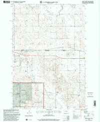
 1998 Cow Butte NE2001 Print · USGSThe borderlands of North and South Dakota come into focus in the late 1990s as ranching life and public lands converge. Genealogists can locate family landmarks like the K Johnson Ranch and the North Grand Ch near Horse Creek.
 - 1998 Map of Hettinger South, 2001 Print
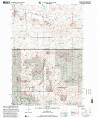
 1998 Hettinger South2001 Print · USGSThe borderlands of North and South Dakota come into focus in the late nineties as they appeared before recent shifts in prairie land use. Genealogists and local historians can trace family-named properties like the O Severson Ranch and M Archibald Ranch along the Grand River.
 - 1998 Map of White Butte, 2001 Print
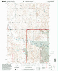
 1998 White Butte2001 Print · USGSThe High Plains borderlands of South Dakota and North Dakota come into focus in the late nineties, showcasing a landscape of sprawling ranches and prairie outposts. Genealogists can locate family landmarks like the B Anderson Ranch and the Petrel Cem near the Grand River National Grassland.
 - 1998 Map of Haynes, 2001 Print
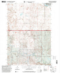
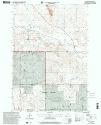 1998 Haynes2001 Print · USGSThe ranching country of the Dakotas is preserved here at the close of the twentieth century, straddling the state line between Adams and Perkins counties. Genealogists and local historians can trace legacy landholdings like the C Frey Ranch or the B Hermann Ranch and find community landmarks from the Haynes Cem to the Townhall.
End of results
Showing maps 1-5 of 5
Top cities of Adams County
Frequently asked questions
- What are the different types of historical maps available for Adams County?
- What is the oldest map of Adams County?
- Where can I purchase historical maps of Adams County for my home or office?
- Where can I download high-res historical maps of Adams County?
- Are there historical topographic maps available for Adams County?
- Is there historical aerial imagery available for Adams County?
- Where are historical maps of Adams County sourced from?