Old Maps of Adams County, North Dakota for Genealogy
Trace your family roots with 197 historic maps of Adams County. These high-res maps reveal old neighborhoods, homesites, landmarks, and streets — helping you uncover where your ancestors lived and how the area evolved over time.
- Explore historic neighborhoods: Identify where your relatives may have lived in the 1800s or 1900s.
- Compare maps over time: Trace the changes in streets, buildings, and landmarks for multi-generational research.
- Perfect for genealogy & ancestry research: Used by family historians and researchers to map out lineage and migration.
These maps are an incredible resource for exploring your personal connection to Adams County's past.
Adams County, ND maps
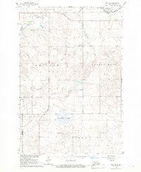
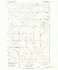
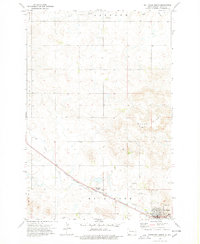
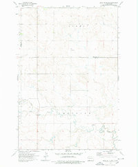
(197)- 1953 Map of McIntosh, 1965 Print
 1953 McIntosh1965 Print · USGSThe north-central Dakota prairie is captured here during the mid-fifties, showing the vast Standing Rock Indian Reservation and the newly formed Oah E Reservoir. Genealogists and historians can trace the Chicago Milwaukee St Paul and Pacific rail line through stops like McIntosh, Walker, and Eagle Butte.3 unique versions available
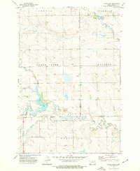
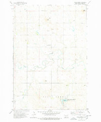
 - 1953 Map of Dickinson, 1968 Print
 1953 Dickinson1968 Print · USGSWestern North Dakota in the fifties remains a landscape of rail-linked prairie towns and rugged badlands. Trace the local impact of the Northern Pacific railroad through Dickinson or locate early rural landmarks like Rainy Butte Church and Boys Ranch.2 unique versions available
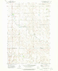
 - 1954 Map of Lemmon, 1964 Print
 1954 Lemmon1964 Print · USGSThe high plains of South Dakota and North Dakota are documented here during the mid-twentieth century. Family researchers can trace dozens of country school sites like Green Cabin School and Bierke School alongside landmarks like The Castles.2 unique versions available
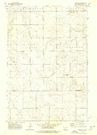
 - 1954 Map of Bismarck, 1967 Print
 1954 Bismarck1967 Print · USGSBismarck and the Missouri River basin are shown in the mid-1960s as the Oahe Reservoir reshaped the valley. Genealogists can trace family-named landmarks like Dog Tooth Buttes and small prairie settlements such as Fort Yates, Selfridge, and Brisbane.2 unique versions available
 - 1957 Map of Dickinson
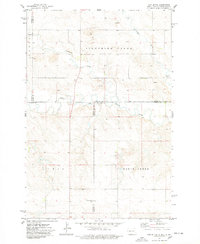
 1957 Dickinson1957 Print · USGSSouthwestern North Dakota in the mid-fifties is a landscape of coal mining and tight-knit rural school districts. Genealogists can trace family footprints through numerous country schools like Fisher School and parish churches like St Stephens.
 - 1957 Map of Lemmon
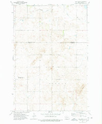
 1957 Lemmon1957 Print · USGSThe northwestern plains of South Dakota and North Dakota are captured here in the mid-fifties, centered on the rail hub of Lemmon. Genealogists and historians can trace dozens of rural schoolhouses and vanished sites like Imogene and the Shadehill Reservoir area.
 - 1958 Map of Bismarck
 1958 Bismarck1958 Print · USGSCentral North Dakota in the late fifties is defined by the Missouri River and the sprawling Standing Rock Indian Reservation. Genealogists and historians can trace rail-line outposts like Sedalia Siding or explore local landmarks like Saint Anthony and Fort Lincoln State Park/Museum.
 - 1958 Map of McIntosh
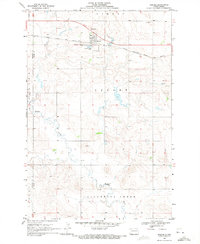
 1958 McIntosh1958 Print · USGSThe north-central Dakotas appear here in the mid-1950s as massive engineering projects and rail lines shaped the plains. Researchers can trace tribal lands within the Standing Rock Indian Reservation and locate local landmarks like the Keller Mine or the Virginia Siding.
 - 1966 Map of Mott SW, 1967 Print
 1966 Mott SW1967 Print · USGSThe southwestern North Dakota plains near the mid-sixties are captured here as the Missouri River Basin development program was underway. Researchers can trace the courses of the Cannonball River and Chilton Creek or locate landmarks like Forsch Rocks.
 - 1969 Map of Reeder, 1971 Print
 1969 Reeder1971 Print · USGSReeder sits at a railroad crossroads in the late 1960s, a hub for local prairie transport and commerce. You can trace the town's street grid along the Milwaukee Road tracks and locate landmarks like Rose Hill Cem and the Reeder Landing Field.
 - 1972 Map of Coffin Buttes, 1974 Print
 1972 Coffin Buttes1974 Print · USGSGrant County at the start of the 1970s reveals a prairie landscape of isolated lookouts and early conservation efforts. Researchers can locate the Selma Union Cem and trace the contours of Coffin Buttes and the Pretty Rock National Wildlife Refuge.
 - 1972 Map of Round Top, 1975 Print
 1972 Round Top1975 Print · USGSThe North Dakota plains of the early 1970s are mapped here as the Standing Rock Indian Reservation meets three county lines. Genealogists and local historians can locate rural landmarks like Menz Sch and trace the Indian Reservation Boundary along the banks of Cedar Creek.
 - 1972 Map of Thunder Hawk, 1975 Print
 1972 Thunder Hawk1975 Print · USGSThe Dakota borderlands come into focus in the early 1970s as the Chicago Milwaukee St Paul and Pacific rail line connects small prairie outposts. Genealogists and historians can trace the tracks through Thunder Hawk and locate landmarks like Thunder Hawk Butte and the settlement of Wheatland.
 - 1973 Map of Liens Dams, 1977 Print
 1973 Liens Dams1977 Print · USGSThe borderlands of Hettinger and Adams counties come into focus in the early seventies, showcasing a classic North Dakota landscape of buttes and prairie draws. Researchers can trace the drainage of Tepee Creek or locate isolated landmarks like Darling Spring and a solitary Grave.
 - 1973 Map of Cedar Lake, 1977 Print
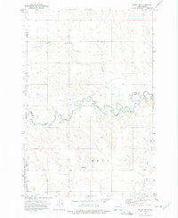
 1973 Cedar Lake1977 Print · USGSThe western North Dakota plains in the early 1970s reveal a landscape of managed waterways and remote homesteads. Genealogists and historians can trace local landmarks like Cedar Lake, the small Cem, and the prairie waters of Rustan Lake.
 - 1973 Map of Enterprise School, 1977 Print
 1973 Enterprise School1977 Print · USGSHettinger and Adams Counties are captured in the early 1970s, showing a prairie landscape defined by small township boundaries and family-named landmarks. Researchers can locate remote rural institutions like Enterprise Sch and the St Helena Cem.
 - 1973 Map of Abbey Hill, 1977 Print
 1973 Abbey Hill1977 Print · USGSLife on the North Dakota prairie during the early seventies centers on the border of Hettinger and Adams counties. Genealogists and local historians can trace family land in Alden and Chilton townships or locate the rural Alden Cem.
 - 1974 Map of Hettinger North, 1978 Print
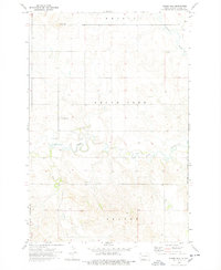
 1974 Hettinger North1978 Print · USGSThe railroad corridor through Adams County comes into focus in the 1970s, centered on the growing town of Hettinger. Researchers can trace the Chicago Milwaukee St Paul and Pacific line or locate rural landmarks like Immanuel Ch and the Townhall.
 - 1974 Map of Nason Hill, 1978 Print
 1974 Nason Hill1978 Print · USGSThe North Dakota prairie landscape of the 1970s is captured here, centered on the winding drainage of Cedar Creek. Genealogists and local historians can trace the locations of Stowers Cem, Cedar Creek Cem, and the small settlement at Beesley.
 - 1974 Map of Hettinger South, 1978 Print
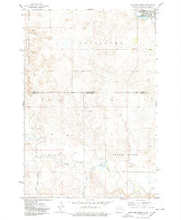 1974 Hettinger South1978 Print · USGSThe North Dakota and South Dakota borderlands come into focus in the mid-1970s, centered on the expansion of Hettinger. Genealogists and researchers can trace the drainages of Billy Young Creek and Hook Creek or locate local landmarks like Mirror Lake and the Claypit.
 - 1974 Map of Plum Butte NE, 1978 Print
 1974 Plum Butte NE1978 Print · USGSThe High Plains of southwest North Dakota come into focus during the mid-1970s, illustrating the rural character of the Hettinger and Adams county line. Genealogists and historians can locate family sites near Sacred Heart Cem or trace the drainage of Timber Creek.
 - 1974 Map of Pearl Butte NW, 1978 Print
 1974 Pearl Butte NW1978 Print · USGSThe North Dakota high plains near the border of Hettinger and Adams Counties are documented here during the mid-seventies. Researchers can trace the meandering course of Cedar Creek and locate specific industrial markers like the Scoria Pits or the remote Gaging Sta.
 - 1974 Map of Cedar Butte, 1978 Print
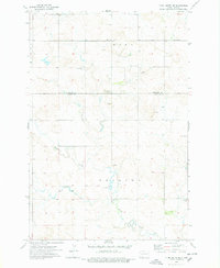
 1974 Cedar Butte1978 Print · USGSAdams County and the North Dakota prairie are captured here in the 1970s, showing a landscape of scattered buttes and rural industry. Genealogists and local historians can locate Spring Butte Cem, the Spring Butte Community Center, and the shores of North Lemmon Lake.
 - 1974 Map of Cow Butte, 1978 Print
 1974 Cow Butte1978 Print · USGSThe Dakota borderlands come into focus in the mid-1970s at the intersection of four counties. Genealogists and local historians can locate rural landmarks like Mamre Ch and Golden Valley Ch Cem along the North Fork Grand River.
 - 1974 Map of Long Butte, 1978 Print
 1974 Long Butte1978 Print · USGSThe open prairies of southwest North Dakota were shaped by resource extraction and land management in the mid-seventies. Researchers can trace land use through the Dog Town State Game Management Area or find the local Long Butte Cem near the prominent Long Butte.
Showing maps 1-25 of 197
Top cities of Adams County
Frequently asked questions
- What are the different types of historical maps available for Adams County?
- What is the oldest map of Adams County?
- Where can I purchase historical maps of Adams County for my home or office?
- Where can I download high-res historical maps of Adams County?
- Are there historical topographic maps available for Adams County?
- Is there historical aerial imagery available for Adams County?
- Where are historical maps of Adams County sourced from?