Old Maps of Nine Mile Corner, North Dakota for Metal Detecting
Plan your next treasure hunt with 10 historic maps of Nine Mile Corner. Find old homesites, ghost towns, trails, and gathering spots that may be lost to time — perfect for identifying promising metal detecting locations.
- Locate forgotten sites: Uncover places like long-lost settlements, abandoned rail lines, or gathering spots.
- Plan better hunts: Use map overlays combined with LiDAR or satellite views to narrow in on historically rich areas.
- Made for detectorists: Thousands of hobbyists use these maps to discover relics, coins, and hidden history.
Use these historic maps to boost your research and find new opportunities beneath the surface of Nine Mile Corner.
Nine Mile Corner, ND maps
(10)- 1949 Map of Bowbells SE
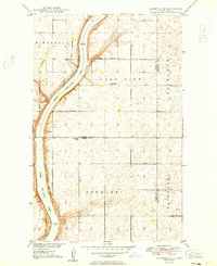 1949 Bowbells SE1949 Print · USGSNorth Dakota's northern plains are captured here just after the war, showing a landscape defined by the Des Lacs Migratory Bird Refuge. Local historians can trace early section-line roads to Nine Mile Corner and the Lake View School No 2.
 - 1950 Map of Bowbells
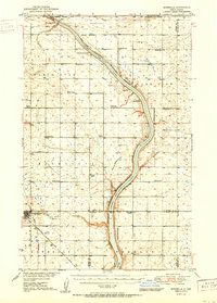 1950 Bowbells1950 Print · USGSThe Burke County prairie meets the international border in the mid-twentieth century, centered on the vital rail junction at Bowbells. Genealogists and historians can trace rural school districts like Masek Sch and explore the early water management of the CCC Dam.2 unique versions available
 - 1953 Map of Williston, 1968 Print
 1953 Williston1968 Print · USGSThe North Dakota high plains meet the waters of Sakakawea Lake in this mid-century survey of the northern borderlands. Trace the rail-and-ranch economy through sites like Anderson Sky Ranch, Sevenmile Corner, and the strip mines near Columbus.2 unique versions available
 - 1957 Map of Williston
 1957 Williston1957 Print · USGSNorthwestern North Dakota is shown here during the mid-fifties, dominated by the sweeping plains and the Missouri River valley. Genealogists and local historians can trace the paths of the Great Northern railroad through Williston, Tioga, and Ray, or locate early industry like the coal strip mines near Lignite.
 - 1982 Map of Kenmare
 1982 Kenmare1982 Print · USGSThe high plains of northwestern North Dakota meet the Canadian border in the early 1980s, an era defined by energy production and prairie conservation. Genealogists and historians can trace the rail corridors of the Soo Line through towns like Bowbells, Flaxton, and the border crossing at Portal.
 - 2011 Map of Bowbells SE, 2011 Print
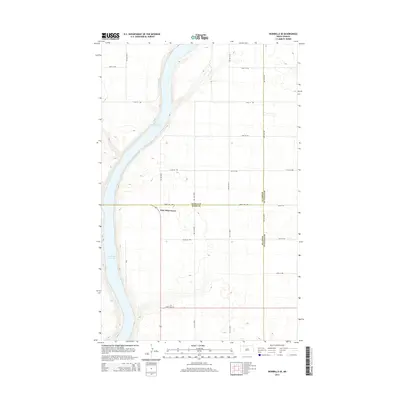
 2011 Bowbells SE2011 Print · USGSCovers Nine Mile Corner, including Ward County, Burke County, and other nearby areas
 - 2014 Map of Bowbells SE, 2014 Print
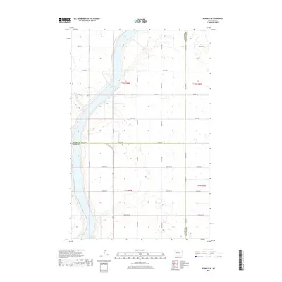
 2014 Bowbells SE2014 Print · USGSCovers Nine Mile Corner, including Ward County, Burke County, and other nearby areas
 - 2017 Map of Bowbells SE, 2017 Print
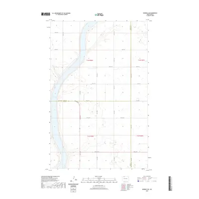
 2017 Bowbells SE2017 Print · USGSCovers Nine Mile Corner, including Ward County, Burke County, and other nearby areas
 - 2020 Map of Bowbells SE, 2020 Print
 2020 Bowbells SE2020 Print · USGSCovers Nine Mile Corner, including Ward County, Burke County, and other nearby areas
 - 2024 Map of Bowbells SE, 2024 Print
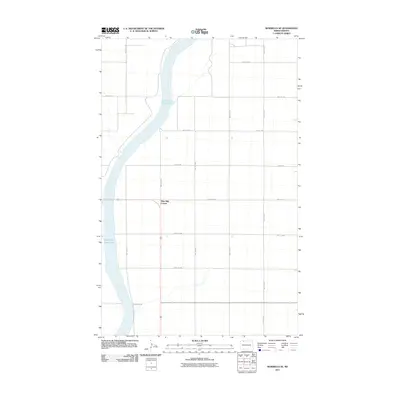
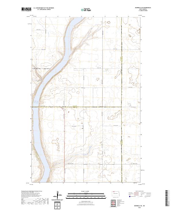 2024 Bowbells SE2024 Print · USGSNorth Dakota's prairie conservation lands are documented here in the early twenty-first century. Researchers can trace the boundaries of the Des Lacs National Wildlife Refuge and the winding shoreline of Upper Des Lacs Lake.
End of results
Showing maps 1-10 of 10
Top cities near Nine Mile Corner
Frequently asked questions
- What are the different types of historical maps available for Nine Mile Corner?
- What is the oldest map of Nine Mile Corner?
- Where can I purchase historical maps of Nine Mile Corner for my home or office?
- Where can I download high-res historical maps of Nine Mile Corner?
- Are there historical topographic maps available for Nine Mile Corner?
- Is there historical aerial imagery available for Nine Mile Corner?
- Where are historical maps of Nine Mile Corner sourced from?