Old Maps of Cass County, North Dakota for Genealogy
Trace your family roots with 255 historic maps of Cass County. These high-res maps reveal old neighborhoods, homesites, landmarks, and streets — helping you uncover where your ancestors lived and how the area evolved over time.
- Explore historic neighborhoods: Identify where your relatives may have lived in the 1800s or 1900s.
- Compare maps over time: Trace the changes in streets, buildings, and landmarks for multi-generational research.
- Perfect for genealogy & ancestry research: Used by family historians and researchers to map out lineage and migration.
These maps are an incredible resource for exploring your personal connection to Cass County's past.
Cass County, ND maps
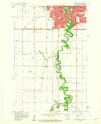
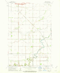
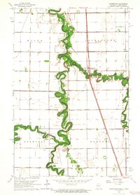
(255)- 1895 Map of Fargo, 1954 Print
 1895 Fargo1954 Print · USGSThe Red River Valley thrived as a rail and agricultural frontier during the 1890s, where North Dakota and Minnesota meet. Genealogists can trace family roots through pioneer settlements and rail stops like Kurtz (Elmer Sta.), Wild Rice, and Christine.3 unique versions available
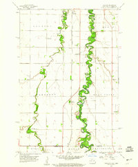
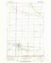
 - 1895 Map of Casselton, 1961 Print
 1895 Casselton1961 Print · USGSNorth Dakota's Red River Valley rail network is in full bloom in the 1890s, with towns emerging at every major junction. Trace early post offices and depots at Chaffee P.O., Embden, and Ripon along the Northern Pacific R. R.
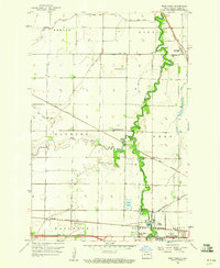
 - 1897 Map of Fargo
 1897 Fargo1897 Print · USGSThe Red River Valley at the close of the nineteenth century was a bustling intersection of rail lines and river commerce. Genealogists and historians can trace the early footprints of Fargo and Moorhead, or find smaller depots like Kurtz (Elmer Sta.) and Wild Rice.12 unique versions available
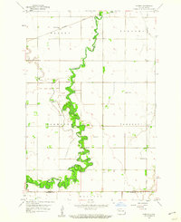
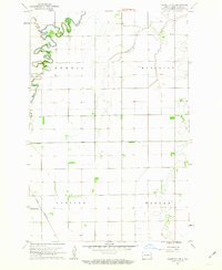
 - 1897 Map of Tower
 1897 Tower1897 Print · USGSIn the late nineteenth century, the expansion of the northern plains centered on the intersection of the Sheyenne River and the arriving railroads. Genealogists and historians can trace early township plats and rail-stop settlements like Valley City, Fingal, and Enderlin.3 unique versions available
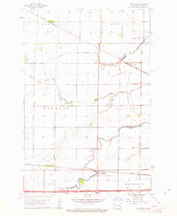
 - 1897 Map of Casselton
 1897 Casselton1897 Print · USGSCass County’s agricultural heartland is captured here in the 1890s, when new rail lines were defining the North Dakota prairie. Genealogists can trace family locations near early hubs like Casselton, the Chaffee P.O. settlement, and the banks of the Maple River.3 unique versions available
 - 1952 Map of Grand Forks, 1967 Print
 1952 Grand Forks1967 Print · USGSThe Red River Valley in the early fifties is shown here at the height of its rail-and-river agricultural economy. Researchers can locate small-town landmarks like the Pleasant View School, the Immanuel Lutheran Church, and trace the path of the Soo Line Railroad.3 unique versions available
 - 1953 Map of Fargo, 1965 Print
 1953 Fargo1965 Print · USGSThe Red River Valley in the mid-fifties was a bustling rail and agricultural corridor during a period of steady prairie growth. Genealogists and historians can trace the intricate rail networks of the Great Northern and Soo Line connecting local hubs like Casselton and Wahpeton.2 unique versions available
 - 1956 Map of Fargo
 1956 Fargo1956 Print · USGSThe Red River Valley's agricultural heartland is documented here in the mid-fifties as the rail-and-road network expanded across the plains. Genealogists can trace family roots through numerous small railroad towns and local landmarks like Casselton, Sheyenne Valley Church, and Sisseton Indian Res.
 - 1956 Map of Grand Forks
 1956 Grand Forks1956 Print · USGSThe Red River Valley in the mid-fifties is captured here as a thriving corridor of grain elevators and rail-linked towns along the North Dakota and Minnesota border. Researchers can trace historic church sites like Immanuel Lutheran Church, vanished rail stops at Tilde Junction, and the boundaries of the White Earth Indian Reservation.
 - 1959 Map of Kindred
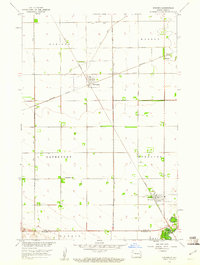 1959 Kindred1959 Print · USGSEastern North Dakota's fertile prairie is captured here in the late fifties, showcasing the vital rail intersections of the Red River Valley. Genealogists and local historians can trace the foundations of Davenport and Kindred, as well as rural sites like Christiania Ch and the German Cem.
 - 1959 Map of Leonard, 1960 Print
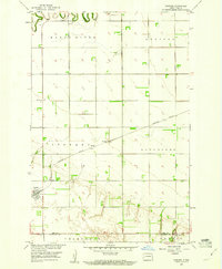 1959 Leonard1960 Print · USGSEastern North Dakota's prairie townships are captured here in the late fifties as the Northern Pacific railroad still defined the local economy. Genealogists and researchers can locate family landmarks such as Bethel Ch, West Prairie Ch, and the brick-industry footprints at the Claypit.
 - 1959 Map of Fargo North, 1960 Print
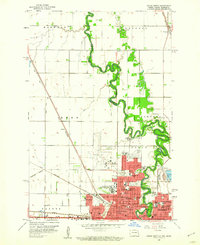 1959 Fargo North1960 Print · USGSThe Red River valley in the late fifties shows the post-war expansion of Fargo and Moorhead along their shared river border. Genealogists can locate family sites near Riverside Cem or trace the early campus of the North Dakota Agriculture College.4 unique versions available
 - 1959 Map of South West Fargo, 1960 Print
 1959 South West Fargo1960 Print · USGSCass County agriculture and the serpentine Sheyenne River define this area just before the interstate era transformed the outskirts of Fargo. Genealogists can locate St Johns Ch and rural burials at Horace Cem and Brink Cem.3 unique versions available
 - 1959 Map of Fargo South, 1960 Print
 1959 Fargo South1960 Print · USGSFargo and Moorhead appear at a pivotal moment of mid-century growth as the Red River of the North defines the state line. Genealogists and local historians can locate early institutions like Concordia College, Sacred Heart Convent, and Riverside Cemetery.4 unique versions available
 - 1959 Map of Hickson, 1960 Print
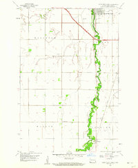
 1959 Hickson1960 Print · USGSThe Red River Valley's rich agricultural borderlands are captured here in the late fifties, showcasing the intricate meanders of the Red River of the North. Genealogists can locate rural landmarks like St Benedict, Hickson, and the North Pleasant Cem.3 unique versions available
 - 1959 Map of West Fargo, 1960 Print
 1959 West Fargo1960 Print · USGSThe Red River Valley's agricultural and rail heartland is captured during a period of growth near West Fargo and South West Fargo. Genealogists and historians can trace local landmarks like Maple-Sheyenne Ch and the Oak Wood Cem.3 unique versions available
 - 1959 Map of Norman, 1960 Print
 1959 Norman1960 Print · USGSSoutheastern North Dakota's agricultural heartland is documented here in the late fifties, dominated by the winding path of the Sheyenne River. Genealogists and historians can locate rural landmarks like Norman Cem and several numbered schoolhouses.2 unique versions available
 - 1961 Map of Durbin, 1963 Print
 1961 Durbin1963 Print · USGSCass County's fertile Red River Valley is captured here in the early sixties, showing a landscape defined by rail and river. You can trace the path of the Great Northern railroad through the settlements of Everest and Durbin, and locate the Canaan Ch.
 - 1961 Map of Casselton, 1963 Print
 1961 Casselton1963 Print · USGSThe rail-driven economy of Cass County is on full display in the early sixties at this junction of two major lines. Genealogists and historians can trace the development of Casselton near St Leo Cem and the industrial Dalrymple Spur.2 unique versions available
 - 1961 Map of Casselton SE, 1963 Print
 1961 Casselton SE1963 Print · USGSThe rural plains of Cass County are captured in the early sixties as a landscape of structured townships and winding river valleys. Genealogists and local historians can trace the paths of the Great Northern railroad and locate the central Townhall or local Cem.2 unique versions available
 - 1961 Map of Sheldon NW, 1963 Print
 1961 Sheldon NW1963 Print · USGSThe rural prairie of Cass County is captured here in the early 1960s as the agricultural grid defined life along the Maple River valley. Researchers can locate vanished rural landmarks such as School No 83, a local Townhall, and a mid-century Landing Strip.
 - 1961 Map of Mapleton, 1963 Print
 1961 Mapleton1963 Print · USGSCass County agriculture and rail life are at the forefront in the early 1960s as these prairie townships grow. Trace the paths of the Great Northern and Northern Pacific lines through Mapleton, Prosper, and the Mapleton Cem.3 unique versions available
 - 1961 Map of Sheldon NE, 1963 Print
 1961 Sheldon NE1963 Print · USGSSoutheast North Dakota’s prairie landscape was shaped by the winding Maple River and the transit lines of the early 1960s. Researchers can trace the legacy of pioneer settlements through the Northern Pacific rail line and family-history sites like Watson Cem and Leonard Cem.
 - 1961 Map of Enderlin North, 1963 Print
 1961 Enderlin North1963 Print · USGSThe borderlands of Cass and Ransom counties are captured here in the early sixties, centered on the growing town of Enderlin. Researchers can locate rural landmarks like Salem Cem, the NORTHERN PACIFIC rail line, and the winding course of the Maple River.
 - 1963 Map of Georgetown, 1964 Print
 1963 Georgetown1964 Print · USGSThe Red River Valley's winding borderlands are captured here in the early sixties, showing the fertile divide between Minnesota and North Dakota. Researchers can trace the paths of the Great Northern railroad and locate community sites like Osterdalen Ch and Osterdalen Cem.
Showing maps 1-25 of 255
Top cities of Cass County
- Fargo historical maps
- West Fargo historical maps
- Casselton historical maps
- Horace historical maps
- Harwood historical maps
- Mapleton historical maps
See more
Frequently asked questions
- What are the different types of historical maps available for Cass County?
- What is the oldest map of Cass County?
- Where can I purchase historical maps of Cass County for my home or office?
- Where can I download high-res historical maps of Cass County?
- Are there historical topographic maps available for Cass County?
- Is there historical aerial imagery available for Cass County?
- Where are historical maps of Cass County sourced from?