1900s (20th Century) Maps of Dickey County, North Dakota
Explore 46 historic maps of Dickey County from the 1900s (20th Century). These maps offer a rare glimpse into what life looked like during the 1900s — showing old roads, neighborhoods, homes, and landmarks that have changed or disappeared over time.
Whether you're researching your family's past, planning a metal detecting trip, or studying how Dickey County's landscape evolved across the 1900s, these high-resolution maps are a powerful tool for exploring the history of this region.
- Focus on a specific era: All maps on this page are from the 1900s, giving you a focused view of this time period.
- See what’s changed: Compare century-old streets, trails, and buildings to today's modern landscape using overlays and satellite layers.
- Research with precision: Use these maps for genealogy, historical research, land use analysis, or educational projects.
- View, download, or print: Maps are fully viewable online in high resolution, and can be downloaded or printed for your own records.
Start exploring Dickey County's history through authentic maps from the 1900s. This is your window into the past.
Dickey County, ND maps
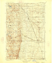
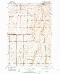
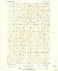
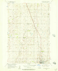
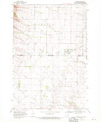
(46)- 1918 Map of La Moure
 1918 La Moure1918 Print · USGSSoutheastern North Dakota was a thriving rail and agricultural hub during the early twentieth century, as seen in this detailed 1918 survey. Researchers can trace the development of the James River corridor and locate early settlements like Grand Rapids, Oakes, and Port Emma.2 unique versions available
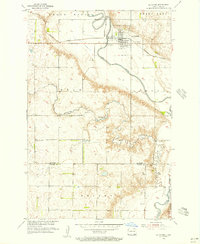
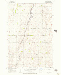
 - 1925 Map of Edgeley
 1925 Edgeley1925 Print · USGSLaMoure and Dickey Counties are shown in the mid-1920s as a complex network of rail lines and prairie townships. Trace the early layout of Ellendale, the historical Whitestone Battlefield Park, and rail stops at Deisem and Medberry.2 unique versions available
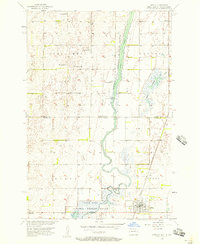
 - 1952 Map of Glover, 1954 Print
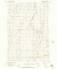
 1952 Glover1954 Print · USGSDickey County agriculture and rail transport intersect along the river valley in the early fifties. Genealogists and local historians can trace family-named landmarks like the Norwegian Cem, the settlement of Glover, and the rural School No 3.
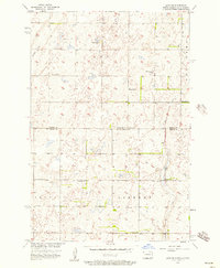
 - 1952 Map of Oakes, 1954 Print
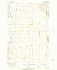
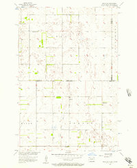
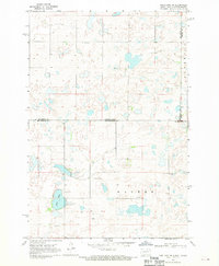
 1952 Oakes1954 Print · USGSIn the early fifties, this Dickey County hub sat at a critical rail junction. Trace the path of three major railroads through Oakes, locate local landmarks like Oakes View Cemetery, and identify rural prairie infrastructure including School No 4 and various flowing wells.
 - 1952 Map of Independence, 1954 Print
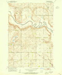
 1952 Independence1954 Print · USGSThe rural prairie of La Moure and Dickey Counties comes into focus in the early 1950s as the Northern Pacific railroad crosses the plains. Genealogists and local historians can trace the settlement of Independence and locate historic rural landmarks like School No 2 and the banks of the James River.
 - 1953 Map of Jamestown
 1953 Jamestown1953 Print · USGSSoutheastern North Dakota was a thriving rail and agricultural corridor in the early fifties, anchored by the James River. Researchers can trace the footprints of institutional landmarks like the North Dakota State Hospital and historic sites such as Whitestone Hill Battlefield Park.3 unique versions available
 - 1953 Map of Ellendale South, 1955 Print
 1953 Ellendale South1955 Print · USGSThe borderlands of North and South Dakota are captured here in the early fifties, centering on the rail hub of Ellendale. Genealogists and historians can locate rural schoolhouses like Gustafson Sch and Senn Sch along with the path of the Great Northern railroad.3 unique versions available
 - 1954 Map of Aberdeen, 1964 Print
 1954 Aberdeen1964 Print · USGSNortheastern South Dakota in the mid-fifties remains a world of rail-dependent prairie towns and sweeping waterfowl refuges. Genealogists can trace family roots through settlements like Eureka and Ipswich or locate rural landmarks near Richmond Lake.2 unique versions available
 - 1955 Map of Oakes SE, 1956 Print
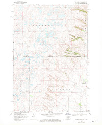
 1955 Oakes SE1956 Print · USGSThe rail-driven landscape of Dickey County is captured in the mid-fifties, featuring the strategic junction at Ludden. Researchers can trace the paths of the Great Northern and Riverdale Sch alongside the winding James River.
 - 1955 Map of Fullerton NE, 1956 Print
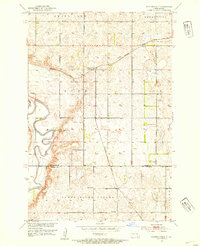
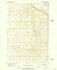 1955 Fullerton NE1956 Print · USGSDickey County, North Dakota, is captured here in the mid-1950s as a landscape of grid-patterned farms and prairie railroads. Researchers can trace the Minneapolis St Paul and Sault Ste Marie line and find rural landmarks like Town Hall and School No 3.
 - 1955 Map of Guelph, 1956 Print
 1955 Guelph1956 Print · USGSThe Dickey County prairie comes into focus in the mid-1950s, showing a landscape defined by the James River and vital rail connections. Researchers can trace the rail-side growth of Guelph and Ludden or locate the Ludden Cem and Flowing Well.
 - 1955 Map of Fullerton SE, 1956 Print
 1955 Fullerton SE1956 Print · USGSDickey County farmland during the mid-fifties reveals an era of organized township boundaries and one-room schoolhouses. Genealogists and local historians can locate early educational sites like School No 4 and trace the path of the Great Northern Railroad through Port Emma.
 - 1955 Map of La Moure, 1956 Print
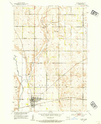
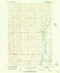
 1955 La Moure1956 Print · USGSLa Moure and the surrounding prairie are captured here in the mid-1950s as the river and rail lines dictated local growth. Genealogists can locate Rosehill Cem and St Ansgar Cem, while following the Northern Pacific through town.2 unique versions available
 - 1956 Map of Aberdeen
 1956 Aberdeen1956 Print · USGSUpper South Dakota during the mid-fifties remains a landscape of rail-connected farming towns and expansive glacial lake basins. Genealogists and historians can trace the paths of the Minneapolis and St Louis railroad through Gettysburg or locate vanished stops near Elm Lake and Richmond Lake.
 - 1956 Map of Jamestown
 1956 Jamestown1956 Print · USGSThe James River valley and the vast alkali lake country of south-central North Dakota are captured here in the mid-fifties. Genealogists can trace family farms across several counties, locating small rail stops like Medberry and monuments like Whitestone Hill Battlefield Park.
 - 1956 Map of Hecla, 1957 Print
 1956 Hecla1957 Print · USGSThe James River valley at the North Dakota and South Dakota border is shown here in the mid-1950s as a balance of rail-side town life and managed wetlands. Researchers can locate the Hecla townsite, the Bell Sch, and the Chicago and Northwestern rail line.
 - 1956 Map of Savo NE, 1957 Print
 1956 Savo NE1957 Print · USGSThe North Dakota and South Dakota borderlands come alive in the mid-fifties, showing a rural landscape of townships and school districts. Genealogists can trace family footprints near Finnish Ch, Youngman Sch, and the isolated Cem in Savo township.
 - 1956 Map of Ellendale North, 1957 Print
 1956 Ellendale North1957 Print · USGSNorth Dakota's southern prairie comes into focus during the mid-fifties, showing a landscape of townships and transition. Genealogists and historians can trace the paths of the Chicago Milwaukee St Paul and Pacific through Duane or locate rural schools like Farming Valley Sch No 2.
 - 1956 Map of Savo NW, 1957 Print
 1956 Savo NW1957 Print · USGSThe North Dakota and South Dakota borderlands are captured here in the mid-fifties, showing the agricultural townships of Van Meter and Savo. Genealogists can locate family-named landmarks like Claeys Sch and Alatalo Sch or the local Finnish Ch.
 - 1956 Map of Silverleaf, 1957 Print
 1956 Silverleaf1957 Print · USGSDickey County agricultural and river lands are captured here in the mid-fifties as the prairie landscape was organized by rail and conservation. Trace the path of the Great Northern railroad to Silverleaf or locate former rural hubs like Holte and School No 1 (Abandoned).
 - 1956 Map of Hecla NE, 1957 Print
 1956 Hecla NE1957 Print · USGSThe Dakota state line in the mid-1950s reveals a sprawling agricultural landscape defined by its rural school districts and township boundaries. Genealogists can trace family homesteads near landmarks like Eaton Sch No 2, Tiry Sch, and the Flowing Well.3 unique versions available
 - 1968 Map of Frederick NW, 1970 Print
 1968 Frederick NW1970 Print · USGSThe borderlands of the Dakotas are captured in the late sixties as the prairie landscape centers on the waters of Elm Lake. Researchers can locate rural landmarks like the Aurdal Ch, the Great Northern rail line, and local Townhall sites.
 - 1968 Map of Forbes, 1970 Print
 1968 Forbes1970 Print · USGSThe borderlands of Dickey and McPherson counties are captured here in the late sixties, centered on the village of Forbes. Genealogists and local historians can trace the Great Northern rail line and locate the Forbes Cem near the state line.
 - 1968 Map of Long Lake NE, 1970 Print
 1968 Long Lake NE1970 Print · USGSThe North Dakota and South Dakota borderlands come into focus in the late sixties, showing a prairie landscape of glacial potholes and section-line roads. Genealogists can locate several family-named landmarks including St Lucas Cem, Ehresman Cem, and Rath Lake.
 - 1968 Map of Forbes NW, 1970 Print
 1968 Forbes NW1970 Print · USGSThe high plains of the Dakotas borderland are seen here in the late sixties, where small prairie lakes and township lines define the landscape. Genealogists can locate family landmarks such as St Peters Cem, the Spring Creek Colony, and Townhall.
Showing maps 1-25 of 46
Top cities of Dickey County
- Oakes historical maps
- Ellendale historical maps
- Clement Township historical maps
- Fullerton historical maps
- Forbes historical maps
- Monango historical maps
Frequently asked questions
- What are the different types of historical maps available for Dickey County?
- What is the oldest map of Dickey County?
- Where can I purchase historical maps of Dickey County for my home or office?
- Where can I download high-res historical maps of Dickey County?
- Are there historical topographic maps available for Dickey County?
- Is there historical aerial imagery available for Dickey County?
- Where are historical maps of Dickey County sourced from?