1970s Maps of Dickey County, North Dakota
Explore 5 historic maps of Dickey County from the 1970s. These maps offer a rare glimpse into what life looked like during the 1970s — showing old roads, neighborhoods, homes, and landmarks that have changed or disappeared over time.
Whether you're researching your family's past, planning a metal detecting trip, or studying how Dickey County's landscape evolved across the 1970s, these high-resolution maps are a powerful tool for exploring the history of this region.
- Focus on a specific era: All maps on this page are from the 1970s, giving you a focused view of this time period.
- See what’s changed: Compare century-old streets, trails, and buildings to today's modern landscape using overlays and satellite layers.
- Research with precision: Use these maps for genealogy, historical research, land use analysis, or educational projects.
- View, download, or print: Maps are fully viewable online in high resolution, and can be downloaded or printed for your own records.
Start exploring Dickey County's history through authentic maps from the 1970s. This is your window into the past.
Dickey County, ND maps
(5)- 1970 Map of Verona, 1973 Print
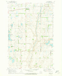 1970 Verona1973 Print · USGSNorth Dakota's southeastern prairie reveals a complex network of wetlands and rail-line settlements during the early 1970s. Researchers can trace the railroad corridor through Verona or locate family history at Pilgrims Rest Cem and St Raphael Cem.
 - 1971 Map of Merricourt SE, 1973 Print
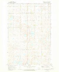
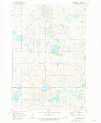
 1971 Merricourt SE1973 Print · USGSDickey County is captured here in the early seventies, showing a prairie landscape organized by township lines and natural drainage. Genealogists can locate family landmarks like the Cem, the central Townhall, and the shores of Happy Lake.
 - 1971 Map of Merricourt, 1973 Print
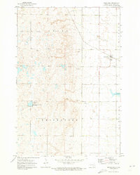 1971 Merricourt1973 Print · USGSMerricourt and the surrounding North Dakota prairie are captured in the early 1970s, showcasing a landscape of rail-fed agriculture and historical preservation. Trace local family roots at Merricourt Cem, the Whitestone Sch, or the grounds of Whitestone Battlefield State Park.
 - 1971 Map of Merricourt NW, 1973 Print
 1971 Merricourt NW1973 Print · USGSDickey County's rural townships are captured here in the early 1970s, showcasing a landscape of scattered farmsteads and glacial wetlands. Genealogists can trace local history through the Seventh Day Adventist Ch, Roloff Cem, and Hoffnungsfeld Cem.
 - 1971 Map of Merricourt SW, 1973 Print
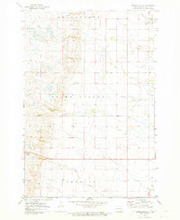
 1971 Merricourt SW1973 Print · USGSDickey County in the early seventies reveals a landscape of prairie potholes and dispersed rural settlements. Genealogists and local historians can locate family landmarks such as the Wirch Cemetery, the local Townhall, and water bodies like Wood Lake.
End of results
Showing maps 1-5 of 5
Top cities of Dickey County
- Oakes historical maps
- Ellendale historical maps
- Clement Township historical maps
- Fullerton historical maps
- Forbes historical maps
- Monango historical maps
Frequently asked questions
- What are the different types of historical maps available for Dickey County?
- What is the oldest map of Dickey County?
- Where can I purchase historical maps of Dickey County for my home or office?
- Where can I download high-res historical maps of Dickey County?
- Are there historical topographic maps available for Dickey County?
- Is there historical aerial imagery available for Dickey County?
- Where are historical maps of Dickey County sourced from?