1940s Maps of Johnson Ford, North Dakota
Explore 1 historic maps of Johnson Ford from the 1940s. These maps offer a rare glimpse into what life looked like during the 1940s — showing old roads, neighborhoods, homes, and landmarks that have changed or disappeared over time.
Whether you're researching your family's past, planning a metal detecting trip, or studying how Johnson Ford's landscape evolved across the 1940s, these high-resolution maps are a powerful tool for exploring the history of this region.
- Focus on a specific era: All maps on this page are from the 1940s, giving you a focused view of this time period.
- See what’s changed: Compare century-old streets, trails, and buildings to today's modern landscape using overlays and satellite layers.
- Research with precision: Use these maps for genealogy, historical research, land use analysis, or educational projects.
- View, download, or print: Maps are fully viewable online in high resolution, and can be downloaded or printed for your own records.
Start exploring Johnson Ford's history through authentic maps from the 1940s. This is your window into the past.
Johnson Ford, ND maps
(1)- 1944 Map of Heart Butte
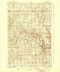 1944 Heart Butte1944 Print · USGSThe rural expanses of Grant and Morton Counties are shown here just before the mid-century, defined by a network of one-room schoolhouses and remote farmsteads. Researchers can trace early family ties at St Joseph Ch or locate the local Lignite Mine along the Heart River.
End of results
Showing maps 1-1 of 1
Top cities near Johnson Ford
- Glen Ullin historical maps
- Elgin historical maps
- Carson historical maps
- New Leipzig historical maps
- Leith historical maps
Frequently asked questions
- What are the different types of historical maps available for Johnson Ford?
- What is the oldest map of Johnson Ford?
- Where can I purchase historical maps of Johnson Ford for my home or office?
- Where can I download high-res historical maps of Johnson Ford?
- Are there historical topographic maps available for Johnson Ford?
- Is there historical aerial imagery available for Johnson Ford?
- Where are historical maps of Johnson Ford sourced from?