1960s Maps of Hettinger County, North Dakota
Explore 17 historic maps of Hettinger County from the 1960s. These maps offer a rare glimpse into what life looked like during the 1960s — showing old roads, neighborhoods, homes, and landmarks that have changed or disappeared over time.
Whether you're researching your family's past, planning a metal detecting trip, or studying how Hettinger County's landscape evolved across the 1960s, these high-resolution maps are a powerful tool for exploring the history of this region.
- Focus on a specific era: All maps on this page are from the 1960s, giving you a focused view of this time period.
- See what’s changed: Compare century-old streets, trails, and buildings to today's modern landscape using overlays and satellite layers.
- Research with precision: Use these maps for genealogy, historical research, land use analysis, or educational projects.
- View, download, or print: Maps are fully viewable online in high resolution, and can be downloaded or printed for your own records.
Start exploring Hettinger County's history through authentic maps from the 1960s. This is your window into the past.
Hettinger County, ND maps
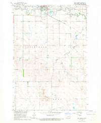
(17)- 1960 Map of White Butte West, 1961 Print
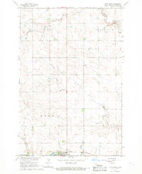
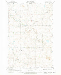
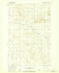 1960 White Butte West1961 Print · USGSHettinger County in the early sixties reveals a landscape of high prairie buttes and winding creek beds. Researchers can locate mid-century rural landmarks such as St Michael Ch, School No 1, and the townships of Madison and Acme.
 - 1960 Map of White Butte NW, 1961 Print
 1960 White Butte NW1961 Print · USGSThe rural borderlands between Stark and Hettinger Counties are captured here at the start of the 1960s. Researchers can locate township divisions in Madison and Campbell or trace the early paths of Plum Creek past local landmarks like School No 1.
 - 1960 Map of Clark Butte NW, 1962 Print
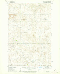
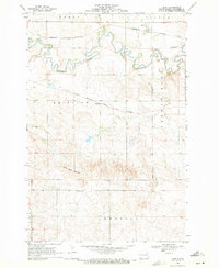
 1960 Clark Butte NW1962 Print · USGSStark and Hettinger Counties at the start of the 1960s reveal a landscape of dispersed prairie homesteads and rural school districts. Genealogists and local historians can locate specific landmarks like Heart River School No. 2, Bethesda Ch, and the rising waters of Lake Tschida.
 - 1960 Map of Clark Butte NE, 1962 Print
 1960 Clark Butte NE1962 Print · USGSThe North Dakota prairie near the intersection of Grant, Morton, and Stark counties is captured here in the early sixties. Researchers can find rural landmarks such as SS Peter and Paul Ch, Heart Butte School No 2, and the newly formed Lake Tschida.
 - 1960 Map of White Butte NE, 1962 Print
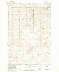
 1960 White Butte NE1962 Print · USGSThe rural borderlands of Stark and Hettinger Counties are captured here in the early sixties, showing a landscape defined by the winding Heart River. Local researchers can locate the St Stephens Ch and trace the drainage of Beaver Creek across the Campbell Highland.
 - 1960 Map of Clark Butte SW, 1962 Print
 1960 Clark Butte SW1962 Print · USGSHettinger County in the early sixties remains a landscape of dispersed farmsteads and rural townships. Trace the location of prairie landmarks like the New Burke Ch, Friedenfeld Cem, and the grid of local schoolhouses including School No 3.
 - 1960 Map of White Butte East, 1962 Print
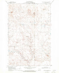
 1960 White Butte East1962 Print · USGSHettinger County's high plains are documented here at the start of the 1960s, showing a landscape of isolated buttes and seasonal creeks. Genealogists and historians can locate rural schoolhouses like Colgrove Sch No 2 and landmarks such as Camel Buttes.
 - 1960 Map of Clark Butte, 1962 Print
 1960 Clark Butte1962 Print · USGSHettinger and Grant Counties appear at the start of the 1960s, showing a landscape of rural townships and prairie schools. Genealogists can locate family landmarks like Zion Cem and Salem Ch or trace the early paths near Clark Butte.
 - 1966 Map of Mott South, 1967 Print
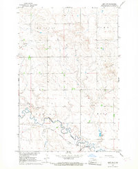
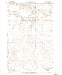
 1966 Mott South1967 Print · USGSHettinger County in the mid-sixties shows the town of Mott as a critical rail and river hub for the surrounding ranchlands. Genealogists and historians can trace the local infrastructure of the era, from the Fairground to the tracks of the Northern Pacific.
 - 1966 Map of Mott NW, 1967 Print
 1966 Mott NW1967 Print · USGSHettinger County's river-and-rail corridor is captured here in the mid-1960s as a vital part of the Missouri River Basin development. Trace the winding Cannonball River alongside the Milwaukee Road tracks and landmarks like Charles Lake.
 - 1966 Map of Regent, 1967 Print
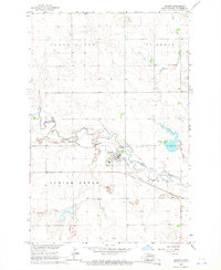 1966 Regent1967 Print · USGSHettinger County in the mid-1960s is defined here by the winding Cannonball River and the rural hub of Regent. Genealogists and local historians can trace the Chicago Milwaukee rail line past the Regent Cem, or locate the era's Drive-in Theater near Larson Lake.
 - 1966 Map of Mott SW, 1967 Print
 1966 Mott SW1967 Print · USGSThe southwestern North Dakota plains near the mid-sixties are captured here as the Missouri River Basin development program was underway. Researchers can trace the courses of the Cannonball River and Chilton Creek or locate landmarks like Forsch Rocks.
 - 1966 Map of Mott North, 1967 Print
 1966 Mott North1967 Print · USGSHettinger County, North Dakota, is documented here in the mid-1960s as the town of Mott thrived along the Missouri River Basin. Genealogists and local historians can trace the Milwaukee Road railroad, locate the Sunny Slope Cem, and follow Spring Creek through the prairie.
 - 1969 Map of Burt, 1971 Print
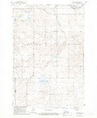
 1969 Burt1971 Print · USGSHettinger County's prairie landscape was a hub of rail activity in the late sixties, where the river plains met the rising buttes. Genealogists and collectors can trace the paths of two major railroads through Burt and Watrous or locate family landmarks like Bethany Cem and the Hogs Back Buttes.
 - 1969 Map of North Star Butte, 1971 Print
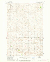
 1969 North Star Butte1971 Print · USGSThe high plains along the Hettinger and Grant county line are captured here in the late sixties. Genealogists and historians can trace rural burial sites at Philadelphia Cem and Ebenezer Cem or locate industrial activity at the Strip Mines.
 - 1969 Map of Bentley, 1971 Print
 1969 Bentley1971 Print · USGSThe Hettinger and Grant County line comes alive in the late sixties as the railroads cross the plains. Genealogists and historians can trace the Burlington Northern line, find the Odessa Cem, and locate the settlement of Bentley.
 - 1969 Map of Burt NW, 1971 Print
 1969 Burt NW1971 Print · USGSHettinger County's rural townships are documented here during the late sixties, showing the exact layout of the plains before modern agricultural shifts. Genealogists and historians can trace family land in districts like Steiner and Beery or locate water sources along Thirtymile Creek.
End of results
Showing maps 1-17 of 17
Top cities of Hettinger County
Frequently asked questions
- What are the different types of historical maps available for Hettinger County?
- What is the oldest map of Hettinger County?
- Where can I purchase historical maps of Hettinger County for my home or office?
- Where can I download high-res historical maps of Hettinger County?
- Are there historical topographic maps available for Hettinger County?
- Is there historical aerial imagery available for Hettinger County?
- Where are historical maps of Hettinger County sourced from?