1970s Maps of LaMoure County, North Dakota
Explore 10 historic maps of LaMoure County from the 1970s. These maps offer a rare glimpse into what life looked like during the 1970s — showing old roads, neighborhoods, homes, and landmarks that have changed or disappeared over time.
Whether you're researching your family's past, planning a metal detecting trip, or studying how LaMoure County's landscape evolved across the 1970s, these high-resolution maps are a powerful tool for exploring the history of this region.
- Focus on a specific era: All maps on this page are from the 1970s, giving you a focused view of this time period.
- See what’s changed: Compare century-old streets, trails, and buildings to today's modern landscape using overlays and satellite layers.
- Research with precision: Use these maps for genealogy, historical research, land use analysis, or educational projects.
- View, download, or print: Maps are fully viewable online in high resolution, and can be downloaded or printed for your own records.
Start exploring LaMoure County's history through authentic maps from the 1970s. This is your window into the past.
LaMoure County, ND maps
(10)- 1970 Map of Litchville, 1972 Print
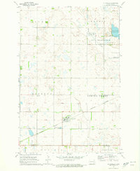 1970 Litchville1972 Print · USGSLitchville and the surrounding townships of Barnes and La Moure counties are captured here during the early seventies. Researchers can trace family sites at St Thomas Cem, Swedish Cem, and St Anns Cem along the Burlington Northern line.
 - 1970 Map of Hastings, 1973 Print
 1970 Hastings1973 Print · USGSThe small town of Hastings and its surrounding prairie townships are captured here in the early 1970s. Researchers can locate family landmarks like the Spring Creek Cem or trace the Burlington Northern line through Spring Creek.
 - 1970 Map of Verona NW, 1973 Print
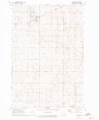
 1970 Verona NW1973 Print · USGSThe wetlands and section lines of LaMoure County are shown here as they appeared in 1970. Genealogists and local historians can locate the crossroads of Benson Corner or trace the boundaries of Pearl Lake and Black Loam.
 - 1970 Map of Litchville SW, 1973 Print
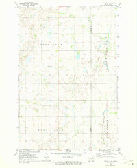
 1970 Litchville SW1973 Print · USGSLaMoure County's pothole prairie is captured here in the early 1970s, showing a remote landscape of section-line roads and family-tilled sections. Genealogists can locate rural landmarks like Griswold Ch, Lutheran Cem, and the community of Gladstone.
 - 1970 Map of Litchville SE, 1973 Print
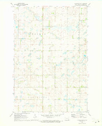
 1970 Litchville SE1973 Print · USGSLaMoure and Ransom counties are captured here in the early seventies, showing a classic North Dakota township landscape. Genealogists can locate specific family landmarks like North LaMoure Ch, Sulli Cem, and the winding path of Bear Creek.
 - 1970 Map of Marion NE, 1973 Print
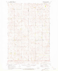
 1970 Marion NE1973 Print · USGSThe North Dakota prairie along the Barnes and La Moure county line is captured here in the early seventies as a grid of family farms and rail corridors. Genealogists and local historians can trace legacy sites like Swedish Cem, Bethlehem Cem, and the tracks of the Burlington Northern.
 - 1970 Map of Marion NW, 1973 Print
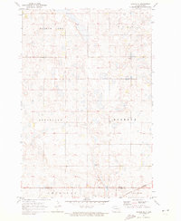
 1970 Marion NW1973 Print · USGSThe rural prairie landscape at the tri-county corner of Stutsman, Barnes, and La Moure counties appears here in the early seventies. Genealogists and local historians can locate North Marion Ch, the neighboring Cem, and rural sections in Greenland and Saratoga.
 - 1970 Map of Verona NE, 1973 Print
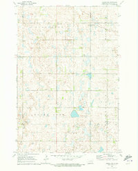
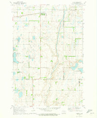
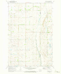 1970 Verona NE1973 Print · USGSLa Moure and Ransom Counties are captured here in the early 1970s, showcasing the agricultural heart of the North Dakota prairie. Researchers can locate property boundaries along Bear Creek and find family landmarks like the West Fairview Cem.
 - 1970 Map of Marion, 1973 Print
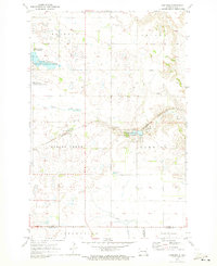
 1970 Marion1973 Print · USGSThe town of Marion and its surrounding rail junctions are captured here during the 1970s. Genealogists can locate family sites across three townships and trace landmarks like Lake View Cem, Grace Cem, and the local Gravel Pit.
 - 1970 Map of Verona, 1973 Print
 1970 Verona1973 Print · USGSNorth Dakota's southeastern prairie reveals a complex network of wetlands and rail-line settlements during the early 1970s. Researchers can trace the railroad corridor through Verona or locate family history at Pilgrims Rest Cem and St Raphael Cem.
End of results
Showing maps 1-10 of 10
Top cities of LaMoure County
- LaMoure historical maps
- Edgeley historical maps
- Kulm historical maps
- Marion historical maps
- Adrian Township historical maps
- Verona historical maps
See more
Frequently asked questions
- What are the different types of historical maps available for LaMoure County?
- What is the oldest map of LaMoure County?
- Where can I purchase historical maps of LaMoure County for my home or office?
- Where can I download high-res historical maps of LaMoure County?
- Are there historical topographic maps available for LaMoure County?
- Is there historical aerial imagery available for LaMoure County?
- Where are historical maps of LaMoure County sourced from?