1980s Maps of LaMoure County, North Dakota
Explore 17 historic maps of LaMoure County from the 1980s. These maps offer a rare glimpse into what life looked like during the 1980s — showing old roads, neighborhoods, homes, and landmarks that have changed or disappeared over time.
Whether you're researching your family's past, planning a metal detecting trip, or studying how LaMoure County's landscape evolved across the 1980s, these high-resolution maps are a powerful tool for exploring the history of this region.
- Focus on a specific era: All maps on this page are from the 1980s, giving you a focused view of this time period.
- See what’s changed: Compare century-old streets, trails, and buildings to today's modern landscape using overlays and satellite layers.
- Research with precision: Use these maps for genealogy, historical research, land use analysis, or educational projects.
- View, download, or print: Maps are fully viewable online in high resolution, and can be downloaded or printed for your own records.
Start exploring LaMoure County's history through authentic maps from the 1980s. This is your window into the past.
LaMoure County, ND maps
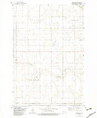
(17)- 1982 Map of Fredonia, 1983 Print
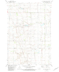
 1982 Fredonia1983 Print · USGSFredonia and the surrounding townships in Logan County are shown here during the early eighties, centered on the SOO LINE railroad corridor. Researchers can locate local burial sites such as Nazareth Parish Cem and trace the boundaries of the National Waterfowl Production Area.
 - 1982 Map of Schlecht-Weixel Dam, 1983 Print
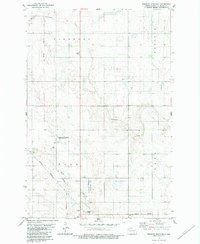
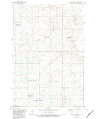 1982 Schlecht-Weixel Dam1983 Print · USGSLaMoure County in the early eighties shows a landscape of conservation and prairie agriculture centered around the Schlecht-Weixel Dam. Family historians can locate rural burial sites at German Cem and Township Cem amidst the Bluebird and Swede divisions.
 - 1982 Map of Deisem, 1983 Print
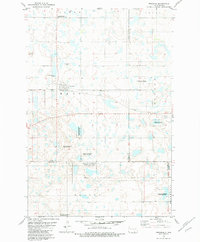
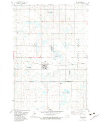
 1982 Deisem1983 Print · USGSLaMoure County's prairie landscape is captured in the early eighties, centered on the rail-side settlement of Deisem. Researchers can trace the Burlington Northern rail line and identify local landmarks like the Forsman Landing Strip and Gravel Pit.
 - 1982 Map of La Moure SW, 1983 Print
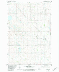
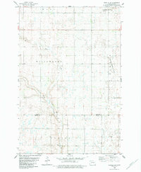
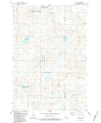
 1982 La Moure SW1983 Print · USGSThe North Dakota prairie at the start of the 1980s reveals a landscape of communal farming and winding creek beds. Researchers can locate the Hutterite Colony, trace the path of Cottonwood Creek, and identify the secluded Emmanuel Cem.
 - 1982 Map of Kulm-Edgeley Dam, 1983 Print
 1982 Kulm-Edgeley Dam1983 Print · USGSThe rural prairie of La Moure and Dickey Counties comes into focus during the late seventies, showing the township structures and water systems of the plains. Researchers can locate the Beresena Cem and local landmarks like the Kulm-Edgeley Dam and Jolin Dam.
 - 1982 Map of Kulm, 1983 Print
 1982 Kulm1983 Print · USGSThe rural landscape around the town of Kulm is captured here in the early 1980s as a patchwork of prairie potholes and agricultural tracts. Genealogists can locate several burial sites like Norwegian Cem and United Cem, while tracing the Soo Line railroad's path.
 - 1982 Map of Edgeley SE, 1983 Print
 1982 Edgeley SE1983 Print · USGSThe North Dakota prairie near the LaMoure and Dickey county line is shown here in the early eighties. Genealogists and local historians can trace the Finnish Cem and survey boundaries for Wano, Willowbank, and Valley.
 - 1982 Map of Fredonia NE, 1983 Print
 1982 Fredonia NE1983 Print · USGSThe Logan and La Moure county line in the early 1980s reveals a prairie landscape defined by family landholdings and conservation areas. Genealogists can locate rural landmarks like St James Cemetery and Tiede Cemetery among the township divisions of Janke and Raney.
 - 1982 Map of Medberry, 1983 Print
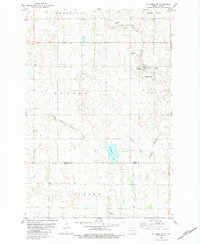
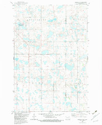
 1982 Medberry1983 Print · USGSLaMoure County prairie life in the early eighties is captured here through its township boundaries and rail corridors. Genealogists and local historians can locate Medberry, the Townhall in Russell, and the course of Cottonwood Creek.
 - 1982 Map of Edgeley Junction, 1983 Print
 1982 Edgeley Junction1983 Print · USGSLaMoure County's prairie landscape is captured here in the early eighties, showcasing the intersection of rail history and conservation. Genealogists and researchers can locate the Townhall, trace the Old Grade, and explore the wetlands of the National Waterfowl Production Area.
 - 1982 Map of Edgeley, 1986 Print
 1982 Edgeley1986 Print · USGSEdgeley and the surrounding prairie wetlands are shown in detail during the early eighties. Genealogists and local historians can locate Mount Hope Cem, the National Waterfowl Production Area, and the banks of the Maple River.
 - 1983 Map of Alfred
 1983 Alfred1983 Print · USGSThe prairie landscape around Alfred is shown during the early 1980s, highlighting a region defined by its rail connections and conservation lands. Researchers can locate the Postal Cem and trace the Burlington Northern line as it passes Arnies Lake.
 - 1983 Map of Gackle NE, 1984 Print
 1983 Gackle NE1984 Print · USGSStutsman and Logan counties appear here in the early 1980s as a quiet patchwork of prairie wetlands and civil townships. Genealogists and researchers can trace township boundaries like Sinclair and Alexander or locate the Seventh Day Adventist Cem.
 - 1985 Map of Steele, 1994 Print
 1985 Steele1994 Print · USGSCentral North Dakota’s prairie pothole region is showcased here in the mid-1980s, revealing a landscape of vital wetlands and rail-dependent towns. Researchers can trace family ties and land use near Steele, Napoleon, and the many waterfowl production areas like Slade National Wildlife Refuge.
 - 1986 Map of Wishek
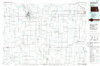
 1986 Wishek1986 Print · USGSMcIntosh and Logan counties are depicted here in the mid-1980s, a period defined by small-town rail commerce and extensive prairie conservation. Genealogists and researchers can trace the rail corridors of the Soo Line and Burlington Northern through centers like Wishek, Ashley, and Fredonia.2 unique versions available
 - 1986 Map of La Moure
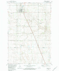
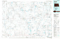
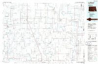 1986 La Moure1986 Print · USGSMid-century settlement patterns and water management define this stretch of the North Dakota prairie during the 1980s. Researchers can trace historic rail lines like the Soo Line or locate sites such as Whitestone Battlefield State Park and Ellendale.2 unique versions available
 - 1986 Map of Jamestown
 1986 Jamestown1986 Print · USGSThe eastern North Dakota prairie comes into focus in the mid-eighties, centered on the rail and river hubs of Jamestown and Valley City. You can trace the Burlington Northern line through historic stops like Eckelson, Sanborn, and Spiritwood while exploring vast wildlife refuges and local landmarks.2 unique versions available
End of results
Showing maps 1-17 of 17
Top cities of LaMoure County
- LaMoure historical maps
- Edgeley historical maps
- Kulm historical maps
- Marion historical maps
- Adrian Township historical maps
- Verona historical maps
See more
Frequently asked questions
- What are the different types of historical maps available for LaMoure County?
- What is the oldest map of LaMoure County?
- Where can I purchase historical maps of LaMoure County for my home or office?
- Where can I download high-res historical maps of LaMoure County?
- Are there historical topographic maps available for LaMoure County?
- Is there historical aerial imagery available for LaMoure County?
- Where are historical maps of LaMoure County sourced from?