Old Maps of Emmet, North Dakota for Metal Detecting
Plan your next treasure hunt with 8 historic maps of Emmet. Find old homesites, ghost towns, trails, and gathering spots that may be lost to time — perfect for identifying promising metal detecting locations.
- Locate forgotten sites: Uncover places like long-lost settlements, abandoned rail lines, or gathering spots.
- Plan better hunts: Use map overlays combined with LiDAR or satellite views to narrow in on historically rich areas.
- Made for detectorists: Thousands of hobbyists use these maps to discover relics, coins, and hidden history.
Use these historic maps to boost your research and find new opportunities beneath the surface of Emmet.
Emmet, ND maps
(8)- 1954 Map of McClusky, 1968 Print
 1954 McClusky1968 Print · USGSCentral North Dakota was undergoing a profound transformation in the fifties as the newly formed Lake Sakakawea reshaped the Missouri River valley. Genealogists and historians can trace rail-town development along the Soo Line and locate historic markers like Garrison Dam or the Lewis and Clark Trail.3 unique versions available
 - 1956 Map of Emmet, 1958 Print
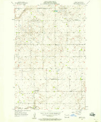 1956 Emmet1958 Print · USGSMcLean County is captured in the mid-1950s, showing a prairie landscape where small-town life and rural school districts remained the backbone of the community. Researchers can locate family-named sites such as Romaas Sch No 2, St Peters Ch, and the Clifton Cem.2 unique versions available
 - 1958 Map of McClusky
 1958 McClusky1958 Print · USGSCentral North Dakota was undergoing a profound change in the late fifties as the Garrison Reservoir filled behind its massive new dam. Trace the early layout of Riverdale, the Lewis and Clark Trail, and the vanishing rail stops of the Northern Pacific.
 - 2011 Map of Emmet, 2011 Print
 2011 Emmet2011 Print · USGSCovers Emmet, including McLean County, United States, and other nearby areas
 - 2014 Map of Emmet, 2014 Print
 2014 Emmet2014 Print · USGSCovers Emmet, including McLean County, United States, and other nearby areas
 - 2017 Map of Emmet, 2017 Print
 2017 Emmet2017 Print · USGSCovers Emmet, including McLean County, United States, and other nearby areas
 - 2020 Map of Emmet, 2020 Print
 2020 Emmet2020 Print · USGSCovers Emmet, including McLean County, United States, and other nearby areas
 - 2024 Map of Emmet, 2024 Print
 2024 Emmet2024 Print · USGSEmmet and the surrounding McLean County countryside are shown in detail as they appear today, preserving the region's agricultural and community layout. Genealogists can locate family landmarks such as Assumption Cem and Saint Peter Cem along the quiet section lines.
End of results
Showing maps 1-8 of 8
Top cities near Emmet
- Garrison historical maps
- Parshall historical maps
- Pick City historical maps
- Douglas historical maps
- Roseglen historical maps
Frequently asked questions
- What are the different types of historical maps available for Emmet?
- What is the oldest map of Emmet?
- Where can I purchase historical maps of Emmet for my home or office?
- Where can I download high-res historical maps of Emmet?
- Are there historical topographic maps available for Emmet?
- Is there historical aerial imagery available for Emmet?
- Where are historical maps of Emmet sourced from?