1970s Maps of Mercer County, North Dakota
Explore 17 historic maps of Mercer County from the 1970s. These maps offer a rare glimpse into what life looked like during the 1970s — showing old roads, neighborhoods, homes, and landmarks that have changed or disappeared over time.
Whether you're researching your family's past, planning a metal detecting trip, or studying how Mercer County's landscape evolved across the 1970s, these high-resolution maps are a powerful tool for exploring the history of this region.
- Focus on a specific era: All maps on this page are from the 1970s, giving you a focused view of this time period.
- See what’s changed: Compare century-old streets, trails, and buildings to today's modern landscape using overlays and satellite layers.
- Research with precision: Use these maps for genealogy, historical research, land use analysis, or educational projects.
- View, download, or print: Maps are fully viewable online in high resolution, and can be downloaded or printed for your own records.
Start exploring Mercer County's history through authentic maps from the 1970s. This is your window into the past.
Mercer County, ND maps
(17)- 1970 Map of Glen Ullin NE, 1972 Print
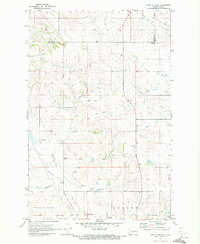 1970 Glen Ullin NE1972 Print · USGSMorton County in the early seventies shows a landscape shaped by rural industry and prairie waterways. Researchers can trace the courses of Coyote Creek and Haymarsh Creek or locate early industrial sites like the Gravel Pits.
 - 1970 Map of Glen Ullin NW, 1972 Print
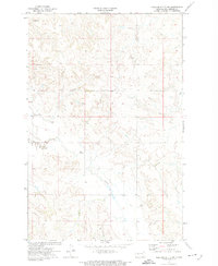
 1970 Glen Ullin NW1972 Print · USGSThe Mercer and Morton county line in the early seventies shows a landscape of high ridges and rural industry. Researchers can find St Clements Ch, the Burlington Northern tracks, and the prominent elevations of Eagles Nest.
 - 1970 Map of Golden Valley NE, 1973 Print
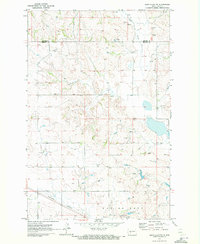
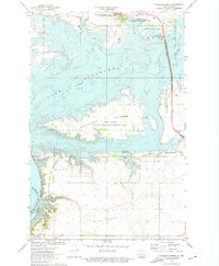
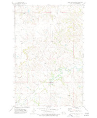
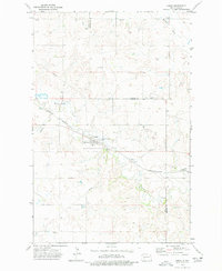
 1970 Golden Valley NE1973 Print · USGSMercer County and the Fort Berthold Indian Reservation boundary are shown here in the early seventies, just as the Missouri River Basin project reshaped the local topography. Researchers can trace the shoreline of Lake Sakakawea and locate the Nayzatch Cem or the high points of Twin Buttes.2 unique versions available
 - 1970 Map of Golden Valley NW, 1973 Print
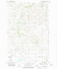
 1970 Golden Valley NW1973 Print · USGSMercer County and the Missouri River Basin are captured here in the early 1970s, showcasing a landscape of high prairie and reservation lands. Genealogists and historians can locate the Defiance Cem and trace the drainage of Goodman Creek and Horse Creek across this rural territory.
 - 1972 Map of Medicine Butte SW, 1973 Print
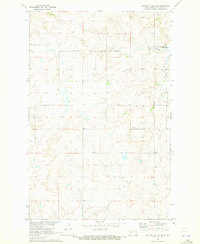
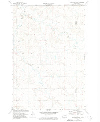
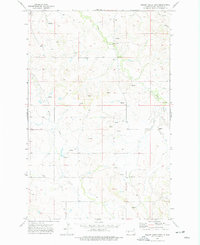
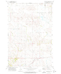
 1972 Medicine Butte SW1973 Print · USGSMercer County's high plains are captured in the early seventies, showcasing a landscape defined by its drainage basins and rural water management. Researchers can locate specific water features like the Flowing Well and trace the paths of Elm Creek and Beaver Cr.
 - 1972 Map of Garrison Dam North, 1974 Print
 1972 Garrison Dam North1974 Print · USGSIn the early seventies, this part of McLean County centered on the massive transformation of the Missouri valley into a regional recreation hub. Researchers can trace the Old Fort Stevenson Military Reservation Boundary and locate early sites like Pick City and Camp Dominic Savio.
 - 1972 Map of Medicine Butte SE, 1974 Print
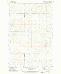
 1972 Medicine Butte SE1974 Print · USGSThe high plains of Mercer and Oliver Counties were still a land of remote homesteads and prairie creeks in the early seventies. Genealogists and local historians can locate family landmarks like the New Gluecksthal Cem, Unruh Cem, and Beaver Creek.
 - 1972 Map of Riverdale North, 1974 Print
 1972 Riverdale North1974 Print · USGSMcLean County is transformed by the Missouri River reservoirs in the early seventies, showcasing a massive landscape of dams and wildlife refuges. Researchers can trace the Old Ft Stevenson Mil Res Bdy and explore the mid-century layout of Riverdale.2 unique versions available
 - 1973 Map of Hebron, 1977 Print
 1973 Hebron1977 Print · USGSHebron and its surrounding prairies are captured in the early 1970s as the town thrived along the Burlington Northern railroad. Genealogists and researchers can locate St John Cem, St Ann Cem, and the old High School near the banks of the Knife River.
 - 1973 Map of Schaffner Creek NE, 1977 Print
 1973 Schaffner Creek NE1977 Print · USGSMercer County prairie lands are captured here in the early seventies, centered on the winding Knife River. Researchers can trace the rural landscape through family-named landmarks, upland Spring locations, and the Gold Creek drainage.
 - 1973 Map of Willow Creek West, 1977 Print
 1973 Willow Creek West1977 Print · USGSDunn County and its neighboring borders are captured in the early 1970s, showcasing the rural water networks of the High Plains. Researchers can trace the winding Knife River and its southern Branch, or locate local landmarks like the Gravel Pit.
 - 1973 Map of Schaffner Creek, 1977 Print
 1973 Schaffner Creek1977 Print · USGSDunn County and Mercer County are captured here during the early 1970s, showing a traditional landscape of prairie homesteads and creek drainages. Genealogists can locate family landmarks such as St Martins Ch, Broncho Cem, and the path of Schaffner Creek.
 - 1973 Map of Willow Creek East, 1977 Print
 1973 Willow Creek East1977 Print · USGSMercer County's prairie landscape is documented here in the early seventies, showing a rural environment shaped by the Knife River and Elm Creek. Researchers can trace the layout of Jaeger and locate specific agricultural landmarks like Storage Bins and a local Gravel Pit.
 - 1973 Map of Dodge, 1977 Print
 1973 Dodge1977 Print · USGSThe rural prairie landscape surrounding the Dunn and Mercer county line is captured here in the early 1970s. Genealogists and local historians can trace the townsite of Dodge, the Burlington Northern rail line, and family burial sites like Loring Cem.
 - 1973 Map of Golden Valley, 1977 Print
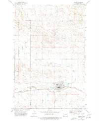
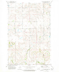
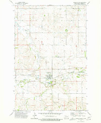 1973 Golden Valley1977 Print · USGSMercer County at the start of the 1970s shows the prairie community of Golden Valley anchored by the Burlington Northern railroad. Researchers can trace local heritage through the Spring Creek Cem, Golgotha Cem, and the path of Goodman Creek.
 - 1973 Map of Indian Butte, 1977 Print
 1973 Indian Butte1977 Print · USGSWestern North Dakota's open plains and rising landmarks are captured here in the early 1970s as the regional economy balanced ranching and rail. Genealogists and historians can locate remote landmarks like Indian Butte, the Burlington Northern rail line, and the confluence of the Branch Knife River.
 - 1974 Map of Killdeer, 1976 Print
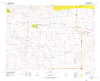 1974 Killdeer1976 Print · USGSWestern North Dakota's ranching and rail country comes into focus in the mid-seventies, showing the prairie landscape before modern energy booms. Trace the Burlington Northern line through Dodge, Werner, and Golden Valley, or locate family landmarks near Manning and New Hradec.
End of results
Showing maps 1-17 of 17
Top cities of Mercer County
- Beulah historical maps
- Hazen historical maps
- Stanton historical maps
- Zap historical maps
- Golden Valley historical maps
- Pick City historical maps
Frequently asked questions
- What are the different types of historical maps available for Mercer County?
- What is the oldest map of Mercer County?
- Where can I purchase historical maps of Mercer County for my home or office?
- Where can I download high-res historical maps of Mercer County?
- Are there historical topographic maps available for Mercer County?
- Is there historical aerial imagery available for Mercer County?
- Where are historical maps of Mercer County sourced from?