1960s Maps of Mercer County, North Dakota
Explore 24 historic maps of Mercer County from the 1960s. These maps offer a rare glimpse into what life looked like during the 1960s — showing old roads, neighborhoods, homes, and landmarks that have changed or disappeared over time.
Whether you're researching your family's past, planning a metal detecting trip, or studying how Mercer County's landscape evolved across the 1960s, these high-resolution maps are a powerful tool for exploring the history of this region.
- Focus on a specific era: All maps on this page are from the 1960s, giving you a focused view of this time period.
- See what’s changed: Compare century-old streets, trails, and buildings to today's modern landscape using overlays and satellite layers.
- Research with precision: Use these maps for genealogy, historical research, land use analysis, or educational projects.
- View, download, or print: Maps are fully viewable online in high resolution, and can be downloaded or printed for your own records.
Start exploring Mercer County's history through authentic maps from the 1960s. This is your window into the past.
Mercer County, ND maps
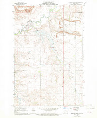
(24)- 1967 Map of Watford City
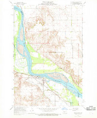
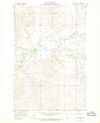
 1967 Watford City1967 Print · USGSWestern North Dakota is captured during a period of landscape transformation as the Missouri River valley was reshaped by the new Garrison Reservoir. Genealogists and local historians can trace the foundations of Watford City, find the Elkhorn Ranch Site, or locate rural landmarks like Ziner Butte and Grassy Butte.
 - 1967 Map of Stanton SE, 1969 Print
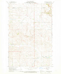
 1967 Stanton SE1969 Print · USGSThe Missouri River valley in the late 1960s serves as a hub of both frontier legacy and industrial utility. Genealogists and historians can locate family landmarks like Basto Cem alongside major sites including Fort Mandan Historic Site and the Northern Pacific rail line.2 unique versions available
 - 1967 Map of Emmet SE, 1969 Print
 1967 Emmet SE1969 Print · USGSThe Missouri River valley in the late sixties shows the rising waters of Lake Sakakawea as they reshaped the McLean County landscape. Trace the legacy of the western frontier along the Old Fort Stevenson Military Road or find family roots at Geminde Cem.2 unique versions available
 - 1967 Map of Blackwater Lake SE, 1969 Print
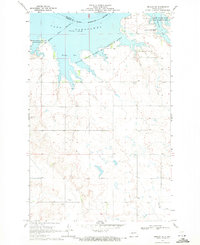
 1967 Blackwater Lake SE1969 Print · USGSThe Missouri River breaks into the sprawling Lake Sakakawea during the late sixties, reshaping the McLean County landscape. Genealogists and historians can trace local landmarks like St Andrews Ch, St Pauls Ch, and early coal interests at the Strip Mines.
 - 1967 Map of Raub SE, 1969 Print
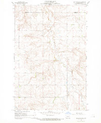
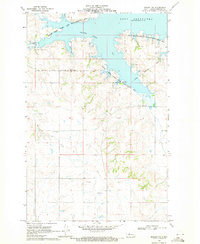
 1967 Raub SE1969 Print · USGSThe Missouri River breaks into the sprawling Lake Sakakawea in the late sixties, defining this Mercer and McLean County landscape. Genealogists and historians can locate the Red Butte Cem and explore the Beaver Creek State Game Management Area.
 - 1967 Map of Twin Buttes, 1969 Print
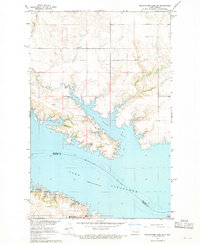
 1967 Twin Buttes1969 Print · USGSThe rising waters of Lake Sakakawea define this part of Mercer and Dunn County during the late 1960s. Researchers can locate numerous local landmarks including St Joseph Ch, Twin Buttes, and several rural cemeteries like Chase Cem.
 - 1967 Map of Blackwater Lake SW, 1969 Print
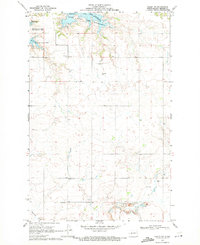
 1967 Blackwater Lake SW1969 Print · USGSThe McLean County shoreline was significantly transformed by the mid-1960s as the rising Missouri River reshaped the landscape. Trace the geography of Nishu Bay and find local landmarks like Beaver Creek Cem and the Buffalo Rock Coulee.2 unique versions available
 - 1967 Map of Emmet SW, 1970 Print
 1967 Emmet SW1970 Print · USGSThe Missouri River valley undergoes a profound change in the late sixties as the Garrison Dam alters the landscape. Researchers can trace the submerged boundaries of the Old Fort Stevenson Military Reservation and locate the Lilly Dale Cem.
 - 1968 Map of Hannover NE, 1969 Print
 1968 Hannover NE1969 Print · USGSThe Missouri River borderlands of Oliver and Mercer Counties are captured here in the late sixties during a period of industrial growth. Local researchers can trace the historic Fort Clark Historic Site, find family names at Bagley Cem, and locate the old Strip Mine and Alderin settlement.2 unique versions available
 - 1968 Map of Red Butte, 1969 Print
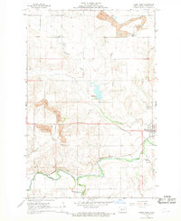
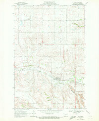
 1968 Red Butte1969 Print · USGSThe prairie border between Oliver and Mercer counties is captured here in the late sixties, showing a landscape of section lines and winding creek beds. Genealogists and local historians can locate Nisbet Cem, Red Butte Cem, and the prominent landmark of Red Butte.
 - 1968 Map of Beulah, 1969 Print
 1968 Beulah1969 Print · USGSIn the late 1960s, Beulah was a growing industrial hub along the Knife River valley. Genealogists and historians can trace the town's footprint, from the Northern Pacific rails to family burial sites like Boeckel Cem and Sarah Cem.2 unique versions available
 - 1968 Map of Medicine Butte NE, 1969 Print
 1968 Medicine Butte NE1969 Print · USGSNorth Dakota's energy and water infrastructure take center stage in the 1960s as mining and rail expand across the Mercer and Oliver county line. Trace local history at Rose Hill Cem, the massive Strip Mine works, and the site of the Proposed Beulah Dam.2 unique versions available
 - 1968 Map of Red Butte NW, 1969 Print
 1968 Red Butte NW1969 Print · USGSOliver and Mercer Counties in the late sixties reveal a landscape of winding coulees and high plains agriculture. Trace local family history at Rhein Cem or study the era's infrastructure through the prominent Pipeline and rural Flowing Well sites.2 unique versions available
 - 1968 Map of Hazen West, 1969 Print
 1968 Hazen West1969 Print · USGSMercer County at the close of the 1960s shows a landscape transformed by coal mining and heavy rail transport along the Knife River. Researchers can trace old family sites and industrial history through locations like Truax, Strip Mine works, and St Martins Cem.2 unique versions available
 - 1968 Map of Stanton, 1969 Print
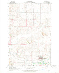
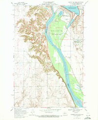
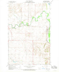 1968 Stanton1969 Print · USGSThe Missouri and Knife River confluence in the late 1960s highlights the river-and-rail economy of Mercer County. Genealogists and historians can trace the Northern Pacific tracks through Stanton and locate family sites like Zion Cem or the Stanton Cem.2 unique versions available
 - 1968 Map of Medicine Butte, 1969 Print
 1968 Medicine Butte1969 Print · USGSMercer County's prairie and river breaks are documented here in the late sixties, just as the region's energy landscape was evolving. Researchers can trace the winding Knife River and locate industrial markers like the Strip Mine or the prominent Medicine Butte.2 unique versions available
 - 1968 Map of Hannover NW, 1969 Print
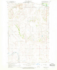
 1968 Hannover NW1969 Print · USGSThe border of Oliver and Mercer counties comes into focus in the late 1960s, showing a prairie landscape of section-line farms and creeks. Researchers can trace the footprints of rural education and community at Pleasant Valley Sch No 1 and a local Cemetery along Kinneman Creek.
 - 1968 Map of Hazen East, 1969 Print
 1968 Hazen East1969 Print · USGSMercer County in the late sixties shows a landscape where the river valley and rail lines intersect at the growing town of Hazen. Researchers can trace the path of the Northern Pacific railroad, find the Cambridge Cem, and locate rural landmarks like Brady or the local Mine.
 - 1969 Map of Hazen NE, 1971 Print
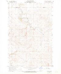
 1969 Hazen NE1971 Print · USGSMercer County's rural prairies are shown just before the turn of the 1970s, revealing a landscape of family-named cemeteries and remote country churches. Genealogists and local historians can trace the locations of Tschaekofske Cem, St Johns Cem, and the Trinity Ch along the banks of Coal Creek.
 - 1969 Map of Beulah NE, 1971 Print
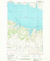
 1969 Beulah NE1971 Print · USGSThe Missouri River valley in Mercer County had recently transformed into a vast reservoir by the late sixties. Genealogists and local historians can trace legacy landmarks like Kronthal Cem, Koehler Cem, and the boundaries of the Fort Berthold Indian Reservation.2 unique versions available
 - 1969 Map of Hazen NW, 1971 Print
 1969 Hazen NW1971 Print · USGSMercer County's prairie and shoreline are captured here in the late sixties as the rising waters of Lake Sakakawea reshaped the northern horizon. Genealogists and local historians can locate several rural burial grounds, including Immanuel Cem, Weiderich Cem, and Bethel Cem.
 - 1969 Map of Beulah NW, 1971 Print
 1969 Beulah NW1971 Print · USGSMercer County's shoreline along Lake Sakakawea is captured here in the late sixties as the reservoir reshaped the landscape. Genealogists can locate rural landmarks like St Johannes Cem and the Fort Berthold Indian Reservation Boundary.2 unique versions available
 - 1969 Map of Zap, 1971 Print
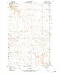
 1969 Zap1971 Print · USGSMercer County prairie life is centered on the valley of Spring Creek during the late sixties. Researchers can trace the community footprint of Zap through its local institutions like St Johns Ch and the neighboring industrial Strip Mine.
 - 1969 Map of Garrison Dam South, 1971 Print
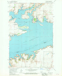
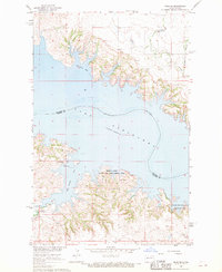
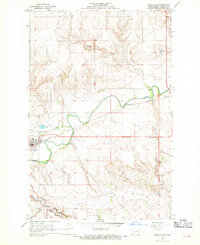
 1969 Garrison Dam South1971 Print · USGSThe Missouri River valley was undergoing significant transformation in the late sixties as the massive Garrison Dam reshaped the North Dakota landscape. Researchers can trace the layout of Riverdale, the Garrison Dam National Fish Hatchery, and the rural St Pauls Ch.2 unique versions available
End of results
Showing maps 1-24 of 24
Top cities of Mercer County
- Beulah historical maps
- Hazen historical maps
- Stanton historical maps
- Zap historical maps
- Golden Valley historical maps
- Pick City historical maps
Frequently asked questions
- What are the different types of historical maps available for Mercer County?
- What is the oldest map of Mercer County?
- Where can I purchase historical maps of Mercer County for my home or office?
- Where can I download high-res historical maps of Mercer County?
- Are there historical topographic maps available for Mercer County?
- Is there historical aerial imagery available for Mercer County?
- Where are historical maps of Mercer County sourced from?