
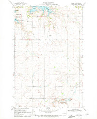
1967 Map of Emmet SW
USGS Topo · Published 1970About this map
The rising waters of Lake Sakakawea dominate this mid-century landscape along the McLean and Mercer County line. Large areas are designated as subject to controlled inundation, illustrating the massive transformation of the Missouri River valley during this period. The map identifies the historical legacy of the region through the Old Fort Stevenson Military Reservation Boundary and the Fort Berthold Indian Reservation Boundary, marking the intersection of indigenous lands and early frontier outposts.
Find a feature on this map
15 named features on this map. Tap any name to fly to it.
Don’t see what you’re looking for? This feature index may not catch every label — zoom into the map to look around manually.
Map Details
Editions of this 1967 Emmet SW Map
This is the sole edition of this map. No revisions or reprints were ever made.
Other maps of this area

1954 · McClusky
USGS Topo · 1:250,000

1956 · Emmet NE
USGS Topo · 1:24,000

1956 · Blackwater Lake
USGS Topo · 1:24,000

1956 · Emmet
USGS Topo · 1:24,000

1958 · McClusky
USGS Topo · 1:250,000

1967 · Emmet SE
USGS Topo · 1:24,000

1967 · Blackwater Lake SE
USGS Topo · 1:24,000

1969 · Hazen NE
USGS Topo · 1:24,000

1969 · Beulah NE
USGS Topo · 1:24,000
1969 · Hazen NW
USGS Topo · 1:24,000