1970s Maps of Morton County, North Dakota
Explore 21 historic maps of Morton County from the 1970s. These maps offer a rare glimpse into what life looked like during the 1970s — showing old roads, neighborhoods, homes, and landmarks that have changed or disappeared over time.
Whether you're researching your family's past, planning a metal detecting trip, or studying how Morton County's landscape evolved across the 1970s, these high-resolution maps are a powerful tool for exploring the history of this region.
- Focus on a specific era: All maps on this page are from the 1970s, giving you a focused view of this time period.
- See what’s changed: Compare century-old streets, trails, and buildings to today's modern landscape using overlays and satellite layers.
- Research with precision: Use these maps for genealogy, historical research, land use analysis, or educational projects.
- View, download, or print: Maps are fully viewable online in high resolution, and can be downloaded or printed for your own records.
Start exploring Morton County's history through authentic maps from the 1970s. This is your window into the past.
Morton County, ND maps
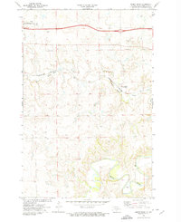
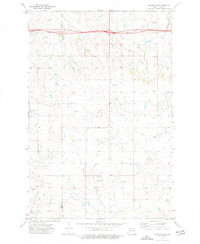
(21)- 1970 Map of Bluegrass, 1972 Print
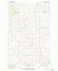
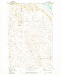
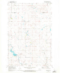 1970 Bluegrass1972 Print · USGSNorth Dakota's prairie landscape comes into focus during the early 1970s, showcasing a rural world of small settlements and emerging conservation areas. Genealogists and historians can trace the local drainage of Sweet Briar Creek, the development of Storm Creek Lake, and the remote outposts of Bluegrass and Briar.
 - 1970 Map of New Salem NW, 1972 Print
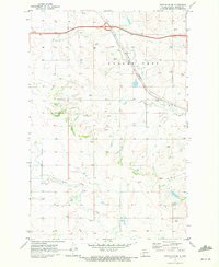
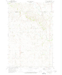
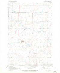 1970 New Salem NW1972 Print · USGSWestern North Dakota prairie life in the early seventies centered on rural settlements and the land's hidden resources. Genealogists and researchers can locate the site of Youngtown, trace the winding Sweet Briar Creek, or identify workings at the local Strip Mine.
 - 1970 Map of Hailstone Butte, 1972 Print
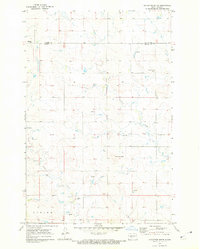 1970 Hailstone Butte1972 Print · USGSMorton and Oliver counties are documented here in the early seventies, showing a landscape of high plains agriculture and scattered prairie landmarks. Genealogists can locate rural burial sites like St Markus Cem and Bluegrass Cem or trace the drainages of Hailstone Creek.
 - 1970 Map of Judson, 1972 Print
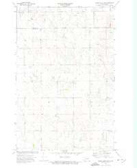
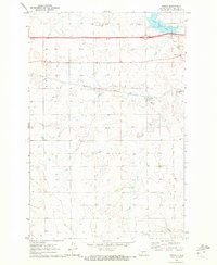 1970 Judson1972 Print · USGSMorton County at the start of the 1970s reveals a prairie landscape of railroads and resource extraction. Researchers can trace the layout of Judson and locate regional landmarks like the Lignite Pits and Sweet Briar Lake.
 - 1970 Map of Glen Ullin NE, 1972 Print
 1970 Glen Ullin NE1972 Print · USGSMorton County in the early seventies shows a landscape shaped by rural industry and prairie waterways. Researchers can trace the courses of Coyote Creek and Haymarsh Creek or locate early industrial sites like the Gravel Pits.
 - 1970 Map of New Salem NE, 1972 Print
 1970 New Salem NE1972 Print · USGSMorton and Oliver counties are documented here in the early seventies, just as the local landscape was adapting to new conservation and water projects. Researchers can trace rural landmarks like Bremen Cem, the Lignite Pit, and the newly formed Sweet Briar Lake.
 - 1970 Map of Glen Ullin NW, 1972 Print
 1970 Glen Ullin NW1972 Print · USGSThe Mercer and Morton county line in the early seventies shows a landscape of high ridges and rural industry. Researchers can find St Clements Ch, the Burlington Northern tracks, and the prominent elevations of Eagles Nest.
 - 1970 Map of Glen Ullin SW, 1972 Print
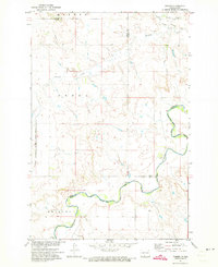
 1970 Glen Ullin SW1972 Print · USGSMorton County in the early seventies shows a transition to modern rail networks while maintaining its deep agricultural roots. Genealogists and researchers can locate a rural Cem and trace the paths of Heart Butte Creek and the Burlington Northern line.
 - 1971 Map of Huff, 1973 Print
 1971 Huff1973 Print · USGSThe Missouri River breaks near Huff are captured here during the early 1970s, showcasing a landscape of high buttes and military history. Genealogists and historians can locate the Parum Cem, Ambulance Butte Sch, and the old Fort Rice Military Reservation Boundary.
 - 1971 Map of Solen SW, 1973 Print
 1971 Solen SW1973 Print · USGSSioux County's river-cut prairie is captured in the early seventies, dominated by the winding path of the Cannonball River. Researchers can trace the Old Railroad Grade and locate local landmarks like Fairview Cem and Dogtooth.
 - 1971 Map of Fort Rice, 1973 Print
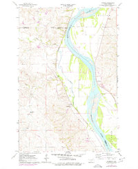
 1971 Fort Rice1973 Print · USGSThe Missouri River valley near Fort Rice appears here in the early seventies during the rise of Lake Oahe. Genealogists and historians can locate the Fort Rice Military Cem, the Fort Rice Historical Site, and an Old Railroad Grade.2 unique versions available
 - 1971 Map of Timmer, 1973 Print
 1971 Timmer1973 Print · USGSThe prairie landscape of south-central North Dakota is captured here in the early 1970s, as the Cannonball River winds along the Standing Rock Indian Reservation Boundary. Researchers can locate the community of Timmer and its local landmarks, including St George Ch and the old Chicago Milwaukee St Paul and Pacific Railroad Grade.
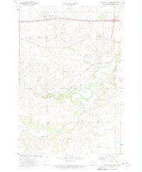
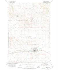
 - 1972 Map of Sweet Briar, 1974 Print
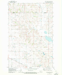
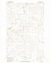
 1972 Sweet Briar1974 Print · USGSMorton County in the early seventies is mapped as a corridor of rail and water, where the Heart River meets the northern prairie. Trace the Burlington Northern line past Sweet Briar or locate rural infrastructure like the Flowing Well and local Gravel Pits.
 - 1972 Map of Crown Butte Lake, 1974 Print
 1972 Crown Butte Lake1974 Print · USGSMorton County in the early seventies shows a landscape of prairie plateaus and deep river valleys during a period of rural consolidation. Trace family roots and local landmarks at Heart River Ch, Square Butte Sch No 1, and the settlement of Lyons.
 - 1972 Map of Crown Butte NW, 1974 Print
 1972 Crown Butte NW1974 Print · USGSMorton and Oliver counties are captured in the early seventies, showcasing a rural landscape defined by prairie agriculture and resource extraction. Researchers can trace land use through the Lignite Pit, Gravel Pits, and local landmarks like St Vincent Ch.
 - 1972 Map of Crown Butte, 1974 Print
 1972 Crown Butte1974 Print · USGSThe rural borderlands between Morton and Oliver counties are captured here in the early seventies, showing a landscape defined by rolling prairie and modern utility. Researchers can trace the path of Square Butte Creek, locate the local Strip Mine, and identify the prominent Crown Butte landmark.
 - 1973 Map of Hebron SE, 1977 Print
 1973 Hebron SE1977 Print · USGSThe prairie landscape along the Morton and Stark county line is captured here in the early seventies, just as modern infrastructure began to cross the rural plains. You can trace the path of Heart Butte Creek, locate the Schmidt landmark, and see the early alignment of 94 near a local Gravel Pit.
 - 1973 Map of Hebron, 1977 Print
 1973 Hebron1977 Print · USGSHebron and its surrounding prairies are captured in the early 1970s as the town thrived along the Burlington Northern railroad. Genealogists and researchers can locate St John Cem, St Ann Cem, and the old High School near the banks of the Knife River.
 - 1976 Map of Harmon, 1977 Print
 1976 Harmon1977 Print · USGSThe Missouri River valley north of Bismarck reveals a landscape of ancient settlements and early rail corridors in the mid-seventies. Trace the historic Double Ditch Indian Village and find remote rural landmarks like Square Butte School No 1 and Harmon.
 - 1976 Map of Sugarloaf Butte, 1977 Print
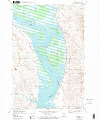
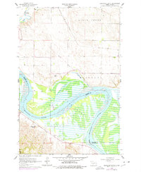 1976 Sugarloaf Butte1977 Print · USGSThe Missouri River valley south of Bismarck is captured here during the mid-seventies as the reservoir waters of Lake Oahe dominated the lowlands. Researchers can trace the Old Fort Rice Military Reservation Boundary or locate local landmarks like Stewartsdale Cem and Sugarloaf Butte.
 - 1979 Map of Bismarck, 1980 Print
 1979 Bismarck1980 Print · USGSBismarck and Mandan sit at the heart of this late-century North Dakota survey, where the Missouri River flows past historic frontier outposts. Trace the old Soo Line rail corridors or locate family landmarks near St Anthony, Fort Rice, and Custer Flats.
End of results
Showing maps 1-21 of 21
Top cities of Morton County
- Mandan historical maps
- New Salem historical maps
- Glen Ullin historical maps
- Hebron historical maps
- Flasher historical maps
- Almont historical maps
Frequently asked questions
- What are the different types of historical maps available for Morton County?
- What is the oldest map of Morton County?
- Where can I purchase historical maps of Morton County for my home or office?
- Where can I download high-res historical maps of Morton County?
- Are there historical topographic maps available for Morton County?
- Is there historical aerial imagery available for Morton County?
- Where are historical maps of Morton County sourced from?