1900s (20th Century) Maps of St. Thomas, North Dakota
Explore 9 historic maps of St. Thomas from the 1900s (20th Century). These maps offer a rare glimpse into what life looked like during the 1900s — showing old roads, neighborhoods, homes, and landmarks that have changed or disappeared over time.
Whether you're researching your family's past, planning a metal detecting trip, or studying how St. Thomas's landscape evolved across the 1900s, these high-resolution maps are a powerful tool for exploring the history of this region.
- Focus on a specific era: All maps on this page are from the 1900s, giving you a focused view of this time period.
- See what’s changed: Compare century-old streets, trails, and buildings to today's modern landscape using overlays and satellite layers.
- Research with precision: Use these maps for genealogy, historical research, land use analysis, or educational projects.
- View, download, or print: Maps are fully viewable online in high resolution, and can be downloaded or printed for your own records.
Start exploring St. Thomas's history through authentic maps from the 1900s. This is your window into the past.
St. Thomas, ND maps
(9)- 1939 Map of Glasston, 1958 Print
 1939 Glasston1958 Print · USGSNorth Dakota's fertile Red River Valley is captured here in the late 1930s, showing a landscape defined by rail and agriculture. Trace the Great Northern line to find Sugar Siding or locate early rural schools like Union Sch and School No 52.
 - 1941 Map of Glasston
 1941 Glasston1941 Print · USGSThe Red River Valley's agricultural heartland is documented here just before the mid-century, showing a landscape defined by rail-side elevators and rural townships. Researchers can trace family roots through numerous country schools like Quam Sch and landmarks such as the Norwegian Cem near Sugar Siding.
 - 1952 Map of Thief River Falls, 1967 Print
 1952 Thief River Falls1967 Print · USGSThe Red River Valley's agricultural and conservation landscape is captured in the mid-1950s, detailing a web of rail lines and international border crossings. Researchers can trace family roots in towns like Thief River Falls, locate the State School for Blind, and survey landmarks like the Agassiz National Wildlife Refuge.2 unique versions available
 - 1956 Map of Thief River Falls
 1956 Thief River Falls1956 Print · USGSThe Red River Valley in the mid-1950s is captured here as a sprawling network of rail corridors and wildlife refuges along the Canadian border. Trace the vanished transport routes of the Dismantled railroad and Abandoned railroad or locate local landmarks like the Herrick Elevator and State School for Blind.
 - 1957 Map of Thief River Falls
 1957 Thief River Falls1957 Print · USGSThe Red River Valley in the mid-fifties is captured here as a thriving network of rail towns and conservation lands. Genealogists and historians can trace family roots through settlements like Grafton, Pembina, and Hallock, or locate landmarks such as the State School for Blind and the Great Northern RR corridor.
 - 1967 Map of Thief River Falls
 1967 Thief River Falls1967 Print · USGSThe Red River Valley and the international border come alive in the 1960s, showing a landscape shaped by major rail lines and river commerce. Genealogists and historians can trace the paths of the Great Northern and Soo Line through towns like Thief River Falls, Grafton, and Hallock.
 - 1971 Map of Glasston, 1973 Print
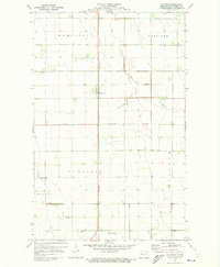 1971 Glasston1973 Print · USGSPembina County agriculture and infrastructure are captured here in the early 1970s. Researchers can trace the Burlington Northern rail line through Glasston or locate the St Thomas Cem and the St Thomas Municipal Airfield.
 - 1972 Map of Saint Thomas, 1974 Print
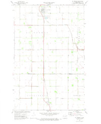 1972 Saint Thomas1974 Print · USGSThe agricultural heart of Pembina and Walsh counties is captured here in the early 1970s. Researchers can trace the railroad-oriented growth of St Thomas and Auburn alongside local landmarks like St Johns Cem and the St Thomas Municipal Airfield.2 unique versions available
 - 1985 Map of Cavalier
 1985 Cavalier1985 Print · USGSThe Red River Valley and the international border meet in this mid-1980s look at the drainage and rail networks of Northeast North Dakota. Trace the paths of the Burlington Northern and Soo Line through border towns like Neche, Pembina, and Noyes.2 unique versions available
End of results
Showing maps 1-9 of 9
Top cities near St. Thomas
- Grafton historical maps
- Cavalier historical maps
- Hoople historical maps
- Oakwood historical maps
- Crystal historical maps
- Joliette historical maps
See more
Top neighborhoods of St. Thomas
Frequently asked questions
- What are the different types of historical maps available for St. Thomas?
- What is the oldest map of St. Thomas?
- Where can I purchase historical maps of St. Thomas for my home or office?
- Where can I download high-res historical maps of St. Thomas?
- Are there historical topographic maps available for St. Thomas?
- Is there historical aerial imagery available for St. Thomas?
- Where are historical maps of St. Thomas sourced from?