1900s (20th Century) Maps of Enger Township, North Dakota
Explore 9 historic maps of Enger Township from the 1900s (20th Century). These maps offer a rare glimpse into what life looked like during the 1900s — showing old roads, neighborhoods, homes, and landmarks that have changed or disappeared over time.
Whether you're researching your family's past, planning a metal detecting trip, or studying how Enger Township's landscape evolved across the 1900s, these high-resolution maps are a powerful tool for exploring the history of this region.
- Focus on a specific era: All maps on this page are from the 1900s, giving you a focused view of this time period.
- See what’s changed: Compare century-old streets, trails, and buildings to today's modern landscape using overlays and satellite layers.
- Research with precision: Use these maps for genealogy, historical research, land use analysis, or educational projects.
- View, download, or print: Maps are fully viewable online in high resolution, and can be downloaded or printed for your own records.
Start exploring Enger Township's history through authentic maps from the 1900s. This is your window into the past.
Enger Township, ND maps
(9)- 1952 Map of Grand Forks, 1967 Print
 1952 Grand Forks1967 Print · USGSThe Red River Valley in the early fifties is shown here at the height of its rail-and-river agricultural economy. Researchers can locate small-town landmarks like the Pleasant View School, the Immanuel Lutheran Church, and trace the path of the Soo Line Railroad.3 unique versions available
 - 1956 Map of Grand Forks
 1956 Grand Forks1956 Print · USGSThe Red River Valley in the mid-fifties is captured here as a thriving corridor of grain elevators and rail-linked towns along the North Dakota and Minnesota border. Researchers can trace historic church sites like Immanuel Lutheran Church, vanished rail stops at Tilde Junction, and the boundaries of the White Earth Indian Reservation.
 - 1966 Map of Grand Forks
 1966 Grand Forks1966 Print · USGSThe Red River Valley in the mid-sixties shows a landscape shaped by rail-line commerce and complex water management. Genealogists and historians can trace rail-side towns like Emerado and Hunter or locate rural landmarks like the Pleasant View Church.
 - 1968 Map of Hope NE, 1970 Print
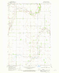 1968 Hope NE1970 Print · USGSSteele County's agricultural heartland is documented in the late sixties as the river systems shaped the rural landscape. Genealogists can trace family farmsteads near Perry Ch, the local Townhall, and along the winding Goose River.
 - 1968 Map of Galesburg NW, 1970 Print
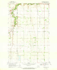 1968 Galesburg NW1970 Print · USGSTraill County's fertile Red River Valley landscape is shown in the late sixties as the river-fed agricultural system matured. Researchers can trace family sites near Portland, locate the Bruflat Cem, and follow the path of the Old Railroad Grade.
 - 1970 Map of Northwood SE, 1972 Print
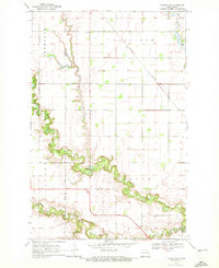
 1970 Northwood SE1972 Print · USGSSteele County's rural townships were characterized by sprawling grain farms and quiet community centers in the 1970s. Researchers can pinpoint early landmarks like Little Forks Ch, the Townhall, and family burial sites including Stevens Memorial Cem.
 - 1970 Map of Hatton SW, 1972 Print
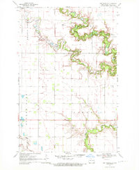
 1970 Hatton SW1972 Print · USGSPortland and the surrounding townships were captured in the early 1970s at the confluence of the Goose River branches. Genealogists and local historians can trace the paths of the Burlington Northern railroad or locate family sites near Aurdal Cem and River Park.
 - 1985 Map of Grand Forks
 1985 Grand Forks1985 Print · USGSThe Red River Valley in the mid-1980s was a landscape of deep-rooted agriculture and rising military significance. Genealogists and researchers can trace the rail-tied development of towns like Larimore and Northwood alongside major landmarks like Grand Forks Air Force Base and Turtle River State Park.2 unique versions available
 - 1985 Map of Hillsboro
 1985 Hillsboro1985 Print · USGSEastern North Dakota’s expansive farming country is mapped here in the mid-1980s, showing the vital link between rail lines and prairie towns. Genealogists and historians can trace family locations near Mayville, Sherbrooke, and the Mayville Cem.2 unique versions available
End of results
Showing maps 1-9 of 9
Top cities near Enger Township
- Mayville historical maps
- Northwood historical maps
- Hatton historical maps
- Portland historical maps
- Hope historical maps
- Colgate Township historical maps
See more
Frequently asked questions
- What are the different types of historical maps available for Enger Township?
- What is the oldest map of Enger Township?
- Where can I purchase historical maps of Enger Township for my home or office?
- Where can I download high-res historical maps of Enger Township?
- Are there historical topographic maps available for Enger Township?
- Is there historical aerial imagery available for Enger Township?
- Where are historical maps of Enger Township sourced from?