2020s Maps of Jefferson Township, Ohio
Explore 4 historic maps of Jefferson Township from the 2020s. These maps offer a rare glimpse into what life looked like during the 2020s — showing old roads, neighborhoods, homes, and landmarks that have changed or disappeared over time.
Whether you're researching your family's past, planning a metal detecting trip, or studying how Jefferson Township's landscape evolved across the 2020s, these high-resolution maps are a powerful tool for exploring the history of this region.
- Focus on a specific era: All maps on this page are from the 2020s, giving you a focused view of this time period.
- See what’s changed: Compare century-old streets, trails, and buildings to today's modern landscape using overlays and satellite layers.
- Research with precision: Use these maps for genealogy, historical research, land use analysis, or educational projects.
- View, download, or print: Maps are fully viewable online in high resolution, and can be downloaded or printed for your own records.
Start exploring Jefferson Township's history through authentic maps from the 2020s. This is your window into the past.
Jefferson Township, OH maps
(4)- 2023 Map of Gageville, 2023 Print
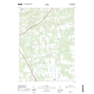 2023 Gageville2023 Print · USGSThe Ashtabula County countryside is revealed in this modern survey of the river valleys and rural crossroads. Local researchers can pinpoint the Gageville Cem, the grounds of the Northeast Ohio Regional Airport, and small settlements like Bulah.
 - 2023 Map of Dorset, 2023 Print
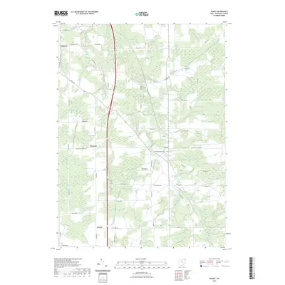 2023 Dorset2023 Print · USGSAshtabula County's rural interior is captured here in the early twenty-first century, showing a landscape of traditional farming settlements and meandering creeks. Researchers can trace family history at the Dorset Cem or locate the small landing strips at Allen Airport near Rowenton.
 - 2023 Map of Jefferson, 2023 Print
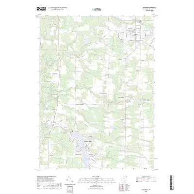 2023 Jefferson2023 Print · USGSAshtabula County remains a landscape of historic village centers and winding river valleys in this recent survey. Researchers can trace family sites near Oakdale Cem or explore the civic layout surrounding the Ashtabula County Courthouse and Rock Creek.
 - 2023 Map of Ashtabula South, 2023 Print
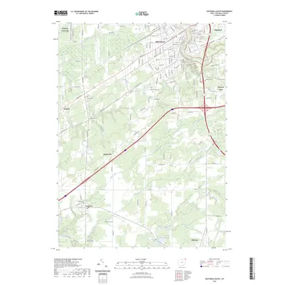 2023 Ashtabula South2023 Print · USGSThe area south of Lake Erie shows a landscape of growing towns and preserved local history in the 2020s. Researchers can trace family roots at Chestnut Grove Cem or follow the waters of the Ashtabula River and Coffee Creek.
End of results
Showing maps 1-4 of 4
Top cities near Jefferson Township
- Ashtabula historical maps
- Conneaut historical maps
- Saybrook historical maps
- Geneva historical maps
- Edgewood historical maps
- Jefferson historical maps
See more
Top neighborhoods of Jefferson Township
Frequently asked questions
- What are the different types of historical maps available for Jefferson Township?
- What is the oldest map of Jefferson Township?
- Where can I purchase historical maps of Jefferson Township for my home or office?
- Where can I download high-res historical maps of Jefferson Township?
- Are there historical topographic maps available for Jefferson Township?
- Is there historical aerial imagery available for Jefferson Township?
- Where are historical maps of Jefferson Township sourced from?