Old Maps of Athens County, Ohio for Genealogy
Trace your family roots with 162 historic maps of Athens County. These high-res maps reveal old neighborhoods, homesites, landmarks, and streets — helping you uncover where your ancestors lived and how the area evolved over time.
- Explore historic neighborhoods: Identify where your relatives may have lived in the 1800s or 1900s.
- Compare maps over time: Trace the changes in streets, buildings, and landmarks for multi-generational research.
- Perfect for genealogy & ancestry research: Used by family historians and researchers to map out lineage and migration.
These maps are an incredible resource for exploring your personal connection to Athens County's past.
Athens County, OH maps
(162)- 1902 Map of Parkersburg
 1902 Parkersburg1902 Print · USGSThe river-and-rail corridor between Ohio and West Virginia comes alive at the dawn of the twentieth century. Researchers can trace the early footprints of Parkersburg and Vienna, the sprawling Blennerhassett Island, and the old rail lines at Belpre.
 - 1903 Map of Athens, 1958 Print
 1903 Athens1958 Print · USGSSoutheast Ohio's Hocking Valley thrives at the height of its coal-mining era, before the shift in regional industry. Researchers can trace historic rail lines like the Electric railway and find vanished company towns such as Orbiston, Buchtel, and Cawthorn.
 - 1904 Map of Parkersburg
 1904 Parkersburg1904 Print · USGSThe riverfront economies of Wood County and Washington County meet at the turn of the century where the Muskingum and Ohio rivers converge. Researchers can trace the early rail networks of the Baltimore and Ohio R.R. and locate family-named settlements like Gravelbank, Center Belpre, and Vincent.5 unique versions available
 - 1904 Map of Zaleski, 1955 Print
 1904 Zaleski1955 Print · USGSVinton and Hocking Counties are shown at the turn of the century as the rail-and-river economy flourished. Trace family roots and vanished landmarks in Zaleski, Moonville, and the brick-making center of Haydenville.2 unique versions available
 - 1904 Map of Chesterhill, 1957 Print
 1904 Chesterhill1957 Print · USGSSoutheast Ohio's rugged hill country is captured here during the peak of its rail-and-river economy in the early twentieth century. Researchers can locate vanished rural post offices and community landmarks like Calvary P O, Bethany Church, and Patten Mills.
 - 1905 Map of Athens
 1905 Athens1905 Print · USGSAthens and the Hocking River valley appear here at the height of the coal and rail era in the early nineteen-hundreds. Genealogists can trace family roots in vanished settlements and industrial junctions like Orbiston, Buchtel, and Marshfield.6 unique versions available
 - 1905 Map of Wilkesville, 1958 Print
 1905 Wilkesville1958 Print · USGSVinton County and its neighbors at the height of the early industrial era show a landscape shaped by charcoal furnaces and narrow-gauge rail interests. Genealogists can trace family footprints across dozens of local school districts like Auburn School or within established centers like Wilkesville and Minerton.
 - 1906 Map of Belleville
 1906 Belleville1906 Print · USGSWood County at the turn of the century is defined by its deep river valleys and the expansion of the Baltimore and Ohio RR. Genealogists and historians can trace late-Victorian settlements like Mineral Wells, Belleville, and the riverfront at Walkers Crossing.2 unique versions available
 - 1906 Map of Chesterhill, 1943 Print
 1906 Chesterhill1943 Print · USGSSoutheastern Ohio at the start of the century reveals a landscape of coal-mining hamlets and river valley rail lines. Genealogists and researchers can trace family landmarks like Mills School, Patten Mills, and the scattered post offices of Calvary PO and Federal.
 - 1907 Map of Pomeroy
 1907 Pomeroy1907 Print · USGSMeigs County at the peak of the river-and-rail era shows a landscape of busy Ohio River towns and remote hillside post offices. Genealogists can trace family footprints near Pomeroy, the Bunker Hill Church, and the dual settlement of Pagetown Downingston PO.3 unique versions available
 - 1907 Map of Keno, 1919 Print
 1907 Keno1919 Print · USGSMeigs County and the Ohio River valley appear in high detail just after the turn of the century, showing a landscape defined by river trade and rail. Researchers can trace family sites at Nease Settlement, find the Minersville PO, or locate old schools like Morningstar School and Redbrush School.3 unique versions available
 - 1907 Map of Zaleski, 1944 Print
 1907 Zaleski1944 Print · USGSVinton and Hocking counties at the turn of the century show an era of intense industrial activity along the coal branches. Trace the paths of the Baltimore and Ohio Southwestern RR through Moonville or find old homesteads near New Plymouth and Zaleski.
 - 1908 Map of Wilkesville, 1943 Print
 1908 Wilkesville1943 Print · USGSThe Vinton County hills are seen here during a peak era of iron furnaces and rail expansion before the Great War. Genealogists and researchers can trace dozens of family-named landmarks and institutions, from the Vinton Furnace site to Boring Church and the Haggerty School.
 - 1911 Map of New Lexington, 1939 Print
 1911 New Lexington1939 Print · USGSPerry County and its neighbors hummed with industrial activity when this survey was conducted. Local researchers can trace old rail lines and family-linked landmarks from St Aloysius Academy down to the mining hubs of Shawnee and New Straitsville.2 unique versions available
 - 1924 Map of Belleville, 1954 Print
 1924 Belleville1954 Print · USGSWood County’s riverfront settlements and rural school districts are captured here in the mid-twenties during the height of the rail era. Genealogists can locate long-lost family landmarks like Harris Ferry, Meldahl, and dozens of rural schoolhouses including Leafy Glen School.
 - 1926 Map of Belleville
 1926 Belleville1926 Print · USGSThe Ohio River valley and its rugged Wood County hinterlands come into focus in the mid-twenties. Genealogists and historians can locate dozens of rural schools and churches like Leafy Glen School, Torch PO, and Serepta Church along the winding runs.2 unique versions available
 - 1947 Map of Columbus, 1948 Print
 1947 Columbus1948 Print · USGSCentral Ohio in the late 1940s is captured in this survey, showing the post-war transition of its rail hubs and military airfield expansions. Genealogists and historians can trace the paths of the Ohio Canal, the Pennsylvania RR lines, and the Camp Sherman Military Reservation.
 - 1949 Map of Clarksburg
 1949 Clarksburg1949 Print · USGSThe upper Ohio River valley and the industrial heart of West Virginia come into focus during this post-war period. Genealogists and researchers can trace the rail corridors of the Baltimore and Ohio and locate centers like Fairmont, Grafton, and Waynesburg.
 - 1956 Map of Clarksburg, 1966 Print
 1956 Clarksburg1966 Print · USGSThe Ohio River valley and the industrial heart of West Virginia are seen here in the mid-1950s as rail and river commerce thrived. Researchers can trace historic transport lines like the Baltimore and Ohio RR and locate ancestral homes in Clarksburg, Moundsville, or Parkersburg.2 unique versions available
 - 1960 Map of Albany, 1961 Print
 1960 Albany1961 Print · USGSSoutheastern Ohio at the start of the sixties reveals a landscape of ridge-top farms and growing extractive industry. Genealogists and historians can trace the paths between Albany and Harrisonville, locating family landmarks like Martin Cem, Pearl Chapel, and the New York Central rail line.4 unique versions available
 - 1960 Map of Alfred, 1961 Print
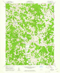 1960 Alfred1961 Print · USGSSoutheast Ohio's ridge country at the start of the sixties reveals a landscape of winding river branches and emerging oil and gas fields. Genealogists can trace family roots through numerous sites like Bishop Cem, the community at Lottridge, and the rural Zion Ch.3 unique versions available
 - 1960 Map of Coolville, 1961 Print
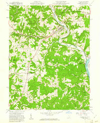 1960 Coolville1961 Print · USGSThe Hocking River valley and Wayne National Forest are captured here in the early sixties, showing a landscape of ridge-top farms and timber. Genealogists can locate family landmarks such as Stewart Cem, Bethel Ch, and the Olive-Orange Township Sch.4 unique versions available
 - 1960 Map of Amesville, 1962 Print
 1960 Amesville1962 Print · USGSSoutheast Ohio’s hill country in the early sixties reveals a landscape transitioning between its mining roots and modern forestry. Genealogists and historians can trace family locations through Mud Sock Cem, Amesville, and the church at Mt Carmel Ch.4 unique versions available
 - 1960 Map of Shade, 1962 Print
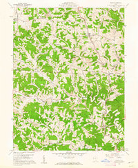 1960 Shade1962 Print · USGSMeigs and Athens Counties at the start of the sixties were defined by the extractive industries and rural crossroads of the Appalachian Plateau. Genealogists and historians can trace family locations through numerous sites like Jeffers Cem, the Burlingham Ch, and the old Bedford Sch.3 unique versions available
 - 1961 Map of Columbus
 1961 Columbus1961 Print · USGSCentral and Southern Ohio are captured here in the early sixties, as the region's industrial rail hubs and military bases reached their peak. Genealogists and historians can trace the transition from urban Columbus to rural townships along the Scioto River, locating Lockbourne USAF and old junctions like Washington Court House.
Showing maps 1-25 of 162
Top cities of Athens County
Frequently asked questions
- What are the different types of historical maps available for Athens County?
- What is the oldest map of Athens County?
- Where can I purchase historical maps of Athens County for my home or office?
- Where can I download high-res historical maps of Athens County?
- Are there historical topographic maps available for Athens County?
- Is there historical aerial imagery available for Athens County?
- Where are historical maps of Athens County sourced from?