1960s Maps of Bellaire, Ohio
Explore 5 historic maps of Bellaire from the 1960s. These maps offer a rare glimpse into what life looked like during the 1960s — showing old roads, neighborhoods, homes, and landmarks that have changed or disappeared over time.
Whether you're researching your family's past, planning a metal detecting trip, or studying how Bellaire's landscape evolved across the 1960s, these high-resolution maps are a powerful tool for exploring the history of this region.
- Focus on a specific era: All maps on this page are from the 1960s, giving you a focused view of this time period.
- See what’s changed: Compare century-old streets, trails, and buildings to today's modern landscape using overlays and satellite layers.
- Research with precision: Use these maps for genealogy, historical research, land use analysis, or educational projects.
- View, download, or print: Maps are fully viewable online in high resolution, and can be downloaded or printed for your own records.
Start exploring Bellaire's history through authentic maps from the 1960s. This is your window into the past.
Bellaire, OH maps
(5)- 1960 Map of Moundsville, 1961 Print
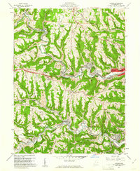
 1960 Moundsville1961 Print · USGSMarshall County's riverfront industry and correctional history are on full display in this mid-century survey of the Ohio River valley. Genealogists and researchers can locate the State Penitentiary, trace rural churches on Waymans Ridge, and find local landmarks like the Grave Creek Indian Mound Museum.4 unique versions available
 - 1960 Map of Lansing, 1961 Print
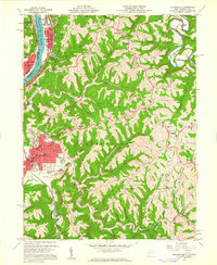
 1960 Lansing1961 Print · USGSBelmont County in the early sixties reveals a landscape shaped by coal mining and historic transit routes. Genealogists and historians can trace family plots at Linwood Cemetery or High Ridge Cem and follow the old National Road through Lansing and Blaine.5 unique versions available
 - 1961 Map of Clarksburg
 1961 Clarksburg1961 Print · USGSThe mid-century industrial and river landscapes of West Virginia and Ohio are detailed here, centered on the Ohio River. Researchers can trace the Baltimore and Ohio rail lines connecting towns like Parkersburg, Clarksburg, and Monongah.
 - 1962 Map of Canton
 1962 Canton1962 Print · USGSThe industrial heartland of Eastern Ohio and Western Pennsylvania thrives in the early sixties as steel mills and rail lines dominate the river valleys. Genealogists and historians can trace local landmarks like McKinley National Memorial, Malone College, and industrial sites such as Republic Steel Corp.2 unique versions available
 - 1968 Map of Wheeling, 1971 Print
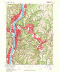 1968 Wheeling1971 Print · USGSThe Ohio River valley thrives during the late sixties as a center of industry and education spanning the West Virginia and Ohio border. Local historians can trace established neighborhoods and institutions like Wheeling Island, Mt de Chantal Academy, and the grounds of Oglebay Park.4 unique versions available
End of results
Showing maps 1-5 of 5
Top cities near Bellaire
- Wheeling historical maps
- Moundsville historical maps
- Martins Ferry historical maps
- Saint Clairsville historical maps
- St. Clairsville historical maps
- Colerain historical maps
See more
Frequently asked questions
- What are the different types of historical maps available for Bellaire?
- What is the oldest map of Bellaire?
- Where can I purchase historical maps of Bellaire for my home or office?
- Where can I download high-res historical maps of Bellaire?
- Are there historical topographic maps available for Bellaire?
- Is there historical aerial imagery available for Bellaire?
- Where are historical maps of Bellaire sourced from?