Old Maps of Springfield, Ohio for Hiking & Exploration
Hike through history with 21 historic maps of Springfield. Explore old trails, ghost towns, and forgotten backroads — perfect for outdoor adventurers and local explorers.
- Rediscover forgotten places: Map out old mining camps, roads, and footpaths that no longer exist on modern maps.
- Layer with modern tools: Combine with LiDAR or satellite views to plan hikes through historical terrain.
- Made for exploration: Popular among hikers, overlanders, and local history lovers.
Use these maps to find adventure and explore the hidden past of Springfield.
Springfield, OH maps
(21)- 1904 Map of Springfield, 1952 Print
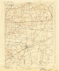
 1904 Springfield1952 Print · USGSWest-central Ohio was a bustling network of electric railways and turnpikes at the opening of the twentieth century. Researchers can trace the early industrial footprint of Springfield or locate family roots near Yellow Springs, Pitchin, and the Masonic Home.2 unique versions available
 - 1906 Map of Springfield, 1942 Print
 1906 Springfield1942 Print · USGSSpringfield and the surrounding Clark and Greene County townships are shown here during the peak era of electric traction and steam rail. Genealogists can trace family footprints through Ferncliff Cemetery, the Masonic Home, and settlements like Yellow Springs and Enon.
 - 1907 Map of South Charleston, 1943 Print
 1907 South Charleston1943 Print · USGSThe Clark County countryside at the turn of the century shows a landscape dominated by rail travel and local school districts. Genealogists can locate family-named landmarks such as Yeazel School, Pancake Chapel, and the settlement of Dolly Varden.2 unique versions available
 - 1947 Map of Columbus, 1948 Print
 1947 Columbus1948 Print · USGSCentral Ohio in the late 1940s is captured in this survey, showing the post-war transition of its rail hubs and military airfield expansions. Genealogists and historians can trace the paths of the Ohio Canal, the Pennsylvania RR lines, and the Camp Sherman Military Reservation.
 - 1955 Map of Springfield, 1956 Print
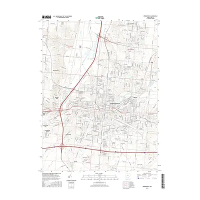
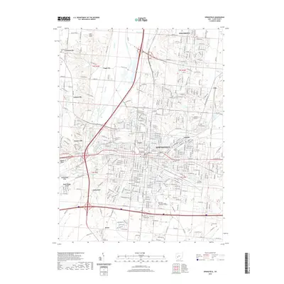
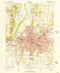 1955 Springfield1956 Print · USGSSpringfield and its Clark County surrounds are captured here during the mid-fifties industrial peak. Genealogists and historians can trace neighborhood growth through dozens of local landmarks, from Wittenberg College to the Masonic Home and Ferncliff Cemetery.
 - 1961 Map of Columbus
 1961 Columbus1961 Print · USGSCentral and Southern Ohio are captured here in the early sixties, as the region's industrial rail hubs and military bases reached their peak. Genealogists and historians can trace the transition from urban Columbus to rural townships along the Scioto River, locating Lockbourne USAF and old junctions like Washington Court House.
 - 1961 Map of New Moorefield, 1962 Print
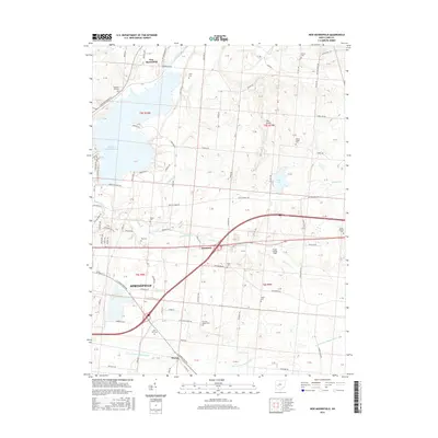
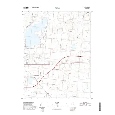
 1961 New Moorefield1962 Print · USGSClark County is captured in the early sixties as the suburban and agricultural landscapes of New Moorefield and Harmony evolved alongside major transit corridors. Researchers can locate numerous pioneer and church burial sites like Foley Cem and Asbury Cem Ch or trace the New York Central rail lines.5 unique versions available
 - 1962 Map of Columbus
 1962 Columbus1962 Print · USGSCentral Ohio during the early sixties reveals a transition from the industrial corridors of Columbus to the forested ridges of the south. Genealogists and historians can trace the rail networks of the Baltimore & Ohio RR and find local landmarks like Washington Court House and Camp Sherman Military Reservation.
 - 1966 Map of Springfield, 1968 Print
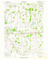
 1966 Springfield1968 Print · USGSSpringfield and Clark County are shown during the mid-sixties as the city's industrial rail network reached its peak complexity. Researchers can trace family sites near Wittenberg University, the historic Ferncliff Cemetery, or the expansive Masonic Home.4 unique versions available
 - 1967 Map of Columbus, 1969 Print
 1967 Columbus1969 Print · USGSCentral Ohio during the late sixties serves as a vital corridor of rail and aviation, from the industrial streets of Springfield to the hangar lines of Lockbourne Air Force Base. Genealogists and researchers can trace the growth of towns like Circleville and London or locate rural landmarks such as St Paul church and the London Correctional Institution.2 unique versions available
 - 1986 Map of Springfield
 1986 Springfield1986 Print · USGSCentral Ohio in the mid-1980s shows the bustling rail-and-road network connecting Springfield and Xenia to the western outskirts of Columbus. Researchers can trace old family sites and transit routes through Glen Haven Mem Cem, Madison Lake State Park, and the CONRAIL line.2 unique versions available
 - 2010 Map of New Moorefield, 2010 Print
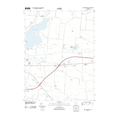 2010 New Moorefield2010 Print · USGSCovers Springfield, including Harmony, Catawba, and other nearby areas
 - 2010 Map of Springfield, 2010 Print
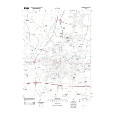 2010 Springfield2010 Print · USGSCovers Springfield, including Happy Valley Mobile Home Park, Limecrest, and other nearby areas
 - 2013 Map of Springfield, 2013 Print
 2013 Springfield2013 Print · USGSCovers Springfield, including Happy Valley Mobile Home Park, Limecrest, and other nearby areas
 - 2013 Map of New Moorefield, 2013 Print
 2013 New Moorefield2013 Print · USGSCovers Springfield, including Harmony, Catawba, and other nearby areas
 - 2016 Map of New Moorefield, 2016 Print
 2016 New Moorefield2016 Print · USGSCovers Springfield, including Harmony, Catawba, and other nearby areas
 - 2016 Map of Springfield, 2016 Print
 2016 Springfield2016 Print · USGSCovers Springfield, including Happy Valley Mobile Home Park, Limecrest, and other nearby areas
 - 2019 Map of New Moorefield, 2019 Print
 2019 New Moorefield2019 Print · USGSCovers Springfield, including Harmony, Catawba, and other nearby areas
 - 2019 Map of Springfield, 2019 Print
 2019 Springfield2019 Print · USGSCovers Springfield, including Happy Valley Mobile Home Park, Limecrest, and other nearby areas
 - 2023 Map of New Moorefield, 2023 Print
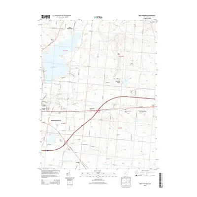
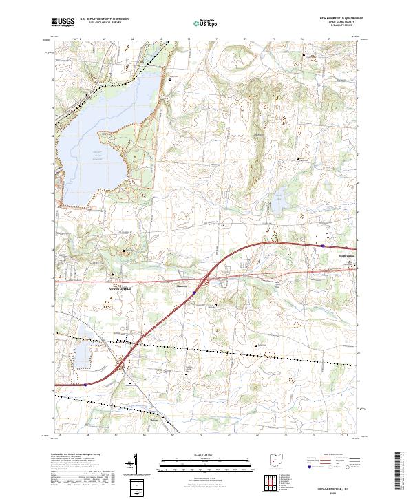 2023 New Moorefield2023 Print · USGSThis Clark County corridor near the edge of the 2020s shows the suburban expansion of Springfield meeting the rural traditions of Harmony and South Vienna. Genealogists can locate several historic burial grounds like Vernon Cem and Titus Cem while tracing the waters of the North Fork Little Miami River.
 - 2023 Map of Springfield, 2023 Print
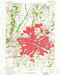
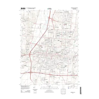
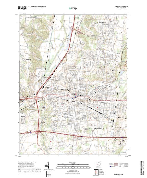 2023 Springfield2023 Print · USGSSpringfield and its Clark County surrounds appear in high detail during this contemporary era of urban density and suburban growth. Researchers can trace historic burial sites like Ferncliff Cem or locate institutional landmarks including Wittenberg University and the Clark County Courthouse.
End of results
Showing maps 1-21 of 21
Top cities near Springfield
- Beavercreek historical maps
- Fairborn historical maps
- Xenia historical maps
- Mad River historical maps
- Urbana historical maps
- New Carlisle historical maps
See more
Top neighborhoods of Springfield
- Home Orchards historical maps
- Kenwood Heights historical maps
- Kingsgate Commons historical maps
- Layne historical maps
- Oakcrest historical maps
- Oakwood Village historical maps
See more
Frequently asked questions
- What are the different types of historical maps available for Springfield?
- What is the oldest map of Springfield?
- Where can I purchase historical maps of Springfield for my home or office?
- Where can I download high-res historical maps of Springfield?
- Are there historical topographic maps available for Springfield?
- Is there historical aerial imagery available for Springfield?
- Where are historical maps of Springfield sourced from?