1990s Maps of Columbiana County, Ohio
Explore 14 historic maps of Columbiana County from the 1990s. These maps offer a rare glimpse into what life looked like during the 1990s — showing old roads, neighborhoods, homes, and landmarks that have changed or disappeared over time.
Whether you're researching your family's past, planning a metal detecting trip, or studying how Columbiana County's landscape evolved across the 1990s, these high-resolution maps are a powerful tool for exploring the history of this region.
- Focus on a specific era: All maps on this page are from the 1990s, giving you a focused view of this time period.
- See what’s changed: Compare century-old streets, trails, and buildings to today's modern landscape using overlays and satellite layers.
- Research with precision: Use these maps for genealogy, historical research, land use analysis, or educational projects.
- View, download, or print: Maps are fully viewable online in high resolution, and can be downloaded or printed for your own records.
Start exploring Columbiana County's history through authentic maps from the 1990s. This is your window into the past.
Columbiana County, OH maps
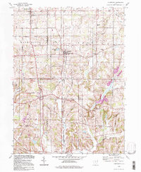
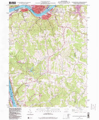
(14)- 1994 Map of Columbiana, 1997 Print
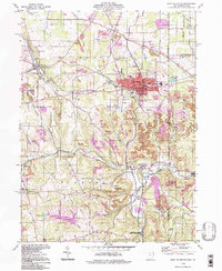
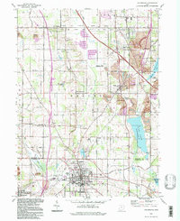 1994 Columbiana1997 Print · USGSThe Mahoning and Columbiana county line region is captured here during the mid-1990s, showing a blend of small-town growth and industrial history. Trace family roots at St Marys Friary, locate local landmarks like Firestone Park, or explore the reclaimed Strip Mine terrain near North Lima.
 - 1994 Map of Alliance, 1997 Print
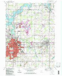 1994 Alliance1997 Print · USGSThe Mahoning Valley industrial corridor and the campus of Mt Union College are captured here in the 1990s. Trace local history through family-named cemeteries like Hartzell Cem and old rail stops at North Benton Sta.
 - 1994 Map of Salem, 1997 Print
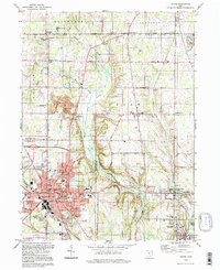 1994 Salem1997 Print · USGSMid-century Ohio industry and rural life converge in this study of the Salem area during its post-war development. Researchers can trace the Conrail rail corridor, locate family plots in Grandview Cem, or explore the reaches of Middle Fork Little Beaver Creek.
 - 1994 Map of Hanoverton, 1997 Print
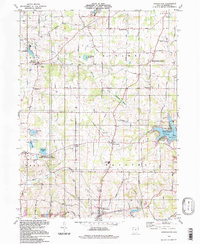 1994 Hanoverton1997 Print · USGSHanoverton and the townships of Knox and Butler appear in the mid-nineties as a landscape of rural hamlets and state-managed reserves. Genealogists can locate family burial sites at Dutton Cem and Figley Cem or trace old homesteads along Mc Cann Road.
 - 1994 Map of East Palestine, 1997 Print
 1994 East Palestine1997 Print · USGSThe Ohio-Pennsylvania borderlands near the end of the century reveal a landscape of heavy industry and quiet rural settlements. Researchers can trace the legacy of resource extraction through extensive Strip Mines while locating family roots at St Marys Cem and Mason Rich Cem.
 - 1994 Map of Damascus, 1997 Print
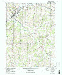
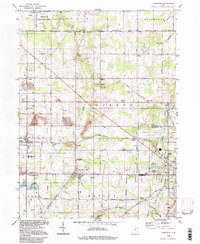 1994 Damascus1997 Print · USGSThe Mahoning and Columbiana county line in the mid-1990s remained a landscape of rural crossroads and historic school districts. Researchers can locate family landmarks like Wilbur Ch, the 3 Tracks rail line, and established settlements such as Damascus and Beloit.
 - 1994 Map of Elkton, 1997 Print
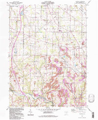 1994 Elkton1997 Print · USGSColumbiana County at the close of the twentieth century shows a landscape shaped by coal mining and deep-rooted rural communities. Trace family history through numerous cemeteries like Zeppernick Cem and landmarks such as the Church Hill Ch.
 - 1994 Map of Kensington, 1998 Print
 1994 Kensington1998 Print · USGSThe border of Columbiana and Carroll Counties in the mid-to-late twentieth century shows a landscape of small coal-mining hamlets and rural churches. Genealogists and local historians can trace family locations near Bethesda Ch, Norristown, or the Sandy Springs Cem.
 - 1994 Map of Wellsville, 1998 Print
 1994 Wellsville1998 Print · USGSThe Ohio River valley at the turn of the millennium shows a landscape shaped by coal mining and river industry. Genealogists can locate family sites at Spring Hill Cem and Cuppy Cem, or trace the rail routes of Conrail through Hammondsville.
 - 1994 Map of Homeworth, 1998 Print
 1994 Homeworth1998 Print · USGSNortheast Ohio farmland and small crossroads settlements are captured here in the 1990s. Genealogists can trace family footprints near New Franklin, Reading, and the Fairmount Childrens Home.
 - 1994 Map of East Liverpool North, 1998 Print
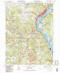
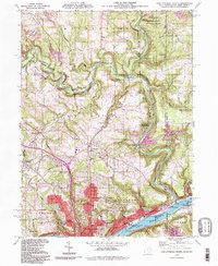 1994 East Liverpool North1998 Print · USGSThe tri-state border region of Ohio, Pennsylvania, and West Virginia is captured here in the late twentieth century as the industrial legacy of the Ohio River meets the protected valley of Little Beaver Creek. Researchers can locate family sites at Riverview Cemetery or trace old routes through Calcutta and Sprucevale.
 - 1994 Map of Minerva, 1998 Print
 1994 Minerva1998 Print · USGSMinerva and the surrounding tri-county area are shown in the 1990s, capturing a landscape of established villages and historic survey boundaries. Researchers can trace family sites like Chestnut Knob Cem, visit St Pauls Ch, or locate the Geographers Line near Manfull Airport.
 - 1994 Map of Salineville, 1998 Print
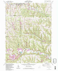 1994 Salineville1998 Print · USGSThe rugged coal country of Columbiana and Jefferson counties is captured here in the 1990s, revealing a landscape shaped by industry and conservation. Genealogists can trace family roots at West Union Cem, Pine Grove Ch, and numerous Strip Mines that defined local life.
 - 1996 Map of East Liverpool South, 1999 Print
 1996 East Liverpool South1999 Print · USGSThe industrial Ohio River valley and West Virginia panhandle are captured in the late 1990s as legacy towns like Newell and Chester face the river. Researchers can trace the region's civic roots through landmarks like the County Childrens Home, Locust Hill Cem, and Tomlinson Run State Park.
End of results
Showing maps 1-14 of 14
Top cities of Columbiana County
- East Liverpool historical maps
- Salem historical maps
- Unity historical maps
- East Palestine historical maps
- Wellsville historical maps
- Lisbon historical maps
See more
Frequently asked questions
- What are the different types of historical maps available for Columbiana County?
- What is the oldest map of Columbiana County?
- Where can I purchase historical maps of Columbiana County for my home or office?
- Where can I download high-res historical maps of Columbiana County?
- Are there historical topographic maps available for Columbiana County?
- Is there historical aerial imagery available for Columbiana County?
- Where are historical maps of Columbiana County sourced from?