Old Maps of Crawford County, Ohio for Genealogy
Trace your family roots with 90 historic maps of Crawford County. These high-res maps reveal old neighborhoods, homesites, landmarks, and streets — helping you uncover where your ancestors lived and how the area evolved over time.
- Explore historic neighborhoods: Identify where your relatives may have lived in the 1800s or 1900s.
- Compare maps over time: Trace the changes in streets, buildings, and landmarks for multi-generational research.
- Perfect for genealogy & ancestry research: Used by family historians and researchers to map out lineage and migration.
These maps are an incredible resource for exploring your personal connection to Crawford County's past.
Crawford County, OH maps
(90)- 1903 Map of Marion, 1961 Print
 1903 Marion1961 Print · USGSMarion emerges as a powerful rail hub at the turn of the century, with nearly ten different lines intersecting at the city's heart. Local historians can trace the early industrial landscape through the Electric RR and the Quarry near Owen.
 - 1905 Map of Marion, 1944 Print
 1905 Marion1944 Print · USGSMarion became a bustling railroad crossroads at the turn of the century, serving as a vital link for the state's industrial and agricultural transport. Researchers can trace the early city grid, the path of the Hocking Valley Line, and rural outposts like Morral and Little Sandusky.
 - 1906 Map of Sycamore, 1932 Print
 1906 Sycamore1932 Print · USGSThe rural heart of north-central Ohio is captured here at the height of its steam-rail era. Genealogists and local historians can trace family locations near Sycamore, Nevada, and Belle Vernon, or locate landmarks like Oakgrove School and the Rock Run Church.
 - 1913 Map of Mount Gilead, 1960 Print
 1913 Mount Gilead1960 Print · USGSNorth Central Ohio during the early rail era reveals a landscape densely packed with small-town life and rural school districts. Genealogists can trace family roots through dozens of local landmarks, from Hog Swamp School to the bustling rail junctions at Martel and Galion.
 - 1915 Map of Bucyrus, 1940 Print
 1915 Bucyrus1940 Print · USGSBucyrus and the surrounding Crawford County plains are captured here at the height of the steam-and-electric rail era. Genealogists can locate rural landmarks like the COUNTY INFIRMARY, trace family plots near Leesville, or find vanished schoolhouses like Muck School.
 - 1915 Map of Crestline, 1943 Print
 1915 Crestline1943 Print · USGSRichland and Crawford counties thrive as a vital railroad corridor in the years before the Great War. Genealogists can locate family homesteads near dozens of numbered district schools or trace the industrial pulse of Crestline, Shelby, and the Spore Mill.
 - 1915 Map of Shauck, 1946 Print
 1915 Shauck1946 Print · USGSRichland County and its neighbors are captured here just before the First World War, showing a landscape of established rail hubs and rural school districts. Genealogists can locate family homesteads near Johnsville Shauck PO, Steam Corners, or Bellville.
 - 1916 Map of Mount Gilead, 1941 Print
 1916 Mount Gilead1941 Print · USGSMorrow and Crawford counties are shown here just before the First World War, when rail lines and rural schools defined the Ohio countryside. Genealogists can locate family-named sites like Miller Cem or schools such as Dice School and Hog Swamp School.
 - 1943 Map of Shauck
 1943 Shauck1943 Print · USGSNorth Central Ohio is captured here in the mid-1940s, showing a landscape of small agricultural hamlets and a dense network of country schools. Genealogists and researchers can trace local landmarks like Johnsville Shauck P O, Chestnut Chapel, and the Erie RR corridor.
 - 1943 Map of Bucyrus
 1943 Bucyrus1943 Print · USGSCrawford County at the height of the Second World War reveals a landscape defined by busy rail junctions and rural school districts. Genealogists and historians can trace family roots through numerous numbered schoolhouses and settlements like Sulphur Springs, Tiro, and the County Infirmary.
 - 1943 Map of Crestline
 1943 Crestline1943 Print · USGSNorth-central Ohio is seen at a mid-century industrial peak, dominated by the massive rail corridors of the PENNSYLVANIA and ERIE lines. Genealogists and historians can trace the rural landscape through dozens of numbered schoolhouses and small settlements like Planktown, Ganges, and Toledo Jc.2 unique versions available
 - 1943 Map of Mount Gilead
 1943 Mount Gilead1943 Print · USGSIn the early 1940s, this pocket of north-central Ohio remained a landscape of rail-connected towns and country school districts. Researchers can trace the rural heritage of Galion and Mount Gilead while locating landmarks like Miller Cem and the Guiding Star Sch.
 - 1950 Map of Marion
 1950 Marion1950 Print · USGSCentral Ohio was a powerhouse of rail and river industry at the mid-century point, serving as a vital corridor between the Great Lakes and the Ohio River valley. Genealogists and rail historians can trace the paths of the Erie RR and Nickel Plate Road through towns like Bucyrus, Galion, and Upper Sandusky.
 - 1960 Map of North Robinson, 1961 Print
 1960 North Robinson1961 Print · USGSCrawford County at the start of the sixties shows a landscape defined by the intersection of major railroads and quiet rural hamlets. Genealogists can trace family landmarks like Windfall Cem and Immanuel Ch, or locate the site of the old Drive-In Theater.4 unique versions available
 - 1960 Map of Oceola, 1961 Print
 1960 Oceola1961 Print · USGSCrawford and Wyandot Counties are captured here in the early sixties, showing a landscape defined by geometric farm plots and historic treaty lines. Genealogists can locate family landmarks like Maple Grove Cem, Mt Zion Sch, and the riverside Camp Michael.3 unique versions available
 - 1960 Map of Lykens, 1961 Print
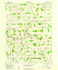 1960 Lykens1961 Print · USGSCrawford County at the start of the sixties reveals a landscape of established farmsteads and old township lines. Researchers can trace the Old Indian Treaty Boundary and locate family burial sites like Lee Cem or Freewill Cem.2 unique versions available
 - 1960 Map of Chatfield, 1961 Print
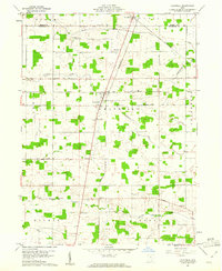 1960 Chatfield1961 Print · USGSCrawford County's rural landscape is captured here in the early sixties, showing the agricultural heart of northern Ohio. Researchers can locate numerous family-history landmarks, from the Windfall Cem to local congregational sites like Broken Sword Ch and St Paul Ch.2 unique versions available
 - 1960 Map of Shelby, 1961 Print
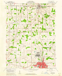 1960 Shelby1961 Print · USGSThe Richland County countryside was a landscape of military readiness and rail industry in the early sixties. Trace old family plots at Hanna Cem, visit the rural Little Rebecca Ch, or locate the sprawling Wilkins Air Force Station.3 unique versions available
 - 1960 Map of New Washington, 1961 Print
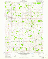 1960 New Washington1961 Print · USGSCrawford and Huron counties are documented here in the early sixties, showing a landscape shaped by early land grants and the railroad economy. Genealogists can trace family footprints across New Washington and Tiro, or locate rural landmarks like St Bernard Cem and Dickson Cem.2 unique versions available
 - 1960 Map of Crestline, 1962 Print
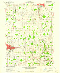 1960 Crestline1962 Print · USGSThe industrial rail hub of Crestline and Shelby comes into focus in 1960 as several major lines intersect. Genealogists and historians can trace family plots at Green Lawn Cem, locate the Drive-in Theater, and find early aviation sites like American Tower Landing Field.3 unique versions available
 - 1960 Map of Bucyrus, 1962 Print
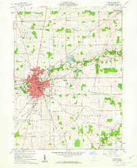 1960 Bucyrus1962 Print · USGSBucyrus flourished as a vital rail and civic crossroads during the early sixties, surrounded by the productive farmsteads of Crawford County. Genealogists and local researchers can trace historic burials at Oakwood Cemetery and Sixteen Cem or locate the old Seccaium Park.4 unique versions available
 - 1960 Map of Galion, 1962 Print
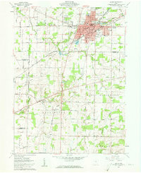 1960 Galion1962 Print · USGSMid-century Galion is captured here at the height of its rail-hub importance, where the major lines of the Midwest intersect. Genealogists and local historians can trace rural family plots like Autin Cem and Garverick Cem or explore early village life in Iberia and St James.3 unique versions available
 - 1961 Map of Blooming Grove, 1962 Print
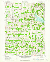 1961 Blooming Grove1962 Print · USGSThe borderlands of Morrow and Richland counties are captured here in the early sixties as the Clear Fork Reservoir shapes the landscape. Family historians can trace small crossroads communities like Blooming Grove, Steam Corners, and Jugs Corners, along with local burial sites including Red Squirrel Cem.4 unique versions available
 - 1961 Map of Caledonia, 1962 Print
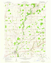 1961 Caledonia1962 Print · USGSAgricultural life in Marion and Crawford counties is captured here in the early sixties, as rail lines still linked small rural hubs. Trace family history through Monnett Chapel, Rush Cem, and the rail junction at Caledonia.2 unique versions available
 - 1961 Map of Monnett, 1963 Print
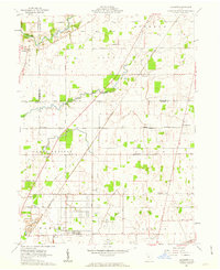 1961 Monnett1963 Print · USGSMarion and Crawford counties appear here in the early 1960s, showing a landscape defined by historical treaty lines and vital rail corridors. Researchers can locate family landmarks like Likens Cem and Kirkpatrick Cem, or trace the tracks of the Pennsylvania railroad through Monnett.2 unique versions available
Showing maps 1-25 of 90
Top cities of Crawford County
- Bucyrus historical maps
- Galion historical maps
- Crestline historical maps
- North Robinson historical maps
Frequently asked questions
- What are the different types of historical maps available for Crawford County?
- What is the oldest map of Crawford County?
- Where can I purchase historical maps of Crawford County for my home or office?
- Where can I download high-res historical maps of Crawford County?
- Are there historical topographic maps available for Crawford County?
- Is there historical aerial imagery available for Crawford County?
- Where are historical maps of Crawford County sourced from?