2020s Maps of Vernon Township, Ohio
Explore 4 historic maps of Vernon Township from the 2020s. These maps offer a rare glimpse into what life looked like during the 2020s — showing old roads, neighborhoods, homes, and landmarks that have changed or disappeared over time.
Whether you're researching your family's past, planning a metal detecting trip, or studying how Vernon Township's landscape evolved across the 2020s, these high-resolution maps are a powerful tool for exploring the history of this region.
- Focus on a specific era: All maps on this page are from the 2020s, giving you a focused view of this time period.
- See what’s changed: Compare century-old streets, trails, and buildings to today's modern landscape using overlays and satellite layers.
- Research with precision: Use these maps for genealogy, historical research, land use analysis, or educational projects.
- View, download, or print: Maps are fully viewable online in high resolution, and can be downloaded or printed for your own records.
Start exploring Vernon Township's history through authentic maps from the 2020s. This is your window into the past.
Vernon Township, OH maps
(4)- 2023 Map of New Washington, 2023 Print
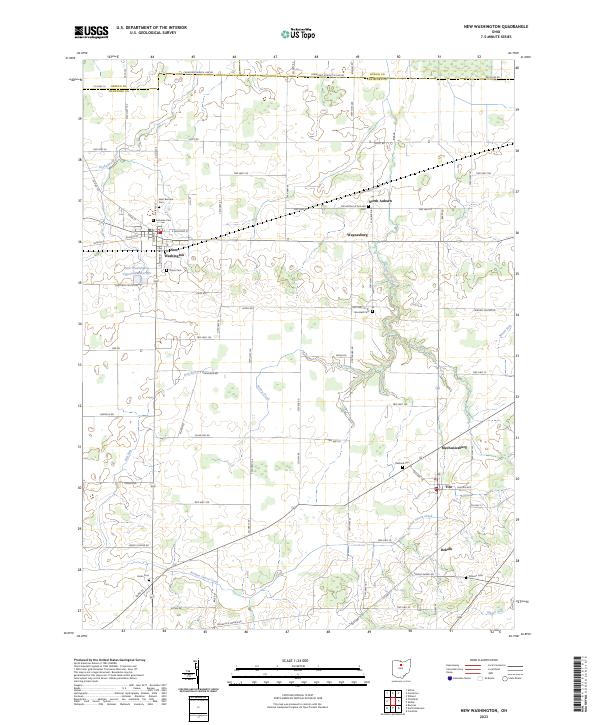 2023 New Washington2023 Print · USGSCrawford County's agricultural heartland is documented here in the early twenty-first century, centered on the village of New Washington. Genealogists can trace local history through numerous burial sites like Our Mother of Sorrows Cem and Goodwill Cem.
 - 2023 Map of Shelby, 2023 Print
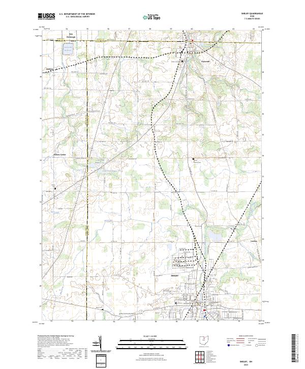 2023 Shelby2023 Print · USGSRichland and Huron counties come together in this modern survey of North Central Ohio's farming heartland. Local historians can trace the rural landscape between Shelby and Plymouth, locating legacy sites like Pioneer Rest Cem and Auburn Center.
 - 2023 Map of Crestline, 2023 Print
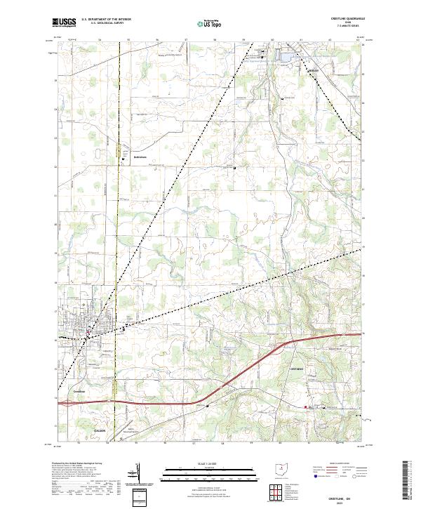 2023 Crestline2023 Print · USGSThe border of Crawford and Richland counties comes into focus in this recent survey of the North Central Ohio agricultural corridor. Local researchers can trace the vicinity of Crestline and Bethlehem, identifying numerous local burial grounds like Riblet Cem and Green Lawn Cem.
 - 2023 Map of North Robinson, 2023 Print
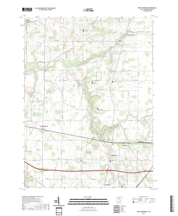 2023 North Robinson2023 Print · USGSCrawford County's agricultural heartland and the outskirts of Galion are captured here in the early twenty-first century. Genealogists can locate family burial sites at Sandusky Cem or Windfall Cem and trace the historic path of the Lincoln Hwy through North Robinson.
End of results
Showing maps 1-4 of 4
Top cities near Vernon Township
- Mansfield historical maps
- Bucyrus historical maps
- Galion historical maps
- Shelby historical maps
- Willard historical maps
- Ontario historical maps
See more
Top neighborhoods of Vernon Township
Frequently asked questions
- What are the different types of historical maps available for Vernon Township?
- What is the oldest map of Vernon Township?
- Where can I purchase historical maps of Vernon Township for my home or office?
- Where can I download high-res historical maps of Vernon Township?
- Are there historical topographic maps available for Vernon Township?
- Is there historical aerial imagery available for Vernon Township?
- Where are historical maps of Vernon Township sourced from?