2020s Maps of Oxford Township, Ohio
Explore 4 historic maps of Oxford Township from the 2020s. These maps offer a rare glimpse into what life looked like during the 2020s — showing old roads, neighborhoods, homes, and landmarks that have changed or disappeared over time.
Whether you're researching your family's past, planning a metal detecting trip, or studying how Oxford Township's landscape evolved across the 2020s, these high-resolution maps are a powerful tool for exploring the history of this region.
- Focus on a specific era: All maps on this page are from the 2020s, giving you a focused view of this time period.
- See what’s changed: Compare century-old streets, trails, and buildings to today's modern landscape using overlays and satellite layers.
- Research with precision: Use these maps for genealogy, historical research, land use analysis, or educational projects.
- View, download, or print: Maps are fully viewable online in high resolution, and can be downloaded or printed for your own records.
Start exploring Oxford Township's history through authentic maps from the 2020s. This is your window into the past.
Oxford Township, OH maps
(4)- 2023 Map of Ashley, 2023 Print
 2023 Ashley2023 Print · USGSThe agricultural borderlands of Delaware and Morrow Counties are captured here in the early twenty-first century. Genealogists and local historians can trace legacy landmarks across the townships, from the Ashley Union Cem to the Center Methodist Episcopal Ch and the historic Mounds Cem.
 - 2023 Map of Kilbourne, 2023 Print
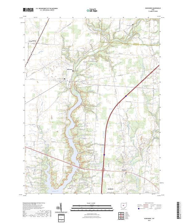 2023 Kilbourne2023 Print · USGSDelaware County, Ohio, is captured here in the early twenty-first century as modern infrastructure meets historic rural settlements. Researchers can trace family sites at Old Kilbourne Cemetery or locate landmarks like Bohannan Airport and Williams Lake.
 - 2023 Map of Waldo, 2023 Print
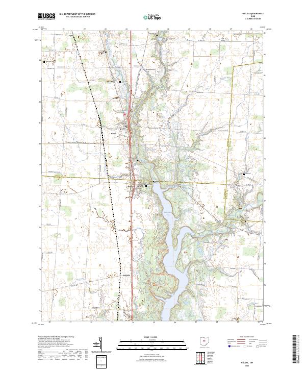 2023 Waldo2023 Print · USGSMarion and Delaware counties are captured in the early 2020s, showing a landscape defined by the Olentangy River and the rural crossroads of Waldo. Genealogists can locate numerous local burying grounds including Drake Cem, Wyatt Cem, and Berringer Cem.
 - 2023 Map of Delaware, 2023 Print
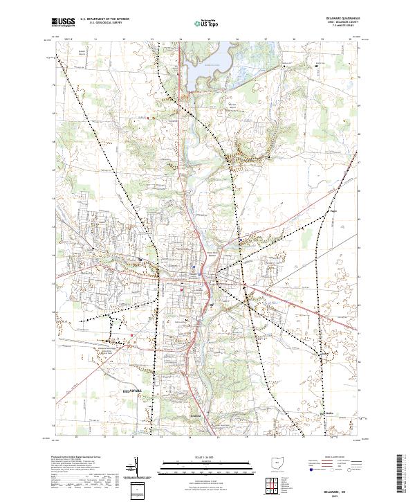 2023 Delaware2023 Print · USGSThe city of Delaware and its surrounding townships are shown here during the early twenty-first century, anchored by the Olentangy River. Researchers can trace the grounds of Ohio Wesleyan University, locate historic sites like Oak Grove Cem, and explore the reaches of Delaware Lake.
End of results
Showing maps 1-4 of 4
Top cities near Oxford Township
- Delaware historical maps
- Marion historical maps
- Powell historical maps
- Jerome historical maps
- Scioto historical maps
- Berkshire historical maps
See more
Top neighborhoods of Oxford Township
Frequently asked questions
- What are the different types of historical maps available for Oxford Township?
- What is the oldest map of Oxford Township?
- Where can I purchase historical maps of Oxford Township for my home or office?
- Where can I download high-res historical maps of Oxford Township?
- Are there historical topographic maps available for Oxford Township?
- Is there historical aerial imagery available for Oxford Township?
- Where are historical maps of Oxford Township sourced from?