Old Maps of Geauga County, Ohio for Metal Detecting
Plan your next treasure hunt with 128 historic maps of Geauga County. Find old homesites, ghost towns, trails, and gathering spots that may be lost to time — perfect for identifying promising metal detecting locations.
- Locate forgotten sites: Uncover places like long-lost settlements, abandoned rail lines, or gathering spots.
- Plan better hunts: Use map overlays combined with LiDAR or satellite views to narrow in on historically rich areas.
- Made for detectorists: Thousands of hobbyists use these maps to discover relics, coins, and hidden history.
Use these historic maps to boost your research and find new opportunities beneath the surface of Geauga County.
Geauga County, OH maps
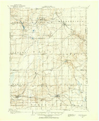
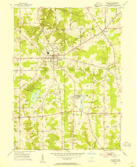
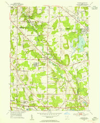
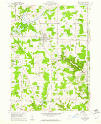
(128)- 1904 Map of Chardon, 1962 Print
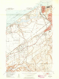
 1904 Chardon1962 Print · USGSGeauga and Lake Counties are shown here during the early twentieth century, just as the region's electric and steam rail networks were at their peak. Researchers can trace the routes of the Cleveland and Chardon Electric RR and find local landmarks like Indian Point or the Infirmary.
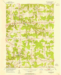
 - 1905 Map of Garrettsville, 1958 Print
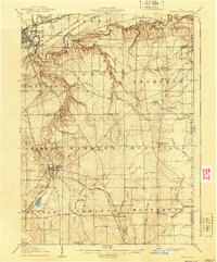
 1905 Garrettsville1958 Print · USGSNortheastern Ohio is shown here at the start of the twentieth century, during a period of heavy rail and traction expansion across Geauga and Portage counties. Genealogists can trace early homesteads near Hiram Rapids, Nelson, and family-named landmarks like Newels Ledge or Steele Crossing.
 - 1905 Map of Mentor, 1961 Print
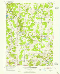
 1905 Mentor1961 Print · USGSLake County and Geauga County thrived in the early twentieth century as a hub for electric rail travel and river-powered industry. Genealogists and historians can trace the foundations of Willoughby and Painesville or locate early milling sites like Wilson Mills and Fowlers Mill.
 - 1906 Map of Chardon, 1940 Print
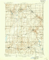
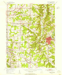
 1906 Chardon1940 Print · USGSGeauga and Lake Counties are mapped here during the era of steam and electric rail, showing the landscape between Chardon and Painesville. Researchers can trace old township boundaries and find landmarks like the Infirmary, Bass Lake, and the New York Chicago and St Louis RR.2 unique versions available
 - 1906 Map of Chagrin Falls, 1955 Print
 1906 Chagrin Falls1955 Print · USGSThe Western Reserve landscape of Northeast Ohio is captured here during a period of rapid transit growth and settlement. Researchers can trace early township hubs and rail stops like Falls Junction Glenwillow PO, Orange Hill Church, and the winding Cleveland and Garrettsville Electric RR.
 - 1907 Map of Garrettsville, 1943 Print
 1907 Garrettsville1943 Print · USGSThe Western Reserve landscape of the early 1900s comes alive in this survey of Geauga and Portage counties. Trace the vanished routes of the Eastern Ohio Traction line or locate family-named settlements like Bundysburg and Smith Crossing.2 unique versions available
 - 1907 Map of Mentor, 1947 Print
 1907 Mentor1947 Print · USGSNortheast Ohio thrives at the turn of the century, where the electric railway and steam lines meet the Lake Erie shore. Genealogists can trace early homesteads near Eagles Mill, Richmond Grand River PO, and the old postal stop at Mulberry Corners.
 - 1908 Map of Chagrin Falls, 1939 Print
 1908 Chagrin Falls1939 Print · USGSThe Chagrin Valley at the turn of the century was a crossroads of electric interurban lines and early rural post offices. Trace the old rail stops at Aurora Station and Cannons Crossing, or locate family landmarks like Orange Hill Church.2 unique versions available
 - 1950 Map of Cleveland
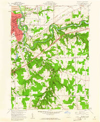
 1950 Cleveland1950 Print · USGSCovers Geauga County, including Cleveland, Akron, and other nearby areas
 - 1953 Map of Chardon, 1954 Print
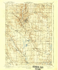
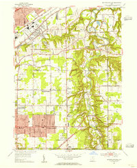
 1953 Chardon1954 Print · USGSMid-century Geauga County comes to life in this survey of the Connecticut Western Reserve during the early fifties. Local historians can locate the County Home, trace family names at Pitkin Cem, and see the early footprint of Chardon Airport.2 unique versions available
 - 1953 Map of South Russell, 1954 Print
 1953 South Russell1954 Print · USGSGeauga County’s rolling landscape is shown here in the early fifties as the area began transitioning from rural farmsteads to suburban enclaves. Researchers can trace historic cemeteries and civic landmarks like Music Cem, Novelty P O, and the Chagrin Falls Airport.
 - 1953 Map of Aurora, 1954 Print
 1953 Aurora1954 Print · USGSThe Aurora and Taborville region of Northeast Ohio is captured in the early fifties during a period of significant growth. Genealogists and local historians can trace the Ohio Turnpike as it first cut through the landscape near Plainview Ch and Fowler Cem.2 unique versions available
 - 1953 Map of Chagrin Falls, 1955 Print
 1953 Chagrin Falls1955 Print · USGSCuyahoga County in the mid-1950s shows a landscape of growing suburbs, river valleys, and recreational estates. Researchers can find numerous historic cemeteries and social landmarks such as Beechbrook Orphanage, Orange Hill Cem, and the Solon Airport.
 - 1953 Map of Twinsburg, 1955 Print
 1953 Twinsburg1955 Print · USGSNortheastern Ohio is shown here during a period of rapid post-war expansion, with the Ohio Turnpike still under construction. Genealogists and local historians can locate Crown Hill Cemetery, the Cleveland Boys Sch, and rail-side hamlets like Falls Junction and Glenwillow.
 - 1953 Map of Burton, 1955 Print
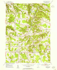
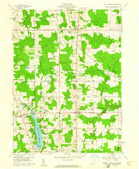
 1953 Burton1955 Print · USGSGeauga County is captured during a period of rural stability in the early fifties, centered on the village of Burton and the upper Cuyahoga River. Researchers can locate family landmarks like Welton Cem, St Helen Ch, and the sprawling Punderson Lake State Park.2 unique versions available
 - 1953 Map of Mayfield Heights, 1955 Print
 1953 Mayfield Heights1955 Print · USGSGreater Cleveland’s eastern suburbs were undergoing a mid-century transformation as residential grids met the river valley. Genealogists can locate family sites near the Little Church in the Vale or the Borromeo Seminary and trace the original County Airport grounds.2 unique versions available
 - 1953 Map of Chesterland, 1955 Print
 1953 Chesterland1955 Print · USGSGeauga and Lake counties are shown here in the early fifties, featuring the established settlements of Chesterland and Kirtland. Genealogists can trace local roots through the Center Chardon Cem or find early industry at Fowlers Mill.
 - 1953 Map of Mentor, 1955 Print
 1953 Mentor1955 Print · USGSLake Erie's southern shore in the early fifties shows a bustling maritime and rail landscape, from the industry of Painesville to the quiet bluffs of Kirtland Hills. Researchers can trace old neighborhood boundaries and find local landmarks like the Old Lighthouse, Lake Erie College, and the Mentor Harbor Yacht Club.2 unique versions available
 - 1956 Map of Cleveland, 1967 Print
 1956 Cleveland1967 Print · USGSNortheast Ohio and Western Pennsylvania are shown at their industrial height during the mid-fifties, from the steel mills to the lakeshore. Researchers can trace the massive Ravenna Arsenal, the Ohio Turnpike, and vanished rail sidings of the B & O RR.3 unique versions available
 - 1959 Map of Mantua, 1960 Print
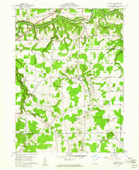
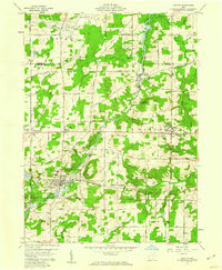 1959 Mantua1960 Print · USGSNorthern Portage County is shown at a mid-century crossroads as the village of Hiram and its historic Hiram College expand. Genealogists and local historians can trace family-named routes like Dudley Road or locate the Mennonite Ch and Westlawn Cem.3 unique versions available
 - 1959 Map of Garrettsville, 1960 Print
 1959 Garrettsville1960 Print · USGSGarrettsville and the surrounding townships are captured in the late fifties, showing a landscape defined by the Western Reserve survey grid and rocky ledges. Researchers can locate several family cemeteries, the Erie RR line, and landmarks like Nelson Ledge State Park.3 unique versions available
 - 1959 Map of East Claridon, 1961 Print
 1959 East Claridon1961 Print · USGSGeauga County in the late fifties remains a rural landscape of headwater creeks and small crossroads settlements. Genealogists and historians can trace family locations along Chardon-Windsor Road or locate the old Huntsburg Cem and Culbertsons Corners.3 unique versions available
 - 1959 Map of Middlefield, 1961 Print
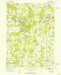
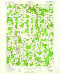
 1959 Middlefield1961 Print · USGSGeauga County's agricultural heartland is documented here in the late fifties, centered on the railroad crossroads of Middlefield. Researchers can trace rural lineages through sites like Burroughs Cem, the Shrine of Maria-Poch, and Burton Station.3 unique versions available
 - 1960 Map of Painesville, 1961 Print
 1960 Painesville1961 Print · USGSPainesville and the surrounding townships of Lake County are captured here just as the suburban era was maturing in the early sixties. Genealogists and local historians can trace family plots in Evergreen Cemetery or locate landmarks like Harvey High Sch and Leroy Center.5 unique versions available
 - 1960 Map of Thompson, 1961 Print
 1960 Thompson1961 Print · USGSThompson and the Grand River valley are captured in 1960, showing the intersection of Lake, Geauga, and Ashtabula counties. Genealogists can trace family names and landmarks like Maple Grove Cem, St Patricks Ch, and the high ridges of The Edges.4 unique versions available
Showing maps 1-25 of 128
Top cities of Geauga County
- Chardon historical maps
- Hambden Township historical maps
- South Russell historical maps
- Bainbridge Township historical maps
- Burton Township historical maps
Frequently asked questions
- What are the different types of historical maps available for Geauga County?
- What is the oldest map of Geauga County?
- Where can I purchase historical maps of Geauga County for my home or office?
- Where can I download high-res historical maps of Geauga County?
- Are there historical topographic maps available for Geauga County?
- Is there historical aerial imagery available for Geauga County?
- Where are historical maps of Geauga County sourced from?