Old Maps of Guernsey County, Ohio for Genealogy
Trace your family roots with 144 historic maps of Guernsey County. These high-res maps reveal old neighborhoods, homesites, landmarks, and streets — helping you uncover where your ancestors lived and how the area evolved over time.
- Explore historic neighborhoods: Identify where your relatives may have lived in the 1800s or 1900s.
- Compare maps over time: Trace the changes in streets, buildings, and landmarks for multi-generational research.
- Perfect for genealogy & ancestry research: Used by family historians and researchers to map out lineage and migration.
These maps are an incredible resource for exploring your personal connection to Guernsey County's past.
Guernsey County, OH maps
(144)- 1903 Map of Flushing, 1959 Print
 1903 Flushing1959 Print · USGSEastern Ohio at the turn of the century is defined here by the meeting of major rail lines and the historic National Road. Trace the path of the Cleveland Lorain and Wheeling railroad through Holloway or locate homes in Flushing.
 - 1905 Map of Woodsfield, 1946 Print
 1905 Woodsfield1946 Print · USGSMonroe and Belmont counties are shown here in the first years of the twentieth century, when the rural landscape was tied together by small postal hubs and creek-side settlements. Genealogists can trace early homesteads near Baileys Mills, Somerton, or Beallsville along the Baltimore and Ohio RR.2 unique versions available
 - 1905 Map of Flushing, 1946 Print
 1905 Flushing1946 Print · USGSEastern Ohio at the turn of the century shows a landscape defined by the National Turnpike and early rail lines. Genealogists can trace family footprints in Holloway, Sewellsville, and Morristown or along the winding Cleveland Lorain and Wheeling railroad.
 - 1909 Map of Antrim
 1909 Antrim1909 Print · USGSEastern Ohio at the turn of the century reveals a landscape of ridge-top farms and valley settlements centered around Antrim and Londonderry. Genealogists can trace family footprints across township lines to sites like Allen Chapel, Moccasin School, and Sewellsville.2 unique versions available
 - 1909 Map of Summerfield, 1958 Print
 1909 Summerfield1958 Print · USGSSoutheastern Ohio at the turn of the century reveals a landscape of tight-knit rural communities and a dense network of country schools. Researchers can trace the vanished postal routes of Spencers Sta PO, locate St Johns Church, or study the early rail lines through Quaker City.
 - 1909 Map of Cambridge, 1963 Print
 1909 Cambridge1963 Print · USGSGuernsey County and the city of Cambridge are documented here in the early nineteen-hundreds, showing a region structured by river valleys and the historic National Road. Genealogists can trace early homesteads near Barnes Mill, the Galigher PO post office, and dozens of rural school sites.
 - 1911 Map of Antrim
 1911 Antrim1911 Print · USGSGuernsey County and parts of Harrison and Tuscarawas Counties appear here just after the first decade of the century, when the rural landscape was dotted with family-named schools and crossroads. Genealogists can trace the exact locations of vanished local landmarks like Moccasin School, Wesley Church, and the dual-named Winterset P.O. Winchester.3 unique versions available
 - 1911 Map of Cumberland, 1939 Print
 1911 Cumberland1939 Print · USGSSoutheastern Ohio at the start of the twentieth century was a landscape of ridge-top schools and valley rail junctions. Genealogists can trace family footprints through dozens of rural landmarks like Goshen Church, Dogtown, and the Rough and Ready School.2 unique versions available
 - 1911 Map of Summerfield, 1942 Print
 1911 Summerfield1942 Print · USGSSoutheast Ohio’s rural landscape is captured here during a time of peak settlement, showing the region's dense network of family-named ridges and valley farms. Genealogists can trace local roots through numerous landmarks like Richland Church, Kings Mine, and the Science Hill School.
 - 1912 Map of Cambridge, 1946 Print
 1912 Cambridge1946 Print · USGSGuernsey County was a bustling hub of rail and river commerce at the start of the century. You can trace the path of the National Road and locate family landmarks like Barnes Mill, Zion Church, and dozens of district schools.2 unique versions available
 - 1949 Map of Clarksburg
 1949 Clarksburg1949 Print · USGSThe upper Ohio River valley and the industrial heart of West Virginia come into focus during this post-war period. Genealogists and researchers can trace the rail corridors of the Baltimore and Ohio and locate centers like Fairmont, Grafton, and Waynesburg.
 - 1951 Map of Canton
 1951 Canton1951 Print · USGSThe industrial heartland of Ohio and Pennsylvania reached its mid-century peak during this era of heavy rail and river transit. Genealogists and historians can trace the development of steel towns like Aliquippa and Weirton alongside the Ohio River and major lines of the Pennsylvania RR.
 - 1953 Map of Canton
 1953 Canton1953 Print · USGSThe industrial heartland of Ohio and Pennsylvania is captured at its mid-century peak in this detailed regional survey. Genealogists and historians can trace the vast rail networks of the Pennsylvania RR and find local landmarks like Nimisila Reservoir and Tappan Reservoir.
 - 1956 Map of Clarksburg, 1966 Print
 1956 Clarksburg1966 Print · USGSThe Ohio River valley and the industrial heart of West Virginia are seen here in the mid-1950s as rail and river commerce thrived. Researchers can trace historic transport lines like the Baltimore and Ohio RR and locate ancestral homes in Clarksburg, Moundsville, or Parkersburg.2 unique versions available
 - 1957 Map of Canton, 1971 Print
 1957 Canton1971 Print · USGSThe industrial heartland of eastern Ohio and western Pennsylvania comes alive in this mid-century survey of the Ohio River Valley. Trace the heritage of rail and river commerce through Pittsburgh, the massive steel towns along the Ohio River, and major junctions on the Pennsylvania RR.3 unique versions available
 - 1961 Map of Clarksburg
 1961 Clarksburg1961 Print · USGSThe mid-century industrial and river landscapes of West Virginia and Ohio are detailed here, centered on the Ohio River. Researchers can trace the Baltimore and Ohio rail lines connecting towns like Parkersburg, Clarksburg, and Monongah.
 - 1961 Map of Piedmont, 1962 Print
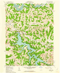 1961 Piedmont1962 Print · USGSHarrison and Belmont counties in the early sixties show a landscape transformed by the Muskingum Watershed Conservancy District. Genealogists and historians can locate the Quaker Cem, trace the Baltimore and Ohio rail lines, and find early coal Strip Mines.4 unique versions available
 - 1961 Map of Fairview, 1962 Print
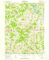 1961 Fairview1962 Print · USGSThe Guernsey and Belmont county border area was undergoing significant change in the 1960s as highway expansion met traditional coal mining. Researchers can trace family history through Salem Ch and Gibson Cem or locate industrial sites like the Strip Mines and Bradfield Airport.3 unique versions available
 - 1961 Map of Byesville, 1963 Print
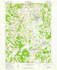 1961 Byesville1963 Print · USGSGuernsey County's mining and rail landscape is captured here in the early sixties, showing the transition between historic military districts and congress lands. Genealogists can locate family sites at Greenwood Cemetery, Beech Grove Sch, and along the Old Railroad Grade.4 unique versions available
 - 1961 Map of Barnesville, 1963 Print
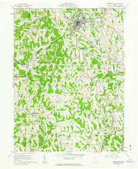 1961 Barnesville1963 Print · USGSThe hilltop town of Barnesville thrived in the early sixties as a center for industry and education in eastern Ohio. Researchers can trace family history through the Old Quaker Cemetery, find the Friends School, or locate rural outposts like Baileys Mills and Somerton.3 unique versions available
 - 1961 Map of Cumberland, 1963 Print
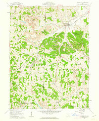 1961 Cumberland1963 Print · USGSSoutheastern Ohio's hill country is captured here during the early sixties, showing a landscape defined by rail transport and surface mining. Trace the Baltimore and Ohio tracks through Cumberland or locate family sites like Brookfield Cem and Ark Springs Ch.4 unique versions available
 - 1961 Map of Quaker City, 1963 Print
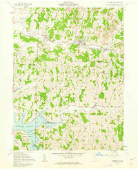 1961 Quaker City1963 Print · USGSQuaker City and the rolling hills of Guernsey County were centers of rail and coal activity in the early sixties. Genealogists can trace family names through landmarks like the Richland Meetinghouse, Sand Hill Cem, and the village of Batesville.2 unique versions available
 - 1961 Map of Senecaville, 1963 Print
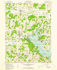 1961 Senecaville1963 Print · USGSSoutheast Ohio in the early sixties was a landscape of watershed engineering and coal mining. Researchers can trace the Baltimore and Ohio rail line through Lore City or locate family plots at St Patricks Cem and Weaver Cem.3 unique versions available
 - 1961 Map of Caldwell North, 1963 Print
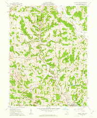 1961 Caldwell North1963 Print · USGSCentral Noble County in the early sixties reveals a landscape of coal-hauling rail lines and creek-bottom settlements. Genealogists can trace family landmarks like McElroy Cemetery, the community at Hiramsburg, and rural landmarks such as Clarks Chapel.3 unique versions available
 - 1961 Map of New Concord, 1963 Print
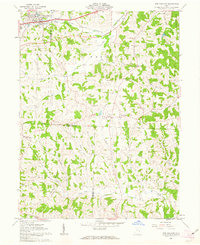 1961 New Concord1963 Print · USGSMuskingum County and the village of New Concord are captured in the early sixties as local industry and campus life expanded. Researchers can trace family roots at Zion Cem or locate former rural landmarks like the Westland Sch and Rix Mills.4 unique versions available
Showing maps 1-25 of 144
Top cities of Guernsey County
- Cambridge historical maps
- Byesville historical maps
- Center historical maps
- Londonderry historical maps
- Quaker City historical maps
- Senecaville historical maps
See more
Frequently asked questions
- What are the different types of historical maps available for Guernsey County?
- What is the oldest map of Guernsey County?
- Where can I purchase historical maps of Guernsey County for my home or office?
- Where can I download high-res historical maps of Guernsey County?
- Are there historical topographic maps available for Guernsey County?
- Is there historical aerial imagery available for Guernsey County?
- Where are historical maps of Guernsey County sourced from?