1900s (20th Century) Maps of Colerain Township, Ohio
Explore 16 historic maps of Colerain Township from the 1900s (20th Century). These maps offer a rare glimpse into what life looked like during the 1900s — showing old roads, neighborhoods, homes, and landmarks that have changed or disappeared over time.
Whether you're researching your family's past, planning a metal detecting trip, or studying how Colerain Township's landscape evolved across the 1900s, these high-resolution maps are a powerful tool for exploring the history of this region.
- Focus on a specific era: All maps on this page are from the 1900s, giving you a focused view of this time period.
- See what’s changed: Compare century-old streets, trails, and buildings to today's modern landscape using overlays and satellite layers.
- Research with precision: Use these maps for genealogy, historical research, land use analysis, or educational projects.
- View, download, or print: Maps are fully viewable online in high resolution, and can be downloaded or printed for your own records.
Start exploring Colerain Township's history through authentic maps from the 1900s. This is your window into the past.
Colerain Township, OH maps
(16)- 1914 Map of West Cincinnati
 1914 West Cincinnati1914 Print · USGSCincinnati and the Ohio River valley appear here in a period of intense industrial growth and suburban expansion just before the First World War. Researchers can trace the dense rail networks of the Chesapeake and Ohio or locate early institutions like the Ohio Military Institute and Spring Grove Cemetery.4 unique versions available
 - 1915 Map of Hamilton
 1915 Hamilton1915 Print · USGSButler County was a bustling industrial and transit corridor in the years before the Great War, centered on the Miami River. Researchers can trace the path of the Miami and Erie Canal and locate historic sites like Shaker Village, Venice Ross P O, and the Biddinger School.2 unique versions available
 - 1917 Map of Hamilton, 1942 Print
 1917 Hamilton1942 Print · USGSButler County and the Miami River valley are captured here just before the era of major highway expansion, when industrial towns and electric railways defined the region. Researchers can locate the Shaker Village, trace the Miami and Erie Canal, or find family sites near Darrtown and Millville.
 - 1953 Map of Cincinnati West, 1955 Print
 1953 Cincinnati West1955 Print · USGSThe western hills and industrial valleys of Cincinnati are captured here in the early fifties as neighborhoods expanded toward the county line. Researchers can locate specialized sites like the Clovernook Blind Home, trace rail lines through Ivorydale, or find family names at Wesleyan Cem.
 - 1953 Map of Cincinnati, 1965 Print
 1953 Cincinnati1965 Print · USGSThe Ohio River valley and the industrial heartland of Indiana and Ohio are captured here during the mid-century peak of rail and river commerce. Genealogists and historians can trace connections between Cincinnati and outlying military sites like Camp Atterbury and Bakalar AFB.3 unique versions available
 - 1954 Map of Addyston, 1955 Print
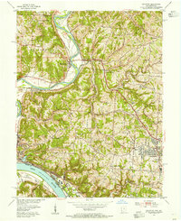 1954 Addyston1955 Print · USGSThe Ohio River valley and its industrial corridors are captured here in the mid-fifties as the Cincinnati suburbs began to crest the western hills. Genealogists and historians can trace the paths of the Baltimore and Ohio railroad through Addyston, North Bend, and landmarks like Bethel Cem.
 - 1955 Map of Shandon, 1957 Print
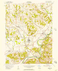 1955 Shandon1957 Print · USGSButler and Hamilton counties in the mid-1950s reveal a mix of quiet rural townships and emerging industrial sites. Genealogists can trace family footprints through several local cemeteries like Scott Cem and Butterfield Cem or the vanished stops of Shandon Sta.
 - 1955 Map of Greenhills, 1957 Print
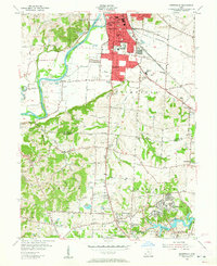 1955 Greenhills1957 Print · USGSButler and Hamilton counties in the mid-fifties reveal a mix of established river towns and new suburban growth. Genealogists and local historians can trace family sites like Huston Cem and Werner Cem, or locate the original grounds of the St Francis Seminary.2 unique versions available
 - 1957 Map of Cincinnati
 1957 Cincinnati1957 Print · USGSThe Ohio River valley and its surrounding highlands thrived during the mid-fifties industrial peak, centered on the bustling Cincinnati and Dayton metropolitan hubs. Researchers can trace the extensive rail networks and military sites like Wright-Patterson AFB and Camp Atterbury.
 - 1960 Map of Addyston, 1963 Print
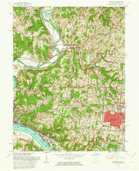 1960 Addyston1963 Print · USGSGreater Cincinnati's western riverfront is captured here in the early sixties, showing the industrial pulse of Addyston and North Bend along the river. Genealogists can trace family names at the Bridgetown Cemetery or locate schools like Oak Hill High Sch.3 unique versions available
 - 1961 Map of Cincinnati West, 1963 Print
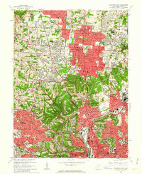 1961 Cincinnati West1963 Print · USGSGreater Cincinnati was rapidly expanding into northern Hamilton County in the early sixties as new subdivisions began to fill the valleys. Genealogists and historians can locate numerous landmarks like Arlington Memorial Gardens Cemetery, St Josephs Orphanage, and the grounds of McAuley High Sch.6 unique versions available
 - 1965 Map of Greenhills, 1968 Print
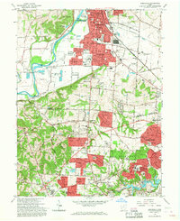 1965 Greenhills1968 Print · USGSGreater Cincinnati's northern suburbs were rapidly evolving in the mid-sixties as post-war growth transformed the Butler and Hamilton County line. Genealogists and local historians can trace family-named sites like Huston Cem and landmarks such as St Francis Seminary and Lake Gloria.4 unique versions available
 - 1965 Map of Shandon, 1968 Print
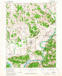 1965 Shandon1968 Print · USGSThe Butler and Hamilton County borderlands were defined in the mid-1960s by a unique mix of industrial facilities and deep-rooted rural settlements. Genealogists can trace family landmarks like Shaker Cem and Scott Cem or locate the sprawling U S Reservation (Atomic Energy Commission) facility at Fernald.3 unique versions available
 - 1982 Map of Addyston
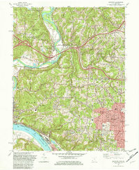 1982 Addyston1982 Print · USGSThe confluence of the Ohio and Great Miami Rivers defines this Hamilton County landscape in the early eighties. Researchers can trace the river-and-rail economy through the Chessie System line and find family sites at Miamitown Cem and Cleves.3 unique versions available
 - 1986 Map of Cincinnati
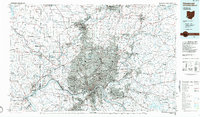 1986 Cincinnati1986 Print · USGSGreater Cincinnati and its tri-state surrounds are captured here in the mid-eighties as suburban growth reached into the neighboring hills and river valleys. Researchers can trace the development of transit hubs like Greater Cincinnati International Airport and historic sites such as Spring Grove Cemetery.3 unique versions available
 - 1996 Map of Addyston, 1999 Print
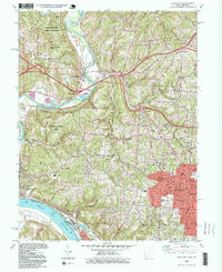 1996 Addyston1999 Print · USGSThe Great Miami and Ohio River valleys show a mix of industrial riverfront and growing suburban centers in the 1990s. Trace local landmarks like the Miamitown Airport, Miami Cem, and the CSX rail corridor as it winds through North Bend and Addyston.
End of results
Showing maps 1-16 of 16
Top cities near Colerain Township
- Cincinnati historical maps
- Hamilton historical maps
- Middletown historical maps
- Fairfield historical maps
- Covington historical maps
- Norwood historical maps
See more
Top neighborhoods of Colerain Township
- Colerain Heights historical maps
- Crestwood Acres historical maps
- Dornbusch historical maps
- Groesbeck historical maps
- Miami Station historical maps
- Northbrook historical maps
See more
Frequently asked questions
- What are the different types of historical maps available for Colerain Township?
- What is the oldest map of Colerain Township?
- Where can I purchase historical maps of Colerain Township for my home or office?
- Where can I download high-res historical maps of Colerain Township?
- Are there historical topographic maps available for Colerain Township?
- Is there historical aerial imagery available for Colerain Township?
- Where are historical maps of Colerain Township sourced from?