2020s Maps of Springfield Township, Ohio
Explore 4 historic maps of Springfield Township from the 2020s. These maps offer a rare glimpse into what life looked like during the 2020s — showing old roads, neighborhoods, homes, and landmarks that have changed or disappeared over time.
Whether you're researching your family's past, planning a metal detecting trip, or studying how Springfield Township's landscape evolved across the 2020s, these high-resolution maps are a powerful tool for exploring the history of this region.
- Focus on a specific era: All maps on this page are from the 2020s, giving you a focused view of this time period.
- See what’s changed: Compare century-old streets, trails, and buildings to today's modern landscape using overlays and satellite layers.
- Research with precision: Use these maps for genealogy, historical research, land use analysis, or educational projects.
- View, download, or print: Maps are fully viewable online in high resolution, and can be downloaded or printed for your own records.
Start exploring Springfield Township's history through authentic maps from the 2020s. This is your window into the past.
Springfield Township, OH maps
(4)- 2023 Map of Glendale, 2023 Print
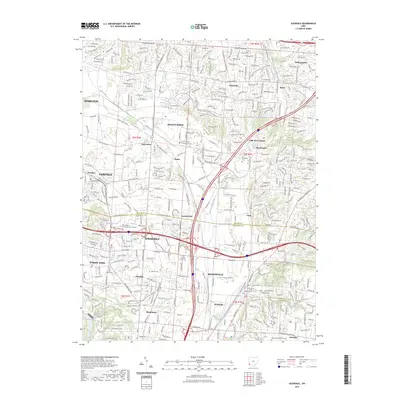 2023 Glendale2023 Print · USGSThe northern suburbs of Cincinnati are shown here in the early twenty-first century as established towns and new developments merge. Researchers can locate several burial grounds including Old Saint Marys Cem and trace older communities like Port Union and Rialto.
 - 2023 Map of Greenhills, 2023 Print
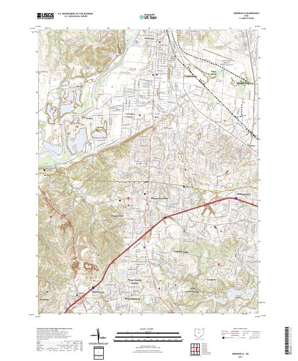 2023 Greenhills2023 Print · USGSGreater Cincinnati's northern suburbs are shown in high detail during their modern era of expansion across Hamilton and Butler counties. Researchers can locate numerous historic burial sites such as Cedar Grove Cem and New Burlington Cem alongside the waters of the Great Miami River.
 - 2023 Map of Cincinnati West, 2023 Print
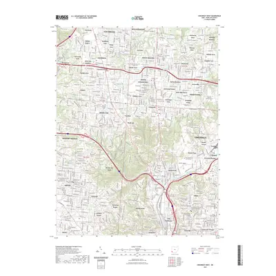 2023 Cincinnati West2023 Print · USGSCincinnati and its northern suburbs are shown here in the 2020s, revealing a dense urban landscape of hospitals, universities, and parks. Genealogists can trace family plots at Spring Grove Cem and Arboretum or find landmarks like the University of Cincinnati.
 - 2023 Map of Cincinnati East, 2023 Print
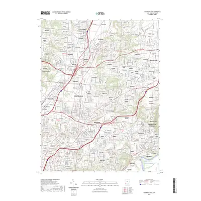 2023 Cincinnati East2023 Print · USGSGreater Cincinnati in the 2020s remains a complex landscape of independent historic communities and industrial corridors. Researchers can trace the layout of Lincoln Heights, find family plots in Reading Lockland Cem, or follow the Little Miami Wild and Scenic River.
End of results
Showing maps 1-4 of 4
Top cities near Springfield Township
- Cincinnati historical maps
- Hamilton historical maps
- Middletown historical maps
- Fairfield historical maps
- Covington historical maps
- Mason historical maps
See more
Top neighborhoods of Springfield Township
- Wyoming Meadows historical maps
- Brookhill historical maps
- Edgemont historical maps
- Compton Park historical maps
- Golfway Acres historical maps
- Greenfield Village historical maps
See more
Frequently asked questions
- What are the different types of historical maps available for Springfield Township?
- What is the oldest map of Springfield Township?
- Where can I purchase historical maps of Springfield Township for my home or office?
- Where can I download high-res historical maps of Springfield Township?
- Are there historical topographic maps available for Springfield Township?
- Is there historical aerial imagery available for Springfield Township?
- Where are historical maps of Springfield Township sourced from?