2020s Maps of Holmes County, Ohio
Explore 15 historic maps of Holmes County from the 2020s. These maps offer a rare glimpse into what life looked like during the 2020s — showing old roads, neighborhoods, homes, and landmarks that have changed or disappeared over time.
Whether you're researching your family's past, planning a metal detecting trip, or studying how Holmes County's landscape evolved across the 2020s, these high-resolution maps are a powerful tool for exploring the history of this region.
- Focus on a specific era: All maps on this page are from the 2020s, giving you a focused view of this time period.
- See what’s changed: Compare century-old streets, trails, and buildings to today's modern landscape using overlays and satellite layers.
- Research with precision: Use these maps for genealogy, historical research, land use analysis, or educational projects.
- View, download, or print: Maps are fully viewable online in high resolution, and can be downloaded or printed for your own records.
Start exploring Holmes County's history through authentic maps from the 2020s. This is your window into the past.
Holmes County, OH maps
(15)- 2023 Map of Killbuck, 2023 Print
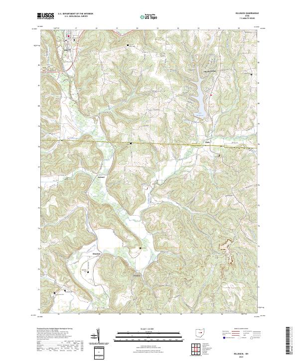 2023 Killbuck2023 Print · USGSThe Killbuck Creek valley in Holmes and Coshocton Counties is captured here in the early twenty-first century, showing the enduring rail and road networks of these rural townships. Researchers can trace family history through numerous local sites like Salem Cem, Blissfield Cem, and the village of Helmick.
 - 2023 Map of Fredericksburg, 2023 Print
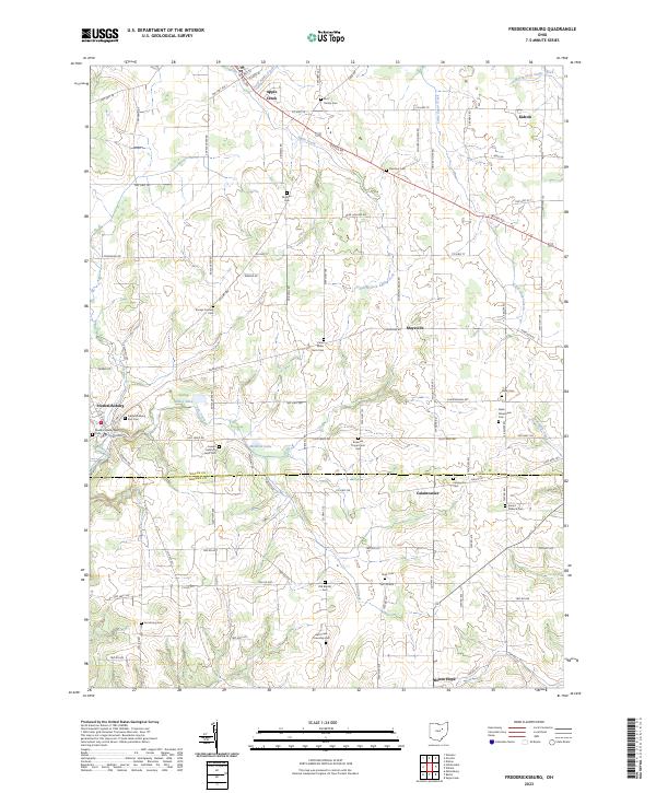 2023 Fredericksburg2023 Print · USGSWayne and Holmes counties are captured here in the early twenty-first century, showcasing the rural heart of Ohio. Genealogists and local historians can trace family land and heritage through numerous burial sites like the Bott Family Cem, Slutz Cem, and Traceys Corners Cem.
 - 2023 Map of Sugarcreek, 2023 Print
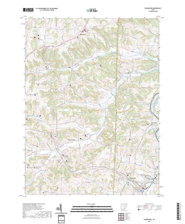 2023 Sugarcreek2023 Print · USGSThis part of Holmes and Tuscarawas Counties is a haven for family historians, showing the ridge-and-valley landscape in great detail. Genealogists can locate numerous family-named burial sites like the Moses J Miller Farm Cem and Henry Beachy Farm Cem near Walnut Creek.
 - 2023 Map of Baltic, 2023 Print
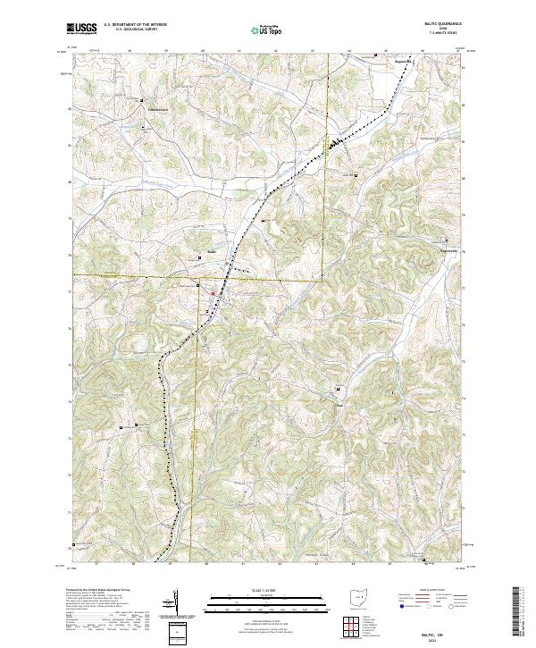 2023 Baltic2023 Print · USGSThe tri-county border of Holmes, Coshocton, and Tuscarawas Counties comes alive in this survey of the region around Baltic and Ragersville. Genealogists can trace family footprints at Farmerstown Cem, Evans Creek Lutheran Cem, and along the banks of Evans Creek.
 - 2023 Map of New Bedford, 2023 Print
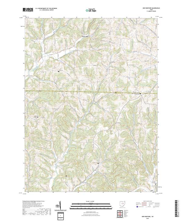 2023 New Bedford2023 Print · USGSThe rural border of Holmes and Coshocton Counties comes into focus in this recent survey of the Ohio countryside. Researchers can trace ancestral lines through numerous burial grounds like Knob Cem, Burkhardt Cem, and the settlement of Becks Mills.
 - 2023 Map of Wilmot, 2023 Print
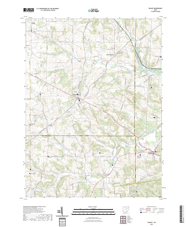 2023 Wilmot2023 Print · USGSThe intersection of four Ohio counties comes into focus in this contemporary survey of the rural landscape near Wilmot and Mount Eaton. Genealogists can trace numerous local burial sites including Keim Cem, Hershberger Cem, and Yoder Cem.
 - 2023 Map of Greer, 2023 Print
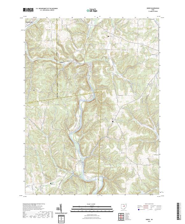 2023 Greer2023 Print · USGSThe Mohican River valley comes into sharp focus in this contemporary survey of the Ashland, Holmes, and Knox county borders. Family historians can trace rural burial grounds like Kaylor Ridge Cem and Ullman Cem near the settlements of Greer and Spellacy.
 - 2023 Map of Spring Mountain, 2023 Print
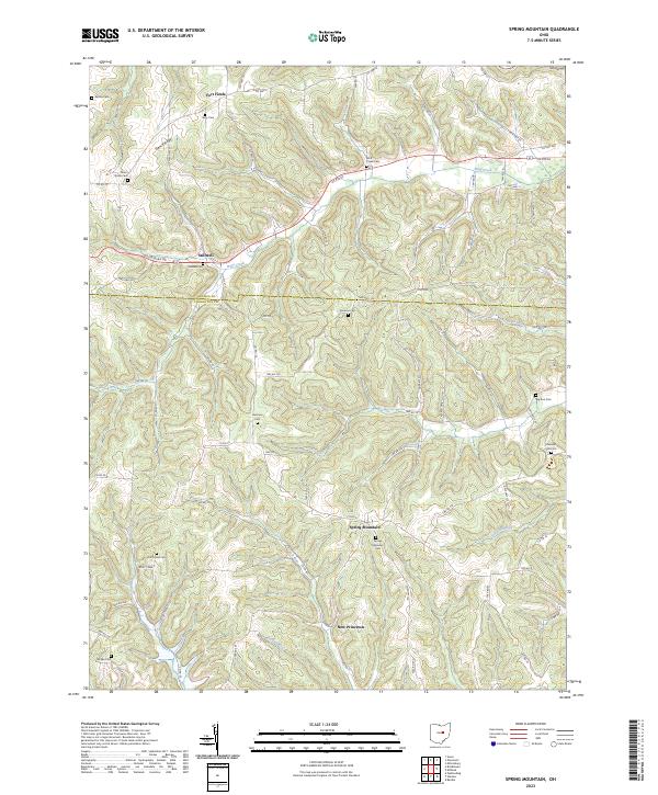 2023 Spring Mountain2023 Print · USGSSpring Mountain and the rural border between Coshocton and Holmes counties appear in this modern survey of central Ohio. Genealogists can trace family landmarks at Spring Mountain Cem, Stillwell, and the curious site of Fort Fizzle.
 - 2023 Map of Berlin, 2023 Print
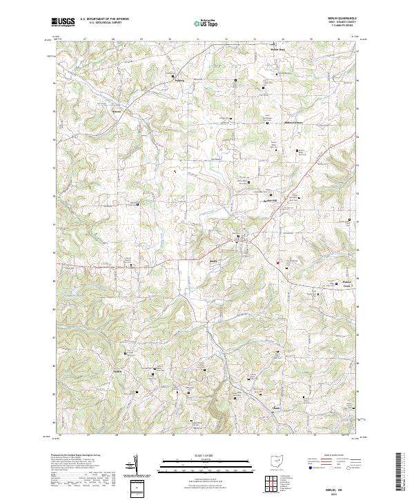 2023 Berlin2023 Print · USGSBerlin and its neighboring Holmes County townships are shown here in a detailed modern survey of this agricultural region. Genealogists can trace decades of family history through dozens of farm-site burial grounds like Berlin Cem, Noah Beachy Farm Cem, and Saint Johns Cem.
 - 2023 Map of Millersburg, 2023 Print
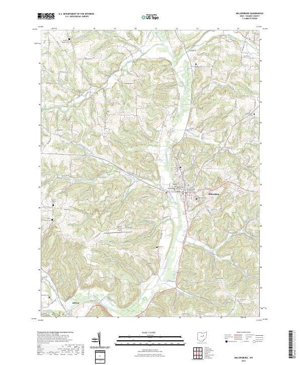 2023 Millersburg2023 Print · USGSMillersburg and the Killbuck Creek valley are captured here in the early twenty-first century, showing the seat of Holmes County and the village of Killbuck. Local historians can trace family roots at Oak Grove Cem or locate the Holmes County Courthouse and Stokers Hill.
 - 2023 Map of Glenmont, 2023 Print
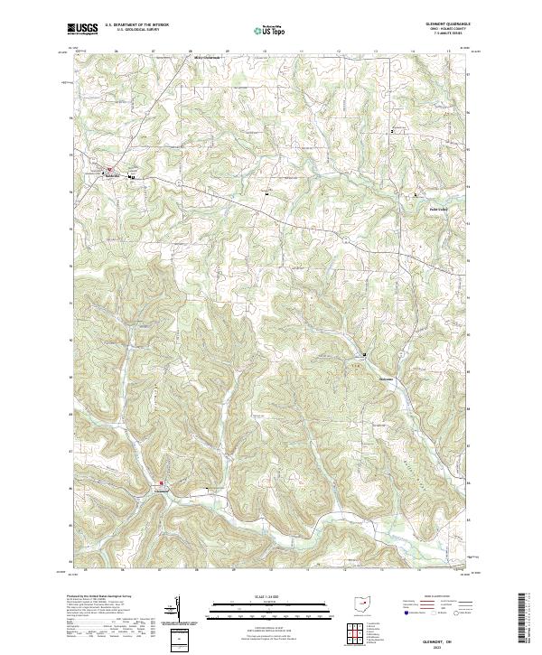 2023 Glenmont2023 Print · USGSHolmes County settlements like Nashville and Glenmont anchor this rural landscape in the twenty-first century. Researchers can trace family roots through numerous burial grounds, including the Old Dutch Lutheran Cem and Sunnyside Cem.
 - 2023 Map of Loudonville, 2023 Print
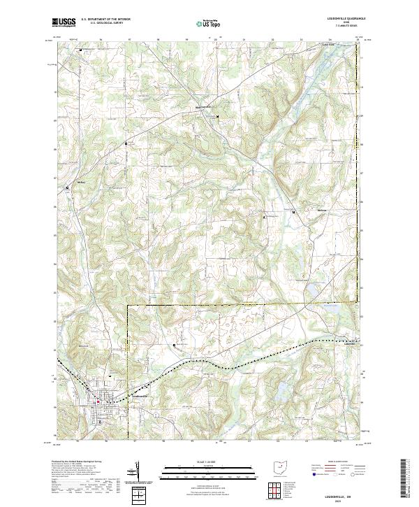 2023 Loudonville2023 Print · USGSLoudonville and the surrounding townships of Ashland and Holmes County are documented here in modern detail. Genealogists and local researchers can trace numerous rural burial sites like Old Sixteen Cem, McKay Cem, and the high ground at Bold Knob.
 - 2023 Map of Shreve, 2023 Print
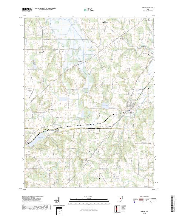 2023 Shreve2023 Print · USGSWayne and Holmes County farmlands meet in this study of North Central Ohio's rural landscape. Genealogists and local historians can trace family roots through numerous sites like Millbrook Cem, Big Prairie, and the wetlands surrounding Shreve Lake.
 - 2023 Map of Brinkhaven, 2023 Print
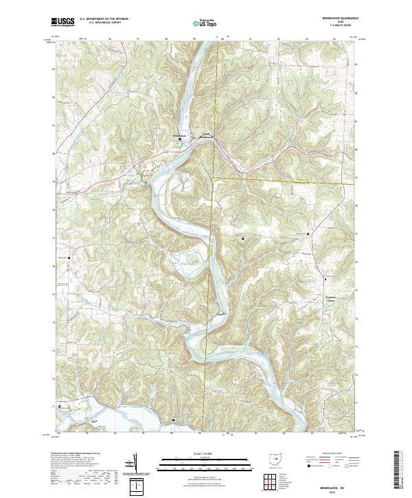 2023 Brinkhaven2023 Print · USGSKnox County hill country in the early twenty-first century is defined by the winding Mohican River and the settlements of Brinkhaven and Gann. Genealogists can locate several rural burial sites, including Tiverton Cem and Hollister Cem, or trace the legacy of the Stone Quarry.
 - 2023 Map of Holmesville, 2023 Print
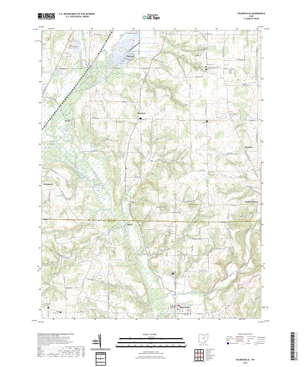 2023 Holmesville2023 Print · USGSThe borderlands of Holmes and Wayne Counties are captured here in the 2020s, showing a traditional rural landscape shaped by Killbuck Creek. Genealogists and historians can locate numerous family and church burial sites, including Moreland Cem and Hermans Cem.
End of results
Showing maps 1-15 of 15
Top cities of Holmes County
- Berlin historical maps
- Walnut Creek historical maps
- Millersburg historical maps
- Killbuck historical maps
- Clark historical maps
- Holmesville historical maps
See more
Frequently asked questions
- What are the different types of historical maps available for Holmes County?
- What is the oldest map of Holmes County?
- Where can I purchase historical maps of Holmes County for my home or office?
- Where can I download high-res historical maps of Holmes County?
- Are there historical topographic maps available for Holmes County?
- Is there historical aerial imagery available for Holmes County?
- Where are historical maps of Holmes County sourced from?