1960s Maps of Jefferson County, Ohio
Explore 16 historic maps of Jefferson County from the 1960s. These maps offer a rare glimpse into what life looked like during the 1960s — showing old roads, neighborhoods, homes, and landmarks that have changed or disappeared over time.
Whether you're researching your family's past, planning a metal detecting trip, or studying how Jefferson County's landscape evolved across the 1960s, these high-resolution maps are a powerful tool for exploring the history of this region.
- Focus on a specific era: All maps on this page are from the 1960s, giving you a focused view of this time period.
- See what’s changed: Compare century-old streets, trails, and buildings to today's modern landscape using overlays and satellite layers.
- Research with precision: Use these maps for genealogy, historical research, land use analysis, or educational projects.
- View, download, or print: Maps are fully viewable online in high resolution, and can be downloaded or printed for your own records.
Start exploring Jefferson County's history through authentic maps from the 1960s. This is your window into the past.
Jefferson County, OH maps
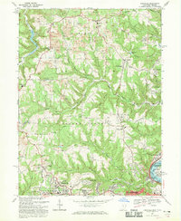
(16)- 1960 Map of Bergholz, 1961 Print
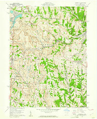
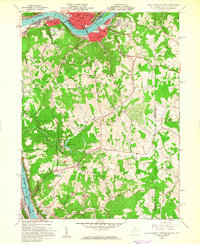
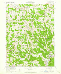 1960 Bergholz1961 Print · USGSEastern Ohio coal and rail country comes to life in the early sixties as industrial mining expands around the village of Bergholz. Genealogists and researchers can trace family roots at Spyder Cem, Palmer Cem, or the Chestnut Ridge Ch.4 unique versions available
 - 1960 Map of Dillonvale, 1961 Print
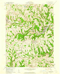 1960 Dillonvale1961 Print · USGSEastern Ohio coal country was in the midst of a mining boom in the early sixties, leaving a landscape defined by industry and deep-seated local roots. Genealogists and historians can trace family locations through numerous sites like St Casimirs Ch, Olszeski Town, and Highland Cem.5 unique versions available
 - 1960 Map of Smithfield, 1961 Print
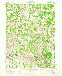
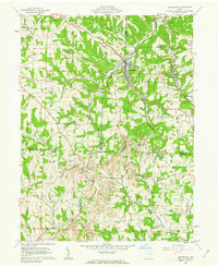
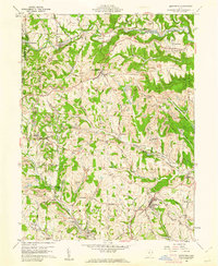 1960 Smithfield1961 Print · USGSJefferson County at the dawn of the sixties shows a landscape transformed by industry and rail. Genealogists can trace family roots through Pine Run Cem and Township Cem, or locate old rail stops like Weems (Smithfield Sta).4 unique versions available
 - 1960 Map of Richmond, 1961 Print
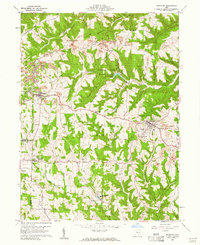 1960 Richmond1961 Print · USGSJefferson County in the early sixties was a landscape of deep-cut ridges and active industry. Researchers can trace family sites at Old Annapolis Cem, explore the grounds of St John Vianney Seminary, or locate early Strip Mines near Richmond.3 unique versions available
 - 1960 Map of Harrisville, 1961 Print
 1960 Harrisville1961 Print · USGSEastern Ohio's coal country comes into sharp focus during the early sixties, showing a landscape shaped by industrial mining and small-town life. Genealogists and historians can trace family plots at Olive Branch Cem or locate the sprawling Georgetown Coal Preparation Plant and the Glencastle Mine.5 unique versions available
 - 1960 Map of Wellsville, 1962 Print
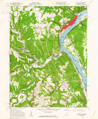 1960 Wellsville1962 Print · USGSThe Ohio River valley in the early sixties is a landscape of heavy industry and riverfront commerce. Genealogists can trace family plots at Spring Hill Cem or explore rail-side communities like Wellsville, Irondale, and Hammondsville.6 unique versions available
 - 1960 Map of Cadiz, 1962 Print
 1960 Cadiz1962 Print · USGSEastern Ohio at the dawn of the 1960s shows a landscape shaped by coal and rail near the Harrison and Jefferson County line. Genealogists and historians can trace family roots at Greenwood Cem and Beech Spring Cem or locate industrial sites like Nelms Mine No 1.4 unique versions available
 - 1960 Map of Salineville, 1962 Print
 1960 Salineville1962 Print · USGSSalineville and the surrounding townships of Columbiana and Jefferson Counties are shown here during the early 1960s coal boom. Genealogists and historians can trace the rural landscape via West Grove Cem, Grants Hill Ch, and the numerous Strip Mine sites.2 unique versions available
 - 1960 Map of East Liverpool South, 1962 Print
 1960 East Liverpool South1962 Print · USGSThe Ohio River borderlands in the early sixties reveal a landscape of heavy industry and quiet ridge-top communities. Genealogists can trace family sites at Glendale Ch, the Locust Hill Cem, and the historic County Childrens Home.6 unique versions available
 - 1960 Map of Amsterdam, 1962 Print
 1960 Amsterdam1962 Print · USGSThe tri-county borderlands of Jefferson, Carroll, and Harrison Counties are captured here in the early 1960s as mining reshaped the landscape. Trace the New York Central line through Amsterdam or locate family roots at Simmons Ridge Cem and Germano.3 unique versions available
 - 1962 Map of Canton
 1962 Canton1962 Print · USGSThe industrial heartland of Eastern Ohio and Western Pennsylvania thrives in the early sixties as steel mills and rail lines dominate the river valleys. Genealogists and historians can trace local landmarks like McKinley National Memorial, Malone College, and industrial sites such as Republic Steel Corp.2 unique versions available
 - 1968 Map of Weirton, 1970 Print
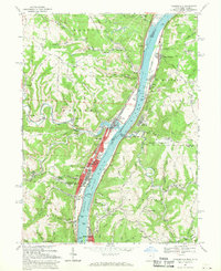
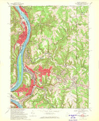 1968 Weirton1970 Print · USGSThe industrial corridor along the Ohio River is shown here at its mid-century peak during the late sixties. Genealogists and local historians can trace family locations through Union Cem, Sacred Heart of Mary Ch, and numerous neighborhood schools like Roosevelt Sch.3 unique versions available
 - 1968 Map of Steubenville West, 1970 Print
 1968 Steubenville West1970 Print · USGSThe industrial and suburban expansion of Jefferson County is on full display in the late 1960s. Researchers can trace the rail corridors of the Penn Central and find historic local sites like Reeds Mill, Tent Ch, and the Union Cemetery.4 unique versions available
 - 1968 Map of Knoxville, 1970 Print
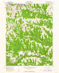
 1968 Knoxville1970 Print · USGSThe Jefferson County hills north of Steubenville are shown here during a period of industrial expansion and suburban growth in the late sixties. Genealogists can trace family names across Shelley Cem, Mt Tabor Cem, and Island Creek Ch while mapping the era's pervasive Strip Mine operations.3 unique versions available
 - 1968 Map of Tiltonsville, 1970 Print
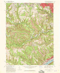
 1968 Tiltonsville1970 Print · USGSThe Ohio River valley in the late sixties reveals a landscape of heavy industry and riverside towns. Genealogists and historians can trace family roots in Tiltonsville and Yorkville or locate landmarks like Rush Run Chapel and the Pike Island Lock and Dam.3 unique versions available
 - 1968 Map of Steubenville East, 1970 Print
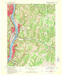 1968 Steubenville East1970 Print · USGSThe Ohio River valley was a bustling hub of industry and transit in the late sixties, where West Virginia and Ohio river towns met. Genealogists can trace family footprints through sites like St Johns Cem, the Lower Buffalo Ch, and Mingo Junction.3 unique versions available
End of results
Showing maps 1-16 of 16
Top cities of Jefferson County
- Steubenville historical maps
- Toronto historical maps
- Wintersville historical maps
- Mingo Junction historical maps
- Tiltonsville historical maps
- Smithfield historical maps
See more
Frequently asked questions
- What are the different types of historical maps available for Jefferson County?
- What is the oldest map of Jefferson County?
- Where can I purchase historical maps of Jefferson County for my home or office?
- Where can I download high-res historical maps of Jefferson County?
- Are there historical topographic maps available for Jefferson County?
- Is there historical aerial imagery available for Jefferson County?
- Where are historical maps of Jefferson County sourced from?