2000s (21st Century) Maps of Union Township, Ohio
Explore 8 historic maps of Union Township from the 2000s (21st Century). These maps offer a rare glimpse into what life looked like during the 2000s — showing old roads, neighborhoods, homes, and landmarks that have changed or disappeared over time.
Whether you're researching your family's past, planning a metal detecting trip, or studying how Union Township's landscape evolved across the 2000s, these high-resolution maps are a powerful tool for exploring the history of this region.
- Focus on a specific era: All maps on this page are from the 2000s, giving you a focused view of this time period.
- See what’s changed: Compare century-old streets, trails, and buildings to today's modern landscape using overlays and satellite layers.
- Research with precision: Use these maps for genealogy, historical research, land use analysis, or educational projects.
- View, download, or print: Maps are fully viewable online in high resolution, and can be downloaded or printed for your own records.
Start exploring Union Township's history through authentic maps from the 2000s. This is your window into the past.
Union Township, OH maps
(8)- 2002 Map of Aid, 2006 Print
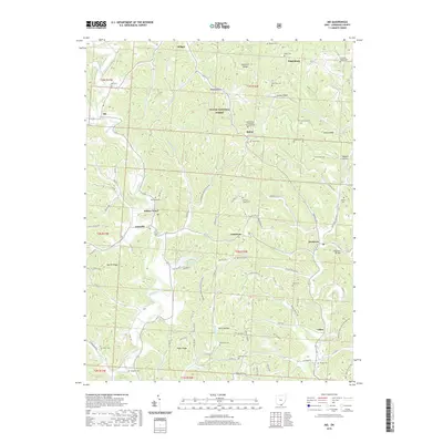
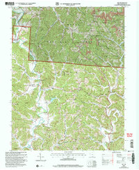 2002 Aid2006 Print · USGSLawrence County at the start of the 21st century reveals a landscape where Wayne National Forest wilderness meets a long history of ridge-top farming and coal mining. Researchers can trace family sites near Aid Cem and Linnville, or locate early educational landmarks like Township Sch No 2 and the Symmes Valley High Sch.
 - 2011 Map of Aid, 2011 Print
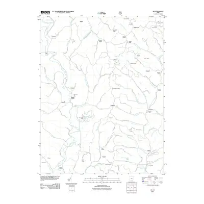 2011 Aid2011 Print · USGSCovers Union Township, including Aid, Fayette Township, and other nearby areas
 - 2013 Map of Aid, 2013 Print
 2013 Aid2013 Print · USGSCovers Union Township, including Aid, Fayette Township, and other nearby areas
 - 2016 Map of Aid, 2016 Print
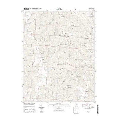
 2016 Aid2016 Print · USGSCovers Union Township, including Aid, Fayette Township, and other nearby areas
 - 2019 Map of Aid, 2019 Print
 2019 Aid2019 Print · USGSCovers Union Township, including Aid, Fayette Township, and other nearby areas
 - 2023 Map of Aid, 2023 Print
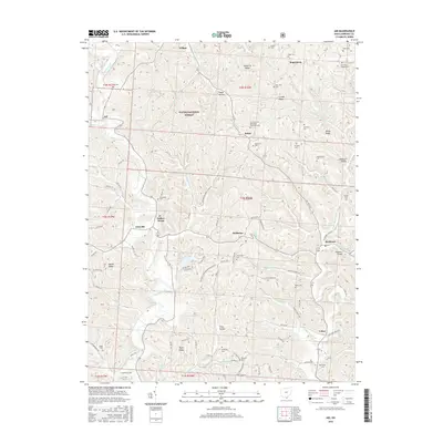
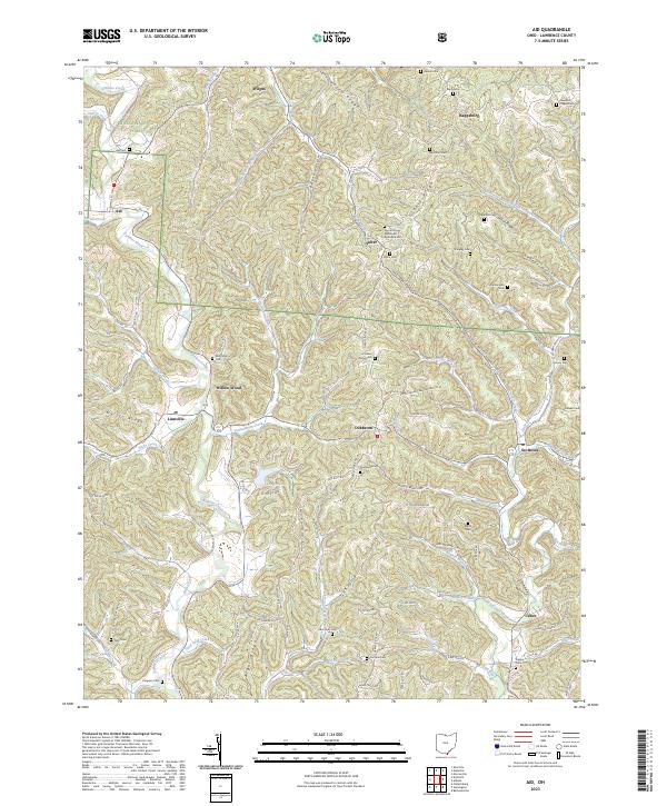 2023 Aid2023 Print · USGSLawrence County's high ridges and creek valleys are documented here in the early twenty-first century. Genealogists can locate family landmarks like Aid Cem, Brammer Cem, and the community of Willow Wood.
 - 2023 Map of Barboursville, 2023 Print
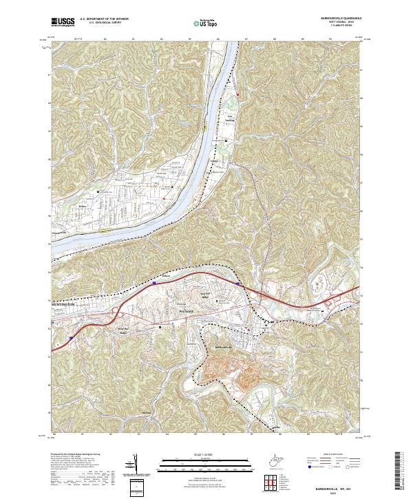 2023 Barboursville2023 Print · USGSThe West Virginia and Ohio borderlands come alive in this recent survey of the Ohio River corridor. Researchers can trace the development of Barboursville and Pea Ridge or locate local landmarks like Robert Newlon Field.
 - 2023 Map of Huntington, 2023 Print
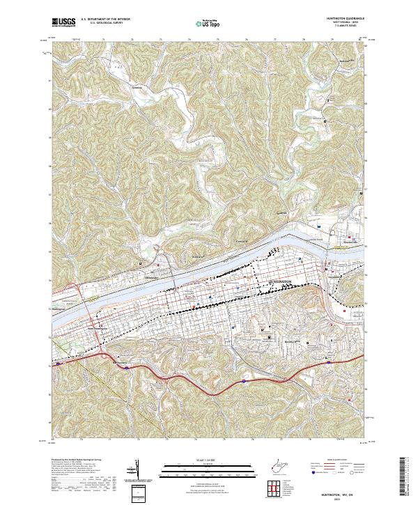 2023 Huntington2023 Print · USGSHuntington and the Ohio River valley come into focus in this contemporary study of the tri-state border. Researchers can trace the legacy of urban and rural life through Spring Hill Cem, Marshall University, and Harveytown.
End of results
Showing maps 1-8 of 8
Top cities near Union Township
- Huntington historical maps
- Ashland historical maps
- Ironton historical maps
- Rome historical maps
- South Point historical maps
- Kenova historical maps
See more
Top neighborhoods of Union Township
- Crescent Lake historical maps
- Getaway historical maps
- Rockwood historical maps
- Symmes Park historical maps
- Bartramville historical maps
- Bradrick historical maps
See more
Frequently asked questions
- What are the different types of historical maps available for Union Township?
- What is the oldest map of Union Township?
- Where can I purchase historical maps of Union Township for my home or office?
- Where can I download high-res historical maps of Union Township?
- Are there historical topographic maps available for Union Township?
- Is there historical aerial imagery available for Union Township?
- Where are historical maps of Union Township sourced from?