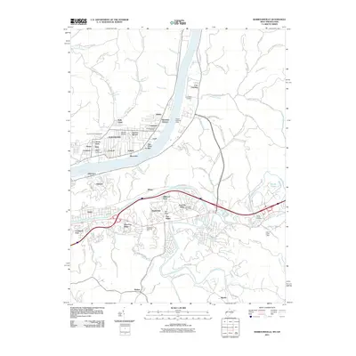
2011 Map of Barboursville
USGS Topo · Published 2011About this map
The Ohio River and the Guyandotte River converge in this river-bottom landscape, where residential development fills the terraces between the water and the rising interior ridges. In the early 21st century, the area shows a dense network of suburban clusters such as Pea Ridge, Altizer, and West Pea Ridge, positioned along the major east-west transportation corridors. This map reveals a community deeply anchored by its memorial sites and public spaces, from Oaklawn Memorial Park to the Lawrence County Fairgrounds just across the river. To the south, the terrain becomes more dissected by waterways like Davis Creek and Mud River, leading toward smaller settlements like Melissa and Martha. The landscape is a mix of floodplain industry, indicated by the Lock and Robert Newlon Field, and quiet recreational spots such as the Lake of Eden.
Find a feature on this map
110 named features on this map. Tap any name to fly to it.
Don’t see what you’re looking for? This feature index may not catch every label — zoom into the map to look around manually.
Map Details
Editions of this 2011 Barboursville Map
This is the sole edition of this map. No revisions or reprints were ever made.
Other maps of this area

1892 · Huntington
USGS Topo · 1:125,000

1898 · Huntington
USGS Topo · 1:125,000

1901 · Guyandot
USGS Topo · 1:62,500

1902 · Guyandot
USGS Topo · 1:62,500

1902 · Milton
USGS Topo · 1:62,500

1906 · Athalia
USGS Topo · 1:62,500

1906 · Glenwood
USGS Topo · 1:62,500

1908 · Athalia
USGS Topo · 1:62,500

1908 · Glenwood
USGS Topo · 1:62,500

1931 · Milton
USGS Topo · 1:62,500