Old Maps of Mercer County, Ohio for Metal Detecting
Plan your next treasure hunt with 111 historic maps of Mercer County. Find old homesites, ghost towns, trails, and gathering spots that may be lost to time — perfect for identifying promising metal detecting locations.
- Locate forgotten sites: Uncover places like long-lost settlements, abandoned rail lines, or gathering spots.
- Plan better hunts: Use map overlays combined with LiDAR or satellite views to narrow in on historically rich areas.
- Made for detectorists: Thousands of hobbyists use these maps to discover relics, coins, and hidden history.
Use these historic maps to boost your research and find new opportunities beneath the surface of Mercer County.
Mercer County, OH maps
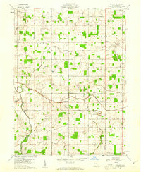
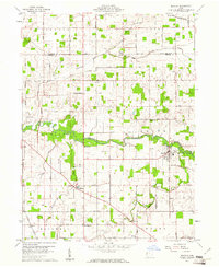
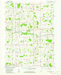
(111)- 1908 Map of St. Henry, 1944 Print
 1908 St. Henry1944 Print · USGSMercer and Darke counties at the start of the twentieth century show a landscape defined by rail-side commerce and early drainage engineering. Genealogists can trace family roots in settlements like St Henry, Burkettsville, and Coldwater, or locate landmarks such as Goulder School and Gilbert Sta.
 - 1909 Map of Loramie, 1961 Print
 1909 Loramie1961 Print · USGSWestern Ohio at the opening of the twentieth century was a landscape defined by the transition from canal transport to electric rail. Genealogists can trace family names across dozens of rural school districts like Walkup School and Diters School, or locate old parish centers such as Maria Stein and St John.
 - 1911 Map of Berne
 1911 Berne1911 Print · USGSThe Ohio-Indiana borderlands come to life in this pre-war survey of the rural landscape between the St. Marys and Wabash rivers. Genealogists can trace family footprints through numerous district sites like Duck Creek School No 4, St Anthony, and Zion Church.
 - 1911 Map of Loramie, 1936 Print
 1911 Loramie1936 Print · USGSWestern Ohio at the start of the twentieth century shows a landscape transitioning from the canal era to the age of electric rail. Researchers can trace the Miami and Erie Canal through Minster and New Bremen, or locate family sites near St Patricks Church and Schwaberow School.
 - 1911 Map of Spencerville, 1942 Print
 1911 Spencerville1942 Print · USGSWestern Ohio in the early 1900s was a hub of canal and rail transport, anchored by the industrial and shipping activity in St Marys. Genealogists and historians can trace numerous rural schoolhouses like Hardscrabble School and the path of the Miami and Erie Canal.
 - 1914 Map of Celina, 1942 Print
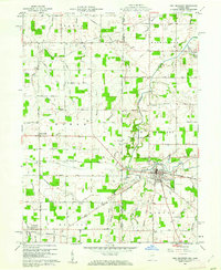
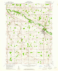
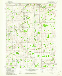
 1914 Celina1942 Print · USGSMercer County's agricultural and railway hub at Celina is captured here in the years before the Great War. Genealogists and local historians can pinpoint dozens of rural schoolhouses and crossroads settlements, including Skeels Crossroads, St Anthony, and the County Infirmary.
 - 1915 Map of Fort Recovery
 1915 Fort Recovery1915 Print · USGSThe Indiana-Ohio borderlands come into focus during the mid-1910s, showing the agricultural and rail-dependent landscape around Fort Recovery. Genealogists and historians can trace the exact locations of numerous rural institutions like Oak Grove School, Mt Zion School, and the Lake Erie and Western railroad corridor.2 unique versions available
 - 1918 Map of Fort Recovery, 1922 Print
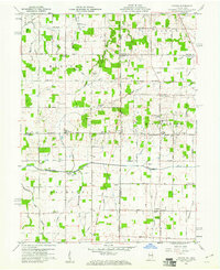
 1918 Fort Recovery1922 Print · USGSFort Recovery and the surrounding Mercer County farmsteads are documented here in the early twentieth century, just years after the turn of the century. Genealogists can trace family connections through a high density of rural schoolhouses like Mt Zion School and settlements such as Macedon and Buck Corners.
 - 1944 Map of Loramie
 1944 Loramie1944 Print · USGSWest-central Ohio farmland is captured here during the mid-forties, showing the intricate grid of rural school districts and turnpikes. Researchers can trace family-named sites like Fledderjohn Sch and St Patricks Ch near the Loramie Reservoir.
 - 1944 Map of Celina
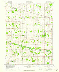
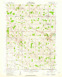
 1944 Celina1944 Print · USGSMercer and Van Wert counties in the mid-1940s show a landscape of productive farmland and lakeside life. Genealogists can locate dozens of country schoolhouses like Victor Sch and trace family roots in settlements from St Anthony to Willshire.
 - 1944 Map of Spencerville
 1944 Spencerville1944 Print · USGSMid-century Western Ohio is shown here at the height of its rail and canal era. Genealogists can trace family roots through dozens of rural landmarks like Deep Cut Sch, Walnut Grove Church, and the Artesian Well at St Marys.
 - 1953 Map of Muncie, 1966 Print
 1953 Muncie1966 Print · USGSIndiana and Ohio borderlands thrive in the early fifties, showing a landscape defined by manufacturing cities and an intensive railroad network. Genealogists can trace family roots across the Indiana-Ohio line through Muncie, Celina, and Portland via the Pennsylvania railroad.5 unique versions available
 - 1956 Map of Muncie
 1956 Muncie1956 Print · USGSEastern Indiana and western Ohio are shown at a peak of rail-driven industry in the mid-fifties. Genealogists and rail historians can trace the paths of the Pennsylvania RR through Muncie or locate landmarks like Lake Saint Marys (Grand Lake Reservoir) and Frances Slocum State Forest.
 - 1960 Map of Fort Recovery, 1961 Print
 1960 Fort Recovery1961 Print · USGSThe Indiana-Ohio borderlands come into focus during the early sixties, centered on the historic village of Fort Recovery. Genealogists and historians can trace the Old Indian Treaty Road and locate numerous family burial grounds like Old Pioneer Cem and Limber Cem.2 unique versions available
 - 1960 Map of Celina, 1961 Print
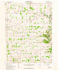
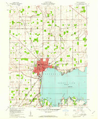 1960 Celina1961 Print · USGSMercer County life in the early sixties centers on the growing shoreline of Grand Lake and the hub of Celina. Trace historical family roots and old property lines using landmarks like North Grove Cemetery, Livingston PO, and the New York Chicago and St Louis RR.3 unique versions available
 - 1960 Map of Erastus, 1961 Print
 1960 Erastus1961 Print · USGSMercer County at the start of the sixties reveals a landscape of small farming hamlets and country schoolhouses. Genealogists can trace family footprints near Swamp College, Erastus, and numerous rural cemeteries like Buck Cem.2 unique versions available
 - 1960 Map of St. Marys, 1961 Print
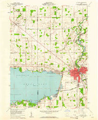 1960 St. Marys1961 Print · USGSSt. Marys and the shores of Grand Lake appear in the early sixties as a hub of water-borne history and mid-century industry. Trace the Miami and Erie Canal (Abandoned) past Forty Acre Pond and find old family sites near Neptune or Villa Nova.3 unique versions available
 - 1960 Map of Mendon, 1961 Print
 1960 Mendon1961 Print · USGSMercer and Van Wert counties are captured in the early 1960s, showing a landscape of productive farmsteads and rural crossroads. Local researchers can trace the New York Central rail line through Mendon or locate family sites like Frisinger Cem and Wesley Chapel.2 unique versions available
 - 1960 Map of Rockford, 1961 Print
 1960 Rockford1961 Print · USGSMercer and Van Wert counties are captured here at the start of the sixties, showcasing a landscape defined by the St Marys River and a busy rail junction. Genealogists can trace family names through landmarks like Riverside Cem, Fountain Chapel Cem, and the rural Bursville settlement.
 - 1960 Map of Cosmos, 1961 Print
 1960 Cosmos1961 Print · USGSThe Indiana-Ohio borderlands at the start of the sixties were a grid of productive farmland and small rural parishes. Researchers can trace ancestral sites and local landmarks like Salem, Raper Chapel, and Mt Zion Cem Ch across the state line.4 unique versions available
 - 1960 Map of Elgin, 1961 Print
 1960 Elgin1961 Print · USGSWestern Ohio farmland is captured here in the early sixties at the meeting point of four counties. Genealogists and historians can trace family-named landmarks like Fissel Lauth Cem and Hankin Cem or locate the village of Elgin along the Erie Lackawanna Railroad.
 - 1960 Map of New Corydon, 1962 Print
 1960 New Corydon1962 Print · USGSThe Indiana-Ohio borderlands come to life in this early 1960s survey of the Wabash River valley. Genealogists and researchers can trace family roots through numerous country landmarks like Jefferson Sch, Liberty Cem, and the small community of New Corydon.3 unique versions available
 - 1960 Map of Willshire, 1964 Print
 1960 Willshire1964 Print · USGSThe Indiana-Ohio borderlands come into focus in the early sixties as a patchwork of small farms and crossroads hamlets. Genealogists and historians can locate family landmarks like Tricker Cem, Blue Creek Sch, and the riverside village of Willshire.3 unique versions available
 - 1961 Map of Rossburg, 1962 Print
 1961 Rossburg1962 Print · USGSDarke and Mercer counties appear here in the early sixties, showing a landscape defined by small rail towns and the upper Stillwater River. Genealogists and local historians can trace New York Central rail stops and country landmarks like St Marys Novitiate and Zion Pilgrim Ch.2 unique versions available
 - 1961 Map of Osgood, 1963 Print
 1961 Osgood1963 Print · USGSThis western Ohio landscape at the start of the sixties reveals a countryside shaped by the historic Treaty Line and the remnants of the canal era. Genealogists can locate numerous rural burial sites like Walkup Cem and St Martins Cem near settlements like Osgood and Willowdell.3 unique versions available
Showing maps 1-25 of 111
Top cities of Mercer County
- Celina historical maps
- Coldwater historical maps
- St. Henry historical maps
- Fort Recovery historical maps
- Rockford historical maps
- Mendon historical maps
See more
Frequently asked questions
- What are the different types of historical maps available for Mercer County?
- What is the oldest map of Mercer County?
- Where can I purchase historical maps of Mercer County for my home or office?
- Where can I download high-res historical maps of Mercer County?
- Are there historical topographic maps available for Mercer County?
- Is there historical aerial imagery available for Mercer County?
- Where are historical maps of Mercer County sourced from?