Old Maps of Portage County, Ohio for Genealogy
Trace your family roots with 138 historic maps of Portage County. These high-res maps reveal old neighborhoods, homesites, landmarks, and streets — helping you uncover where your ancestors lived and how the area evolved over time.
- Explore historic neighborhoods: Identify where your relatives may have lived in the 1800s or 1900s.
- Compare maps over time: Trace the changes in streets, buildings, and landmarks for multi-generational research.
- Perfect for genealogy & ancestry research: Used by family historians and researchers to map out lineage and migration.
These maps are an incredible resource for exploring your personal connection to Portage County's past.
Portage County, OH maps
(138)- 1901 Map of Canton, 1958 Print
 1901 Canton1958 Print · USGSStark County at the turn of the century is a landscape of growing industrial towns and busy rail corridors. Genealogists can trace family roots in New Berlin and Louisville or locate landmarks like Westlawn Cem and the Infirmary.
 - 1903 Map of Canton, 1939 Print
 1903 Canton1939 Print · USGSCanton was a flourishing rail and manufacturing center at the dawn of the century, serving as the nexus for multiple major lines. Genealogists can trace early homesteads and community centers near New Berlin, Osnaburg, and the Westlawn Cem.2 unique versions available
 - 1905 Map of Garrettsville, 1958 Print
 1905 Garrettsville1958 Print · USGSNortheastern Ohio is shown here at the start of the twentieth century, during a period of heavy rail and traction expansion across Geauga and Portage counties. Genealogists can trace early homesteads near Hiram Rapids, Nelson, and family-named landmarks like Newels Ledge or Steele Crossing.
 - 1906 Map of Kent, 1941 Print
 1906 Kent1941 Print · USGSPortage and Summit Counties are captured here at the height of the steam and electric rail era. Researchers can trace ancestral roots through early settlements like Tallmadge and Mogadore, or locate landmarks like the County Infirmary.2 unique versions available
 - 1906 Map of Chagrin Falls, 1955 Print
 1906 Chagrin Falls1955 Print · USGSThe Western Reserve landscape of Northeast Ohio is captured here during a period of rapid transit growth and settlement. Researchers can trace early township hubs and rail stops like Falls Junction Glenwillow PO, Orange Hill Church, and the winding Cleveland and Garrettsville Electric RR.
 - 1906 Map of Ravenna, 1961 Print
 1906 Ravenna1961 Print · USGSPortage County at the turn of the century was a network of rail-side hamlets and one-room schoolhouses. Genealogists can trace family roots through specific stops like New Milford Rootstown Sta and rural landmarks such as Whippoorwill School.
 - 1907 Map of Garrettsville, 1943 Print
 1907 Garrettsville1943 Print · USGSThe Western Reserve landscape of the early 1900s comes alive in this survey of Geauga and Portage counties. Trace the vanished routes of the Eastern Ohio Traction line or locate family-named settlements like Bundysburg and Smith Crossing.2 unique versions available
 - 1908 Map of Chagrin Falls, 1939 Print
 1908 Chagrin Falls1939 Print · USGSThe Chagrin Valley at the turn of the century was a crossroads of electric interurban lines and early rural post offices. Trace the old rail stops at Aurora Station and Cannons Crossing, or locate family landmarks like Orange Hill Church.2 unique versions available
 - 1908 Map of Ravenna, 1946 Print
 1908 Ravenna1946 Print · USGSPortage County at the dawn of the twentieth century was a vital crossroads of major rail lines and rural townships. Genealogists can trace family footprints across several rural schools like Evergreen School and vanished depots such as Palmyra Sta or Freedom Station.2 unique versions available
 - 1909 Map of Alliance
 1909 Alliance1909 Print · USGSAlliance and its surrounding industrial townships are captured in detail just after the turn of the century as the rail network reached its peak. Genealogists can trace family roots through numerous rural schools like Linden Hall School and vanished stations such as Freeburg Sta.4 unique versions available
 - 1950 Map of Cleveland
 1950 Cleveland1950 Print · USGSCovers Portage County, including Cleveland, Akron, and other nearby areas
 - 1951 Map of Canton
 1951 Canton1951 Print · USGSThe industrial heartland of Ohio and Pennsylvania reached its mid-century peak during this era of heavy rail and river transit. Genealogists and historians can trace the development of steel towns like Aliquippa and Weirton alongside the Ohio River and major lines of the Pennsylvania RR.
 - 1952 Map of Alliance, 1954 Print
 1952 Alliance1954 Print · USGSAlliance and its surrounding industrial townships are captured in the early fifties, showcasing a dense rail and school network. Genealogists can trace family names through several burial sites like Old German Cem and Hartzell Cem, or locate historic homes near Mt Union College.3 unique versions available
 - 1953 Map of Canton
 1953 Canton1953 Print · USGSThe industrial heartland of Ohio and Pennsylvania is captured at its mid-century peak in this detailed regional survey. Genealogists and historians can trace the vast rail networks of the Pennsylvania RR and find local landmarks like Nimisila Reservoir and Tappan Reservoir.
 - 1953 Map of Aurora, 1954 Print
 1953 Aurora1954 Print · USGSThe Aurora and Taborville region of Northeast Ohio is captured in the early fifties during a period of significant growth. Genealogists and local historians can trace the Ohio Turnpike as it first cut through the landscape near Plainview Ch and Fowler Cem.2 unique versions available
 - 1953 Map of Twinsburg, 1955 Print
 1953 Twinsburg1955 Print · USGSNortheastern Ohio is shown here during a period of rapid post-war expansion, with the Ohio Turnpike still under construction. Genealogists and local historians can locate Crown Hill Cemetery, the Cleveland Boys Sch, and rail-side hamlets like Falls Junction and Glenwillow.
 - 1953 Map of Hudson, 1955 Print
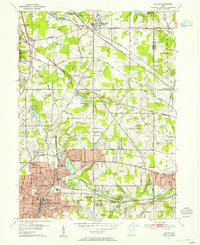 1953 Hudson1955 Print · USGSNortheast Ohio's suburban and industrial growth is captured here in the early fifties as the rail lines still dominated the landscape. Genealogists and local historians can trace family plots at Markillie Cem or locate the old Mid City Airport and Lincoln Sch.
 - 1956 Map of Cleveland, 1967 Print
 1956 Cleveland1967 Print · USGSNortheast Ohio and Western Pennsylvania are shown at their industrial height during the mid-fifties, from the steel mills to the lakeshore. Researchers can trace the massive Ravenna Arsenal, the Ohio Turnpike, and vanished rail sidings of the B & O RR.3 unique versions available
 - 1957 Map of Canton, 1971 Print
 1957 Canton1971 Print · USGSThe industrial heartland of eastern Ohio and western Pennsylvania comes alive in this mid-century survey of the Ohio River Valley. Trace the heritage of rail and river commerce through Pittsburgh, the massive steel towns along the Ohio River, and major junctions on the Pennsylvania RR.3 unique versions available
 - 1958 Map of Akron East, 1959 Print
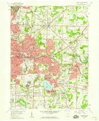 1958 Akron East1959 Print · USGSMid-century Akron and Tallmadge show a landscape of industrial might and suburban growth just before the interstate era. Trace family roots at Ellet Memorial Cem or explore aviation landmarks like the Goodyear Airdock and Derby Downs.
 - 1958 Map of North Canton, 1959 Print
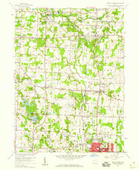 1958 North Canton1959 Print · USGSNortheast Ohio saw significant expansion in the late fifties as suburban life developed around major transportation hubs. Genealogists and local historians can trace the footprint of Greentown and Uniontown, or locate smaller sites like Tritts Millpond and Klinefelter Cem.
 - 1959 Map of Mantua, 1960 Print
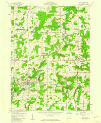 1959 Mantua1960 Print · USGSNorthern Portage County is shown at a mid-century crossroads as the village of Hiram and its historic Hiram College expand. Genealogists and local historians can trace family-named routes like Dudley Road or locate the Mennonite Ch and Westlawn Cem.3 unique versions available
 - 1959 Map of Garrettsville, 1960 Print
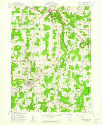 1959 Garrettsville1960 Print · USGSGarrettsville and the surrounding townships are captured in the late fifties, showing a landscape defined by the Western Reserve survey grid and rocky ledges. Researchers can locate several family cemeteries, the Erie RR line, and landmarks like Nelson Ledge State Park.3 unique versions available
 - 1959 Map of Windham, 1961 Print
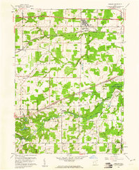 1959 Windham1961 Print · USGSPortage County at the end of the fifties reveals a landscape shaped by military expansion and major transport lines. Researchers can trace the massive Ravenna Arsenal complex alongside small rail stops like Wayland and the historic Hawley Cem.3 unique versions available
 - 1960 Map of Limaville, 1961 Print
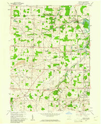 1960 Limaville1961 Print · USGSStark and Portage counties are captured here at the dawn of the sixties as small villages like Limaville and Marlboro sit amid a busy rail network. Genealogists can locate family sites like St Pauls Cem or trace the old Railroad Grade near Lexington.4 unique versions available
Showing maps 1-25 of 138
Top cities of Portage County
- Kent historical maps
- Streetsboro historical maps
- Aurora historical maps
- Ravenna historical maps
- Windham historical maps
- Garrettsville historical maps
See more
Frequently asked questions
- What are the different types of historical maps available for Portage County?
- What is the oldest map of Portage County?
- Where can I purchase historical maps of Portage County for my home or office?
- Where can I download high-res historical maps of Portage County?
- Are there historical topographic maps available for Portage County?
- Is there historical aerial imagery available for Portage County?
- Where are historical maps of Portage County sourced from?