1940s Maps of Ross County, Ohio
Explore 7 historic maps of Ross County from the 1940s. These maps offer a rare glimpse into what life looked like during the 1940s — showing old roads, neighborhoods, homes, and landmarks that have changed or disappeared over time.
Whether you're researching your family's past, planning a metal detecting trip, or studying how Ross County's landscape evolved across the 1940s, these high-resolution maps are a powerful tool for exploring the history of this region.
- Focus on a specific era: All maps on this page are from the 1940s, giving you a focused view of this time period.
- See what’s changed: Compare century-old streets, trails, and buildings to today's modern landscape using overlays and satellite layers.
- Research with precision: Use these maps for genealogy, historical research, land use analysis, or educational projects.
- View, download, or print: Maps are fully viewable online in high resolution, and can be downloaded or printed for your own records.
Start exploring Ross County's history through authentic maps from the 1940s. This is your window into the past.
Ross County, OH maps
(7)- 1943 Map of Era
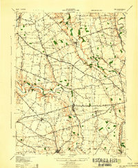 1943 Era1943 Print · USGSPickaway and Ross Counties are shown in the early 1940s, a period when rural education and river-based land divisions still shaped the Ohio countryside. Genealogists can locate dozens of country schoolhouses like Frogeye Sch and trace the Pennsylvania rail line through Williamsport and Atlanta.
 - 1943 Map of Circleville
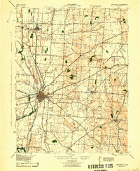 1943 Circleville1943 Print · USGSMid-century Pickaway County is defined here by its intersection of rail power and ancient landmarks along the Scioto River. Genealogists and historians can trace dozens of rural schoolhouses like Bushwhack Sch, the county Infirmary, and the site of the Logan Elm.
 - 1944 Map of Piketon
 1944 Piketon1944 Print · USGSSouthern Ohio's hill country meets the Scioto River valley in the mid-1940s, a landscape defined by ancient earthworks and rugged ridge-top schoolhouses. Researchers can locate family landmarks like the County Home, trace the Norfolk and Western RR, or find vanished community hubs like Bethel Pike PO and Morgantown.
 - 1944 Map of Laurelville
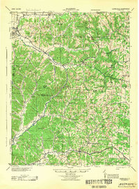 1944 Laurelville1944 Print · USGSMid-century Hocking and Vinton Counties appear here as a patchwork of tight-knit upland communities during the Second World War. Researchers can locate dozens of local landmarks including Adelphi, Eagle Mills, and the Chestnut Grove Church nestled among the hollows.
 - 1944 Map of Greenfield
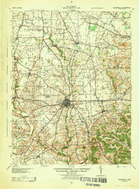 1944 Greenfield1944 Print · USGSMid-century Highland and Ross Counties center on the rail crossroads of Greenfield during the final years of the war. Genealogists can trace rural family life through dozens of named schoolhouses like Pikes Peak Sch and early settlements such as South Salem or Good Hope.
 - 1944 Map of Roxabell
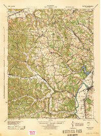
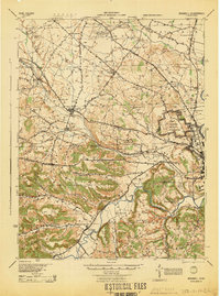 1944 Roxabell1944 Print · USGSRoss County during the mid-forties reveals a rural landscape defined by ancient earthworks and modern military mobilization. Genealogists and historians can locate dozens of country schools like Metzger Sch and Cline Sch alongside the Camp Sherman Military Reservation.
 - 1947 Map of Columbus, 1948 Print
 1947 Columbus1948 Print · USGSCentral Ohio in the late 1940s is captured in this survey, showing the post-war transition of its rail hubs and military airfield expansions. Genealogists and historians can trace the paths of the Ohio Canal, the Pennsylvania RR lines, and the Camp Sherman Military Reservation.
End of results
Showing maps 1-7 of 7
Top cities of Ross County
- Chillicothe historical maps
- Bainbridge historical maps
- Frankfort historical maps
- Kingston historical maps
- Clarksburg historical maps
- Adelphi historical maps
See more
Frequently asked questions
- What are the different types of historical maps available for Ross County?
- What is the oldest map of Ross County?
- Where can I purchase historical maps of Ross County for my home or office?
- Where can I download high-res historical maps of Ross County?
- Are there historical topographic maps available for Ross County?
- Is there historical aerial imagery available for Ross County?
- Where are historical maps of Ross County sourced from?