2020s Maps of Sandusky County, Ohio
Explore 14 historic maps of Sandusky County from the 2020s. These maps offer a rare glimpse into what life looked like during the 2020s — showing old roads, neighborhoods, homes, and landmarks that have changed or disappeared over time.
Whether you're researching your family's past, planning a metal detecting trip, or studying how Sandusky County's landscape evolved across the 2020s, these high-resolution maps are a powerful tool for exploring the history of this region.
- Focus on a specific era: All maps on this page are from the 2020s, giving you a focused view of this time period.
- See what’s changed: Compare century-old streets, trails, and buildings to today's modern landscape using overlays and satellite layers.
- Research with precision: Use these maps for genealogy, historical research, land use analysis, or educational projects.
- View, download, or print: Maps are fully viewable online in high resolution, and can be downloaded or printed for your own records.
Start exploring Sandusky County's history through authentic maps from the 2020s. This is your window into the past.
Sandusky County, OH maps
(14)- 2023 Map of Pemberville, 2023 Print
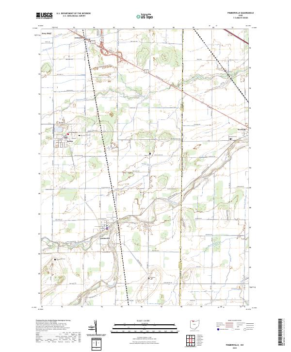 2023 Pemberville2023 Print · USGSThe Wood County countryside near Pemberville and Woodville is shown here as a mature agricultural landscape. Researchers can locate several family and municipal burial sites like Eisenhour Cem and Troy Township Cem along the Portage River.
 - 2023 Map of Helena, 2023 Print
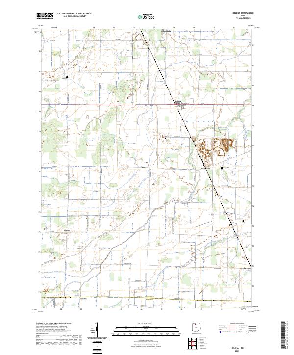 2023 Helena2023 Print · USGSThe rural agricultural lands of Sandusky County come into focus in this contemporary survey of the crossroads and creek-side villages. Local researchers can trace the roads and waterways connecting Gibsonburg and Helena to burial sites like Saint Mary Cem and Trinity Cem.
 - 2023 Map of Lindsey, 2023 Print
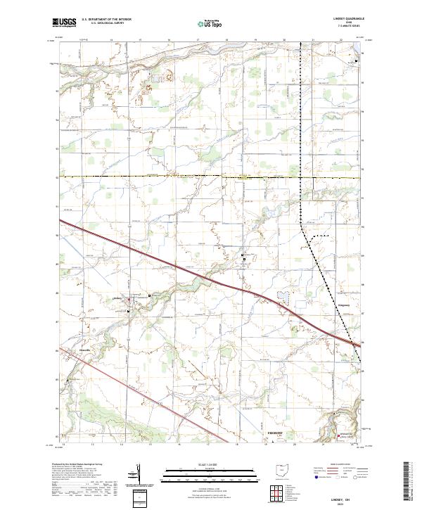 2023 Lindsey2023 Print · USGSThe village of Lindsey and its surrounding farmsteads are documented here in the early twenty-first century. Genealogists can locate several family burial sites including Roose Cem, Hessville Cem, and the Faith Lutheran Cem.
 - 2023 Map of Walbridge, 2023 Print
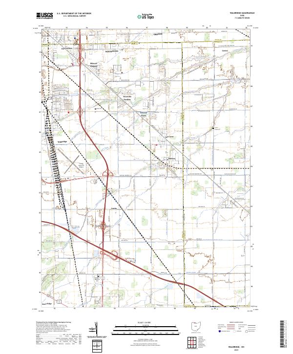 2023 Walbridge2023 Print · USGSThe Wood County suburbs and transit corridors east of Toledo are captured here in the early 2020s. Researchers can trace the layout of Walbridge and Millbury, or find family sites at Lake Cem and Restlawn Memorial Park.
 - 2023 Map of Elmore, 2023 Print
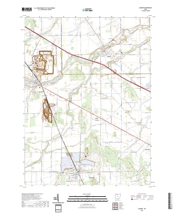 2023 Elmore2023 Print · USGSElmore and Woodville anchor this northern Ohio landscape along the Portage River near the turn of the millennium. Genealogists can trace family roots through numerous local sites like Harris-Elmore Union Cem, Woodville Cem, and the Sandusky County Courthouse District Number Two.
 - 2023 Map of Wightmans Grove, 2023 Print
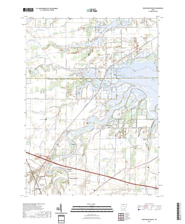 2023 Wightmans Grove2023 Print · USGSCoastal marshlands meet productive Ohio farmland in this study of the Sandusky River delta during the early twenty-first century. Researchers can locate family heritage at the Green Creek Burial Ground or trace old local clusters like Schlegels Grove and Wightmans Grove.
 - 2023 Map of Fremont East, 2023 Print
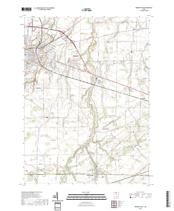 2023 Fremont East2023 Print · USGSFremont and the surrounding Sandusky County farmlands are documented here in the early twenty-first century, showing the enduring layout of these historic Ohio settlements. Researchers can locate numerous family burial sites such as Dana Cem and Bakertown Cem or trace the course of Bark Creek through the rural townships.
 - 2023 Map of Genoa, 2023 Print
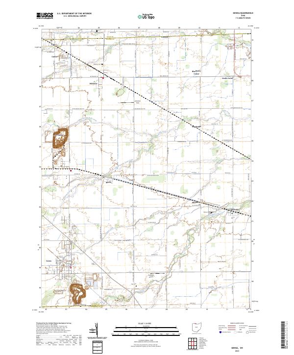 2023 Genoa2023 Print · USGSNorthern Ohio's rural landscape is revealed in this modern survey of the Ottawa County area. Genealogists and local historians can trace family locations near Genoa and Williston, or locate burial sites at Clay Cem and Oak Wood Cem.
 - 2023 Map of Bellevue, 2023 Print
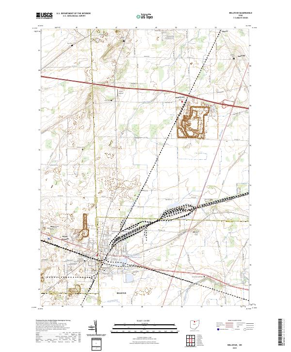 2023 Bellevue2023 Print · USGSInland from Lake Erie in the 2020s, this area of northern Ohio reveals a landscape defined by county-line crossroads and municipal reservoirs. Researchers can trace family history through a dozen rural burial grounds including Wickwire Cem and Sandhill Cem near the hamlet of Weyers.
 - 2023 Map of Clyde, 2023 Print
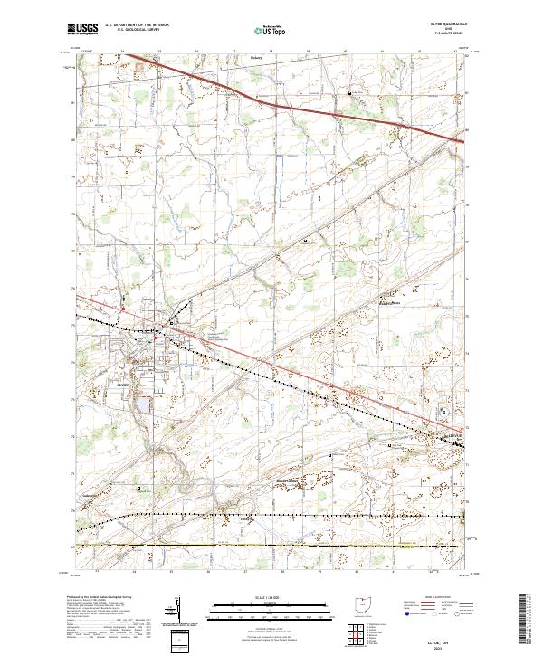 2023 Clyde2023 Print · USGSSandusky County in the early twenty-first century is captured here as a landscape of established towns and rural intersections. Genealogists and local researchers can locate numerous burial sites and family landmarks, from McPherson Cem in Clyde to the York Free Chapel Cem near Bellevue.
 - 2023 Map of Bradner, 2023 Print
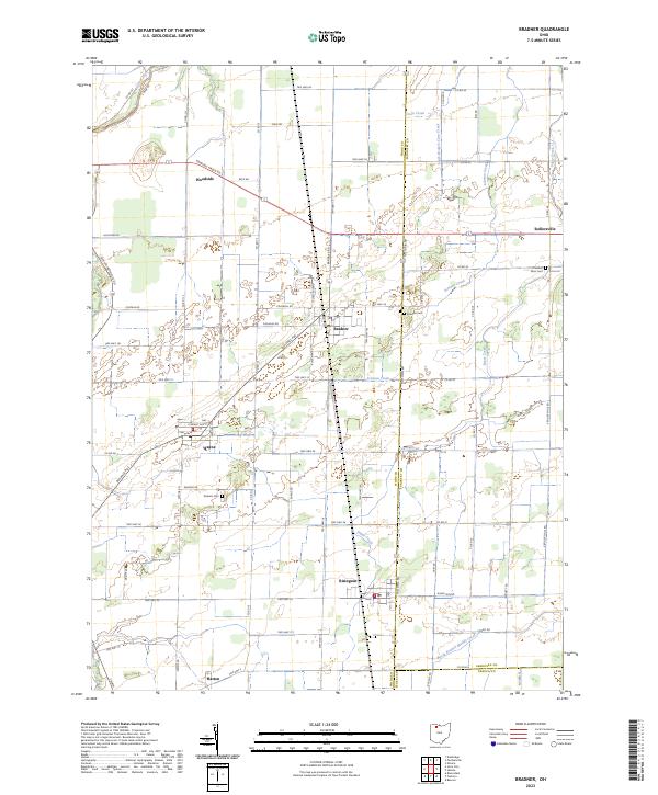 2023 Bradner2023 Print · USGSThe crossroads and creeks of Wood and Sandusky counties are captured in this modern survey of Northwest Ohio. Researchers can trace family roots at Bradner Cem or Pember Farm Cem and locate small settlements like Risingsun, Wayne, and Rollersville.
 - 2023 Map of Fremont West, 2023 Print
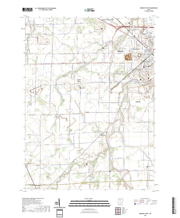 2023 Fremont West2023 Print · USGSFremont and the Sandusky River valley appear here in the early 2020s, showing a landscape of established neighborhoods and persistent rural crossroads. Genealogists can trace family plots at Oakwood Cem, Hayes Cem, or the small Hite Cem near the Seneca County line.
 - 2023 Map of Castalia, 2023 Print
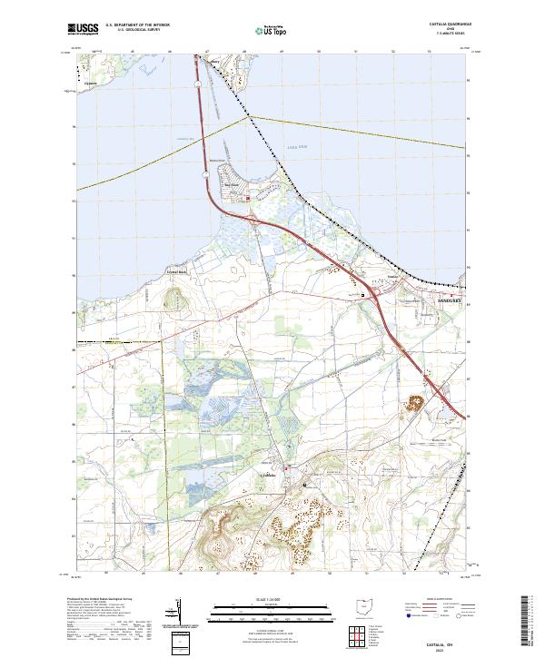 2023 Castalia2023 Print · USGSThe Erie County shoreline near Castalia and Sandusky is shown in this recent survey of the bay. Researchers can trace local lineage through Castalia Cem, explore the residential layout of Bay View, or locate the historic path of Old Railroad Rd.
 - 2023 Map of Vickery, 2023 Print
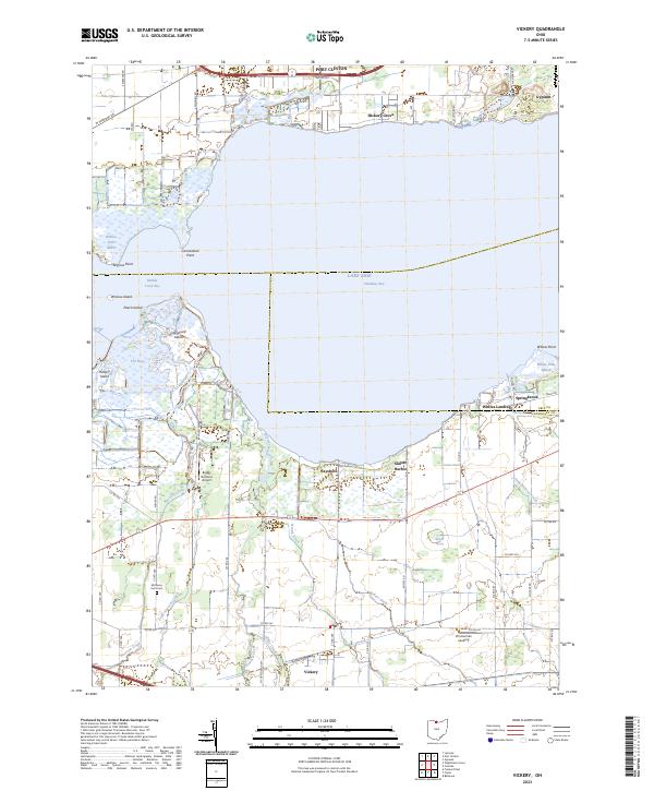 2023 Vickery2023 Print · USGSThe marshes and inlets of Sandusky Bay are captured here in the early 2020s, showing a landscape defined by the water. Researchers can locate Whites Landing, the rural community of Vickery, and the McCreery Farm Cem.
End of results
Showing maps 1-14 of 14
Top cities of Sandusky County
- Fremont historical maps
- Green Creek historical maps
- Ballville historical maps
- Clyde historical maps
- York historical maps
- Gibsonburg historical maps
See more
Frequently asked questions
- What are the different types of historical maps available for Sandusky County?
- What is the oldest map of Sandusky County?
- Where can I purchase historical maps of Sandusky County for my home or office?
- Where can I download high-res historical maps of Sandusky County?
- Are there historical topographic maps available for Sandusky County?
- Is there historical aerial imagery available for Sandusky County?
- Where are historical maps of Sandusky County sourced from?