Old Maps of Washington Township, Ohio for Genealogy
Trace your family roots with 35 historic maps of Washington Township. These high-res maps reveal old neighborhoods, homesites, landmarks, and streets — helping you uncover where your ancestors lived and how the area evolved over time.
- Explore historic neighborhoods: Identify where your relatives may have lived in the 1800s or 1900s.
- Compare maps over time: Trace the changes in streets, buildings, and landmarks for multi-generational research.
- Perfect for genealogy & ancestry research: Used by family historians and researchers to map out lineage and migration.
These maps are an incredible resource for exploring your personal connection to Washington Township's past.
Washington Township, OH maps
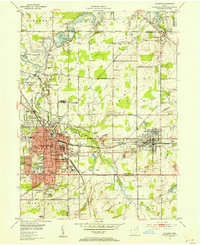
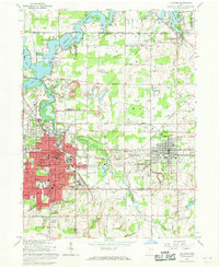
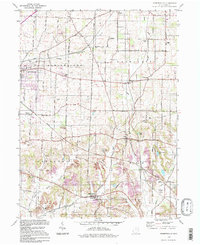
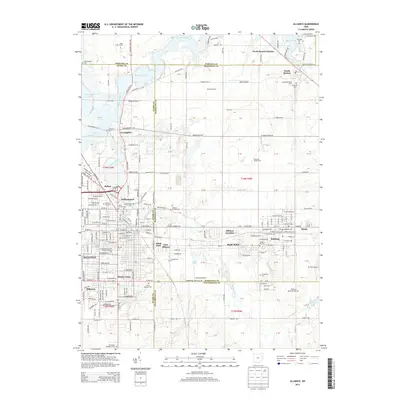
(35)- 1909 Map of Alliance
 1909 Alliance1909 Print · USGSAlliance and its surrounding industrial townships are captured in detail just after the turn of the century as the rail network reached its peak. Genealogists can trace family roots through numerous rural schools like Linden Hall School and vanished stations such as Freeburg Sta.4 unique versions available
 - 1951 Map of Canton
 1951 Canton1951 Print · USGSThe industrial heartland of Ohio and Pennsylvania reached its mid-century peak during this era of heavy rail and river transit. Genealogists and historians can trace the development of steel towns like Aliquippa and Weirton alongside the Ohio River and major lines of the Pennsylvania RR.
 - 1952 Map of Alliance, 1954 Print
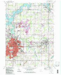
 1952 Alliance1954 Print · USGSAlliance and its surrounding industrial townships are captured in the early fifties, showcasing a dense rail and school network. Genealogists can trace family names through several burial sites like Old German Cem and Hartzell Cem, or locate historic homes near Mt Union College.3 unique versions available
 - 1953 Map of Canton
 1953 Canton1953 Print · USGSThe industrial heartland of Ohio and Pennsylvania is captured at its mid-century peak in this detailed regional survey. Genealogists and historians can trace the vast rail networks of the Pennsylvania RR and find local landmarks like Nimisila Reservoir and Tappan Reservoir.
 - 1957 Map of Canton, 1971 Print
 1957 Canton1971 Print · USGSThe industrial heartland of eastern Ohio and western Pennsylvania comes alive in this mid-century survey of the Ohio River Valley. Trace the heritage of rail and river commerce through Pittsburgh, the massive steel towns along the Ohio River, and major junctions on the Pennsylvania RR.3 unique versions available
 - 1960 Map of Limaville, 1961 Print
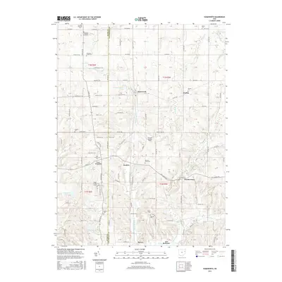
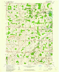 1960 Limaville1961 Print · USGSStark and Portage counties are captured here at the dawn of the sixties as small villages like Limaville and Marlboro sit amid a busy rail network. Genealogists can locate family sites like St Pauls Cem or trace the old Railroad Grade near Lexington.4 unique versions available
 - 1960 Map of Homeworth, 1961 Print
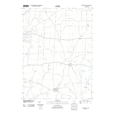
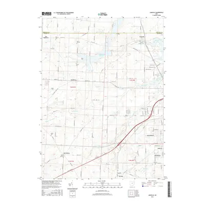
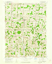 1960 Homeworth1961 Print · USGSEastern Ohio farm country and small rail towns come alive in the early sixties as the Pennsylvania railroad cuts through Homeworth. Researchers can locate family landmarks like the Fairmount Childrens Home, Walker Cemetery, and the Knox School.4 unique versions available
 - 1960 Map of Robertsville, 1961 Print
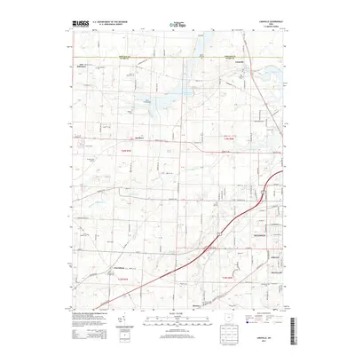
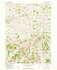 1960 Robertsville1961 Print · USGSStark County in the early 1960s was a landscape defined by its mining operations and rural rail hubs. Researchers can trace the New York Chicago and St Louis line through Robertsville or locate family sites like Beech Ch and Zwick Cem.4 unique versions available
 - 1962 Map of Canton
 1962 Canton1962 Print · USGSThe industrial heartland of Eastern Ohio and Western Pennsylvania thrives in the early sixties as steel mills and rail lines dominate the river valleys. Genealogists and historians can trace local landmarks like McKinley National Memorial, Malone College, and industrial sites such as Republic Steel Corp.2 unique versions available
 - 1966 Map of Alliance, 1968 Print
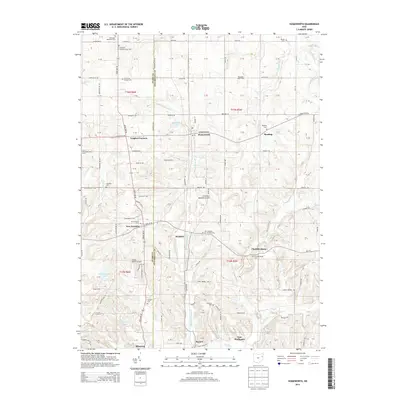
 1966 Alliance1968 Print · USGSAlliance and its surrounding townships thrive in the mid-1960s as a vital rail and academic center. Researchers can trace the development of Mt Union College, identify family names at Hartzell Cem, or locate industry at the Strip Mines.3 unique versions available
 - 1986 Map of Canton
 1986 Canton1986 Print · USGSNortheastern Ohio’s industrial corridor and rural heartland are captured here in the mid-1980s as the region's rail and highway networks reached their modern form. Researchers can trace the layout of Canton and Massillon, locate family sites near West Lawn Cemetery, or explore the grounds of Malone College and Walsh College.2 unique versions available
 - 1994 Map of Alliance, 1997 Print
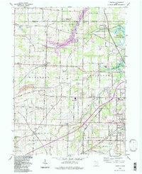
 1994 Alliance1997 Print · USGSThe Mahoning Valley industrial corridor and the campus of Mt Union College are captured here in the 1990s. Trace local history through family-named cemeteries like Hartzell Cem and old rail stops at North Benton Sta.
 - 1994 Map of Limaville, 1997 Print
 1994 Limaville1997 Print · USGSStark and Portage counties meet here in the 1990s, where rural township grids intersect with large-scale water management projects. Genealogists can locate family sites like Marlboro Cem and Quaker Hill Cem, while historians can trace the Conrail line through Lexington and Maximo.
 - 1994 Map of Homeworth, 1998 Print
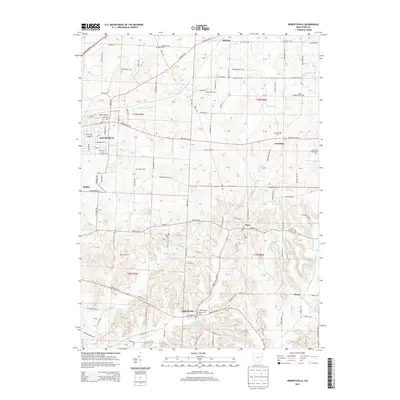
 1994 Homeworth1998 Print · USGSNortheast Ohio farmland and small crossroads settlements are captured here in the 1990s. Genealogists can trace family footprints near New Franklin, Reading, and the Fairmount Childrens Home.
 - 1994 Map of Robertsville, 1998 Print
 1994 Robertsville1998 Print · USGSStark County's southern townships show a blend of intensive coal mining and rural village life during the mid-nineties. Genealogists and historians can trace family locations near Snyder Cem, Beech Ch, and the numerous strip mines that shaped the local economy.
 - 2010 Map of Limaville, 2010 Print
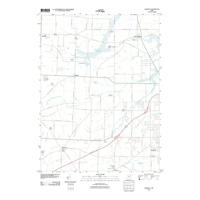 2010 Limaville2010 Print · USGSCovers Washington Township, including Alliance, Marlboro, and other nearby areas
 - 2010 Map of Homeworth, 2010 Print
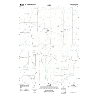 2010 Homeworth2010 Print · USGSCovers Washington Township, including Minerva, Homeworth, and other nearby areas
 - 2010 Map of Alliance, 2010 Print
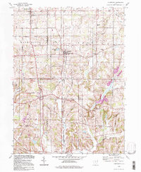
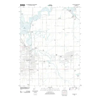 2010 Alliance2010 Print · USGSCovers Washington Township, including Alliance, Lexington, and other nearby areas
 - 2010 Map of Robertsville, 2010 Print
 2010 Robertsville2010 Print · USGSCovers Washington Township, including Louisville, Paris, and other nearby areas
 - 2013 Map of Limaville, 2013 Print
 2013 Limaville2013 Print · USGSCovers Washington Township, including Alliance, Marlboro, and other nearby areas
 - 2013 Map of Robertsville, 2013 Print
 2013 Robertsville2013 Print · USGSCovers Washington Township, including Louisville, Paris, and other nearby areas
 - 2013 Map of Homeworth, 2013 Print
 2013 Homeworth2013 Print · USGSCovers Washington Township, including Minerva, Homeworth, and other nearby areas
 - 2013 Map of Alliance, 2013 Print
 2013 Alliance2013 Print · USGSCovers Washington Township, including Alliance, Lexington, and other nearby areas
 - 2016 Map of Limaville, 2016 Print
 2016 Limaville2016 Print · USGSCovers Washington Township, including Alliance, Marlboro, and other nearby areas
 - 2016 Map of Homeworth, 2016 Print
 2016 Homeworth2016 Print · USGSCovers Washington Township, including Minerva, Homeworth, and other nearby areas
Showing maps 1-25 of 35
Top cities near Washington Township
- Canton historical maps
- Plain historical maps
- Alliance historical maps
- North Canton historical maps
- Louisville historical maps
- Suffield historical maps
See more
Top neighborhoods of Washington Township
- Maximo historical maps
- Freeburg historical maps
- Beechwood historical maps
- Yeagleys Corners historical maps
Frequently asked questions
- What are the different types of historical maps available for Washington Township?
- What is the oldest map of Washington Township?
- Where can I purchase historical maps of Washington Township for my home or office?
- Where can I download high-res historical maps of Washington Township?
- Are there historical topographic maps available for Washington Township?
- Is there historical aerial imagery available for Washington Township?
- Where are historical maps of Washington Township sourced from?