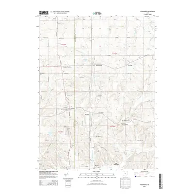
2013 Map of Homeworth
USGS Topo · Published 2013About this map
Middle Br Sandy Cr and the Mahoning River shape the terrain of this agricultural and residential corridor along the border of Stark and Columbiana counties. The landscape is dotted with long-established rural settlements such as Homeworth, New Franklin, Reading, and Chambersburg, which retain their historical footprints through numerous local cemeteries including Fairmount Memorial Cem and Moultrie Chapel Cem. Transportation and land use are defined by a grid of rural roads like Georgetown Rd and the presence of small airfields such as Crosswind Meadows Airport and Sleepy Hollow Airport. The survey also documents family-owned agricultural enterprises like Buckeye Lawn Farm and Lily of the Valley Herb Farm, alongside several small lakes such as Woodland Lake and Brocklehurst Lake, illustrating the post-war development of this region of Northeast Ohio.
Find a feature on this map
87 named features on this map. Tap any name to fly to it.
Don’t see what you’re looking for? This feature index may not catch every label — zoom into the map to look around manually.
Map Details
Editions of this 2013 Homeworth Map
This is the sole edition of this map. No revisions or reprints were ever made.
Other maps of this area

1905 · Salineville
USGS Topo · 1:62,500

1909 · Alliance
USGS Topo · 1:62,500

1909 · Lisbon
USGS Topo · 1:62,500

1910 · Carrollton
USGS Topo · 1:62,500

1912 · Carrollton
USGS Topo · 1:62,500

1951 · Canton
USGS Topo · 1:250,000

1952 · Alliance
USGS Topo · 1:24,000

1952 · Damascus
USGS Topo · 1:24,000

1953 · Canton
USGS Topo · 1:250,000

1957 · Canton
USGS Topo · 1:250,000