1950s Maps of Summit County, Ohio
Explore 17 historic maps of Summit County from the 1950s. These maps offer a rare glimpse into what life looked like during the 1950s — showing old roads, neighborhoods, homes, and landmarks that have changed or disappeared over time.
Whether you're researching your family's past, planning a metal detecting trip, or studying how Summit County's landscape evolved across the 1950s, these high-resolution maps are a powerful tool for exploring the history of this region.
- Focus on a specific era: All maps on this page are from the 1950s, giving you a focused view of this time period.
- See what’s changed: Compare century-old streets, trails, and buildings to today's modern landscape using overlays and satellite layers.
- Research with precision: Use these maps for genealogy, historical research, land use analysis, or educational projects.
- View, download, or print: Maps are fully viewable online in high resolution, and can be downloaded or printed for your own records.
Start exploring Summit County's history through authentic maps from the 1950s. This is your window into the past.
Summit County, OH maps
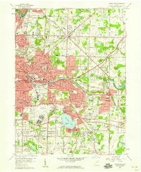
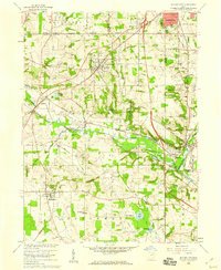
(17)- 1950 Map of Cleveland
 1950 Cleveland1950 Print · USGSCovers Summit County, including Cleveland, Akron, and other nearby areas
 - 1951 Map of Canton
 1951 Canton1951 Print · USGSThe industrial heartland of Ohio and Pennsylvania reached its mid-century peak during this era of heavy rail and river transit. Genealogists and historians can trace the development of steel towns like Aliquippa and Weirton alongside the Ohio River and major lines of the Pennsylvania RR.
 - 1953 Map of Canton
 1953 Canton1953 Print · USGSThe industrial heartland of Ohio and Pennsylvania is captured at its mid-century peak in this detailed regional survey. Genealogists and historians can trace the vast rail networks of the Pennsylvania RR and find local landmarks like Nimisila Reservoir and Tappan Reservoir.
 - 1953 Map of Broadview Heights, 1955 Print
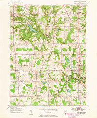
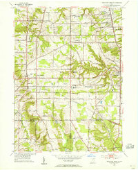 1953 Broadview Heights1955 Print · USGSBroadview Heights and the southern Cleveland suburbs appear in the early fifties during a period of major infrastructure expansion. Genealogists and local historians can locate early broadcast sites like Television Station (WXEL), local schools including Marycrest Sch, and the emerging path of the Ohio Turnpike.2 unique versions available
 - 1953 Map of Twinsburg, 1955 Print
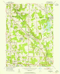 1953 Twinsburg1955 Print · USGSNortheastern Ohio is shown here during a period of rapid post-war expansion, with the Ohio Turnpike still under construction. Genealogists and local historians can locate Crown Hill Cemetery, the Cleveland Boys Sch, and rail-side hamlets like Falls Junction and Glenwillow.
 - 1953 Map of Northfield, 1955 Print
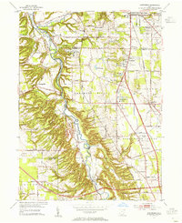 1953 Northfield1955 Print · USGSThe Cuyahoga Valley in the early 1950s reveals a landscape poised between its industrial rail past and the coming highway era. Genealogists and researchers can trace the early path of the Ohio Turnpike, the mill site at Jaite, and mid-century landmarks like the Drive-in Theater.2 unique versions available
 - 1953 Map of Hudson, 1955 Print
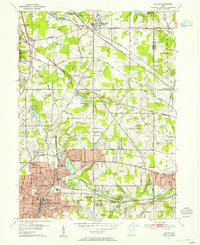 1953 Hudson1955 Print · USGSNortheast Ohio's suburban and industrial growth is captured here in the early fifties as the rail lines still dominated the landscape. Genealogists and local historians can trace family plots at Markillie Cem or locate the old Mid City Airport and Lincoln Sch.
 - 1953 Map of West Richfield, 1955 Print
 1953 West Richfield1955 Print · USGSMedina and Summit counties show a landscape of transition in the early fifties as historic rural townships began to grow. Genealogists and local historians can trace family locations near Morris Chapel, Hinckley Lake, and old burial grounds like Beach Cem.
 - 1953 Map of Peninsula, 1955 Print
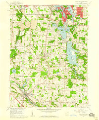
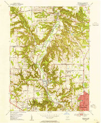 1953 Peninsula1955 Print · USGSSummit County in the early fifties showcases a river valley caught between its industrial heritage and burgeoning parklands. You can trace the historic Ohio and Erie Canal past settlements like Everett and Botzum, or locate local landmarks like East Bath Cem and Camp Manatoc.
 - 1956 Map of Cleveland, 1967 Print
 1956 Cleveland1967 Print · USGSNortheast Ohio and Western Pennsylvania are shown at their industrial height during the mid-fifties, from the steel mills to the lakeshore. Researchers can trace the massive Ravenna Arsenal, the Ohio Turnpike, and vanished rail sidings of the B & O RR.3 unique versions available
 - 1957 Map of Canton, 1971 Print
 1957 Canton1971 Print · USGSThe industrial heartland of eastern Ohio and western Pennsylvania comes alive in this mid-century survey of the Ohio River Valley. Trace the heritage of rail and river commerce through Pittsburgh, the massive steel towns along the Ohio River, and major junctions on the Pennsylvania RR.3 unique versions available
 - 1958 Map of Akron East, 1959 Print
 1958 Akron East1959 Print · USGSMid-century Akron and Tallmadge show a landscape of industrial might and suburban growth just before the interstate era. Trace family roots at Ellet Memorial Cem or explore aviation landmarks like the Goodyear Airdock and Derby Downs.
 - 1958 Map of Wadsworth, 1959 Print
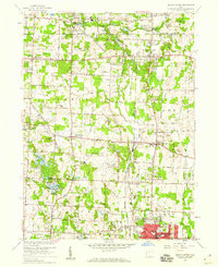
 1958 Wadsworth1959 Print · USGSMedina and Summit Counties are captured here in the late fifties as residential growth begins to bridge the gaps between industrial hubs. Genealogists and local historians can trace family roots through Woodlawn Cemetery, Sharon Center, and neighborhood landmarks like Mt Zwingle Ch and Lincoln Sch.
 - 1958 Map of Akron West, 1959 Print
 1958 Akron West1959 Print · USGSAkron and Barberton are shown at a peak of industrial and suburban growth in the late fifties. Researchers can trace historic family landmarks and transit routes like Summit Lake, Lake Anna, and the winding Ohio and Erie Canal.
 - 1958 Map of Doylestown, 1959 Print
 1958 Doylestown1959 Print · USGSDoylestown and the Tuscarawas River valley are shown in the late fifties at the intersection of four major rail lines. Researchers can trace rural lineages through numerous country landmarks like St Michaels Ch, Maple Grove Cem, and Harvey Sch.
 - 1958 Map of Canal Fulton, 1959 Print
 1958 Canal Fulton1959 Print · USGSNortheastern Ohio’s transition from a canal-era landscape to a post-war recreational and suburban hub is on display during the late fifties. Genealogists and local historians can trace family locations near Manchester, identify old rural schools like Township Sch, or locate the path of the Ohio Canal.4 unique versions available
 - 1958 Map of North Canton, 1959 Print
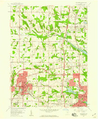
 1958 North Canton1959 Print · USGSNortheast Ohio saw significant expansion in the late fifties as suburban life developed around major transportation hubs. Genealogists and local historians can trace the footprint of Greentown and Uniontown, or locate smaller sites like Tritts Millpond and Klinefelter Cem.
End of results
Showing maps 1-17 of 17
Top cities of Summit County
- Akron historical maps
- Cuyahoga Falls historical maps
- Stow historical maps
- Green historical maps
- Barberton historical maps
- Hudson historical maps
See more
Frequently asked questions
- What are the different types of historical maps available for Summit County?
- What is the oldest map of Summit County?
- Where can I purchase historical maps of Summit County for my home or office?
- Where can I download high-res historical maps of Summit County?
- Are there historical topographic maps available for Summit County?
- Is there historical aerial imagery available for Summit County?
- Where are historical maps of Summit County sourced from?