Old Maps of Summit County, Ohio for Hiking & Exploration
Hike through history with 115 historic maps of Summit County. Explore old trails, ghost towns, and forgotten backroads — perfect for outdoor adventurers and local explorers.
- Rediscover forgotten places: Map out old mining camps, roads, and footpaths that no longer exist on modern maps.
- Layer with modern tools: Combine with LiDAR or satellite views to plan hikes through historical terrain.
- Made for exploration: Popular among hikers, overlanders, and local history lovers.
Use these maps to find adventure and explore the hidden past of Summit County.
Summit County, OH maps
(115)- 1901 Map of Massillon, 1955 Print
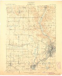
 1901 Massillon1955 Print · USGSMassillon and the Tuscarawas valley thrive at the turn of the century as centers of canal transit and heavy rail industry. Local historians can trace the paths of the Ohio and Erie Canal, the massive Insane Asylum, and coal operations like the Turkeyfoot Mine.2 unique versions available
 - 1901 Map of Canton, 1958 Print
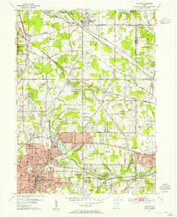
 1901 Canton1958 Print · USGSStark County at the turn of the century is a landscape of growing industrial towns and busy rail corridors. Genealogists can trace family roots in New Berlin and Louisville or locate landmarks like Westlawn Cem and the Infirmary.
 - 1903 Map of Massillon, 1934 Print
 1903 Massillon1934 Print · USGSNortheastern Ohio at the start of the century is a landscape of industrial growth and intricate canal-side settlements. Genealogists and historians can trace the early rail-and-water economy through features like the Ohio Canal, Turkeyfoot Mine, and the Insane Asylum.2 unique versions available
 - 1903 Map of Cleveland, 1939 Print
 1903 Cleveland1939 Print · USGSThe Cleveland lakefront and Cuyahoga valley are captured here at the start of the twentieth century as rail lines and industry expanded southward. Genealogists and local historians can locate early landmarks like Riverside Cemetery, Walling Corners, and Brandywine.2 unique versions available
 - 1903 Map of Canton, 1939 Print
 1903 Canton1939 Print · USGSCanton was a flourishing rail and manufacturing center at the dawn of the century, serving as the nexus for multiple major lines. Genealogists can trace early homesteads and community centers near New Berlin, Osnaburg, and the Westlawn Cem.2 unique versions available
 - 1903 Map of Akron, 1961 Print
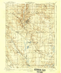
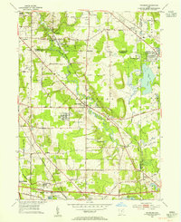
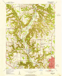
 1903 Akron1961 Print · USGSAkron and the surrounding Summit County townships were at a peak of rail and canal activity in the early 1900s. Trace the Ohio and Erie Canal locks, family-named crossroads like Osborn Corners, and local landmarks from Glendale Cemetery to the Boston Ledges.
 - 1905 Map of Akron
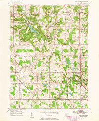
 1905 Akron1905 Print · USGSIn the first years of the twentieth century, the industrial corridor between Akron and Barberton was a hive of canal and rail activity. Trace the path of the Ohio Canal through Peninsula and locate early settlements like Ghent and Coddingville.7 unique versions available
 - 1906 Map of Kent, 1941 Print
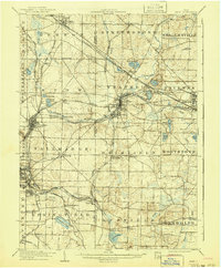 1906 Kent1941 Print · USGSPortage and Summit Counties are captured here at the height of the steam and electric rail era. Researchers can trace ancestral roots through early settlements like Tallmadge and Mogadore, or locate landmarks like the County Infirmary.2 unique versions available
 - 1906 Map of Chagrin Falls, 1955 Print
 1906 Chagrin Falls1955 Print · USGSThe Western Reserve landscape of Northeast Ohio is captured here during a period of rapid transit growth and settlement. Researchers can trace early township hubs and rail stops like Falls Junction Glenwillow PO, Orange Hill Church, and the winding Cleveland and Garrettsville Electric RR.
 - 1908 Map of Chagrin Falls, 1939 Print
 1908 Chagrin Falls1939 Print · USGSThe Chagrin Valley at the turn of the century was a crossroads of electric interurban lines and early rural post offices. Trace the old rail stops at Aurora Station and Cannons Crossing, or locate family landmarks like Orange Hill Church.2 unique versions available
 - 1950 Map of Cleveland
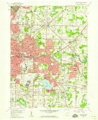
 1950 Cleveland1950 Print · USGSCovers Summit County, including Cleveland, Akron, and other nearby areas
 - 1951 Map of Canton
 1951 Canton1951 Print · USGSThe industrial heartland of Ohio and Pennsylvania reached its mid-century peak during this era of heavy rail and river transit. Genealogists and historians can trace the development of steel towns like Aliquippa and Weirton alongside the Ohio River and major lines of the Pennsylvania RR.
 - 1953 Map of Canton
 1953 Canton1953 Print · USGSThe industrial heartland of Ohio and Pennsylvania is captured at its mid-century peak in this detailed regional survey. Genealogists and historians can trace the vast rail networks of the Pennsylvania RR and find local landmarks like Nimisila Reservoir and Tappan Reservoir.
 - 1953 Map of Broadview Heights, 1955 Print
 1953 Broadview Heights1955 Print · USGSBroadview Heights and the southern Cleveland suburbs appear in the early fifties during a period of major infrastructure expansion. Genealogists and local historians can locate early broadcast sites like Television Station (WXEL), local schools including Marycrest Sch, and the emerging path of the Ohio Turnpike.2 unique versions available
 - 1953 Map of Twinsburg, 1955 Print
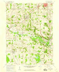
 1953 Twinsburg1955 Print · USGSNortheastern Ohio is shown here during a period of rapid post-war expansion, with the Ohio Turnpike still under construction. Genealogists and local historians can locate Crown Hill Cemetery, the Cleveland Boys Sch, and rail-side hamlets like Falls Junction and Glenwillow.
 - 1953 Map of Northfield, 1955 Print
 1953 Northfield1955 Print · USGSThe Cuyahoga Valley in the early 1950s reveals a landscape poised between its industrial rail past and the coming highway era. Genealogists and researchers can trace the early path of the Ohio Turnpike, the mill site at Jaite, and mid-century landmarks like the Drive-in Theater.2 unique versions available
 - 1953 Map of Hudson, 1955 Print
 1953 Hudson1955 Print · USGSNortheast Ohio's suburban and industrial growth is captured here in the early fifties as the rail lines still dominated the landscape. Genealogists and local historians can trace family plots at Markillie Cem or locate the old Mid City Airport and Lincoln Sch.
 - 1953 Map of West Richfield, 1955 Print
 1953 West Richfield1955 Print · USGSMedina and Summit counties show a landscape of transition in the early fifties as historic rural townships began to grow. Genealogists and local historians can trace family locations near Morris Chapel, Hinckley Lake, and old burial grounds like Beach Cem.
 - 1953 Map of Peninsula, 1955 Print
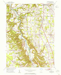
 1953 Peninsula1955 Print · USGSSummit County in the early fifties showcases a river valley caught between its industrial heritage and burgeoning parklands. You can trace the historic Ohio and Erie Canal past settlements like Everett and Botzum, or locate local landmarks like East Bath Cem and Camp Manatoc.
 - 1956 Map of Cleveland, 1967 Print
 1956 Cleveland1967 Print · USGSNortheast Ohio and Western Pennsylvania are shown at their industrial height during the mid-fifties, from the steel mills to the lakeshore. Researchers can trace the massive Ravenna Arsenal, the Ohio Turnpike, and vanished rail sidings of the B & O RR.3 unique versions available
 - 1957 Map of Canton, 1971 Print
 1957 Canton1971 Print · USGSThe industrial heartland of eastern Ohio and western Pennsylvania comes alive in this mid-century survey of the Ohio River Valley. Trace the heritage of rail and river commerce through Pittsburgh, the massive steel towns along the Ohio River, and major junctions on the Pennsylvania RR.3 unique versions available
 - 1958 Map of Akron East, 1959 Print
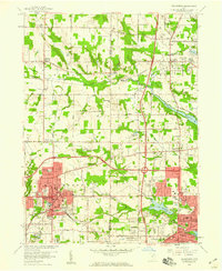
 1958 Akron East1959 Print · USGSMid-century Akron and Tallmadge show a landscape of industrial might and suburban growth just before the interstate era. Trace family roots at Ellet Memorial Cem or explore aviation landmarks like the Goodyear Airdock and Derby Downs.
 - 1958 Map of Wadsworth, 1959 Print
 1958 Wadsworth1959 Print · USGSMedina and Summit Counties are captured here in the late fifties as residential growth begins to bridge the gaps between industrial hubs. Genealogists and local historians can trace family roots through Woodlawn Cemetery, Sharon Center, and neighborhood landmarks like Mt Zwingle Ch and Lincoln Sch.
 - 1958 Map of Akron West, 1959 Print
 1958 Akron West1959 Print · USGSAkron and Barberton are shown at a peak of industrial and suburban growth in the late fifties. Researchers can trace historic family landmarks and transit routes like Summit Lake, Lake Anna, and the winding Ohio and Erie Canal.
 - 1958 Map of Doylestown, 1959 Print
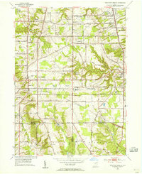
 1958 Doylestown1959 Print · USGSDoylestown and the Tuscarawas River valley are shown in the late fifties at the intersection of four major rail lines. Researchers can trace rural lineages through numerous country landmarks like St Michaels Ch, Maple Grove Cem, and Harvey Sch.
Showing maps 1-25 of 115
Top cities of Summit County
- Akron historical maps
- Cuyahoga Falls historical maps
- Stow historical maps
- Green historical maps
- Barberton historical maps
- Hudson historical maps
See more
Frequently asked questions
- What are the different types of historical maps available for Summit County?
- What is the oldest map of Summit County?
- Where can I purchase historical maps of Summit County for my home or office?
- Where can I download high-res historical maps of Summit County?
- Are there historical topographic maps available for Summit County?
- Is there historical aerial imagery available for Summit County?
- Where are historical maps of Summit County sourced from?