2020s Maps of Summit County, Ohio
Explore 12 historic maps of Summit County from the 2020s. These maps offer a rare glimpse into what life looked like during the 2020s — showing old roads, neighborhoods, homes, and landmarks that have changed or disappeared over time.
Whether you're researching your family's past, planning a metal detecting trip, or studying how Summit County's landscape evolved across the 2020s, these high-resolution maps are a powerful tool for exploring the history of this region.
- Focus on a specific era: All maps on this page are from the 2020s, giving you a focused view of this time period.
- See what’s changed: Compare century-old streets, trails, and buildings to today's modern landscape using overlays and satellite layers.
- Research with precision: Use these maps for genealogy, historical research, land use analysis, or educational projects.
- View, download, or print: Maps are fully viewable online in high resolution, and can be downloaded or printed for your own records.
Start exploring Summit County's history through authentic maps from the 2020s. This is your window into the past.
Summit County, OH maps
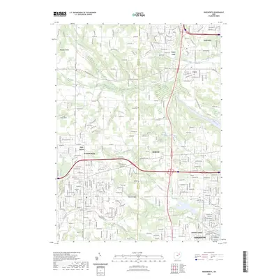
(12)- 2023 Map of Hudson, 2023 Print
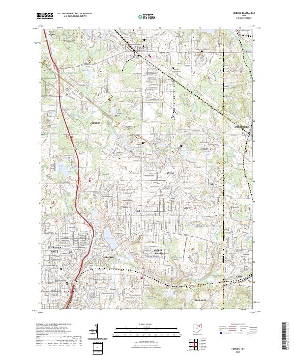 2023 Hudson2023 Print · USGSNortheastern Ohio's residential heartland is showcased here during a period of modern growth near the Cuyahoga Valley National Park. Genealogists and local historians can locate several burial sites including the Old Hudson Township Burying Ground Cem and Maple Lawn Cem.
 - 2023 Map of Canal Fulton, 2023 Print
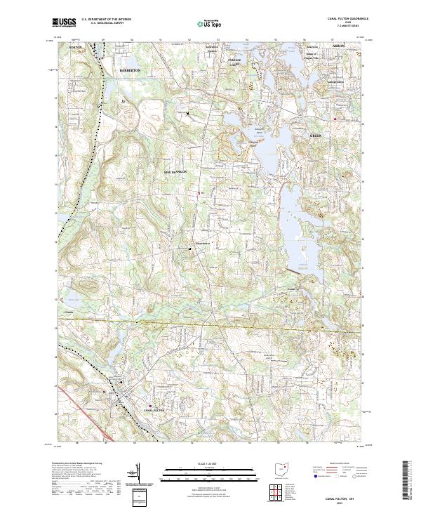 2023 Canal Fulton2023 Print · USGSCanal Fulton and the Tuscarawas River valley are captured in this modern survey of the Summit and Stark county line. Researchers can trace historic cemeteries and waterways like Saints Philip and James Church Cem, Nimisila Reservoir, and the Canal Feeder.
 - 2023 Map of Doylestown, 2023 Print
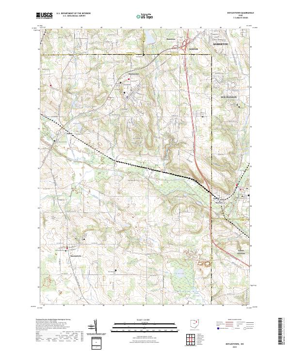 2023 Doylestown2023 Print · USGSDoylestown and Marshallville appear in this contemporary study of the Wayne and Summit county borderlands. Genealogists and historians can trace numerous burial sites like Saint Peters and Pauls Cem and landmarks such as Rogues Hollow and Fox Lake.
 - 2023 Map of North Canton, 2023 Print
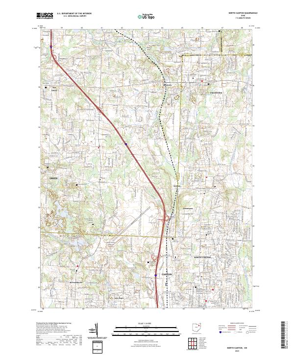 2023 North Canton2023 Print · USGSNortheast Ohio's suburban corridor and rural remnants meet at the Stark-Summit line in the early twenty-first century. Genealogists can locate family sites at the Jonathan Grable Burying Ground, Greentown Cem, or Woods Cem.
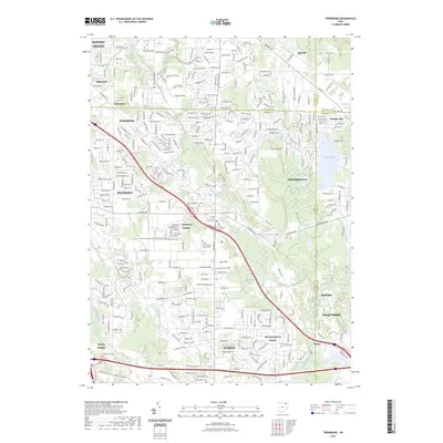
 - 2023 Map of Wadsworth, 2023 Print
 2023 Wadsworth2023 Print · USGSThe borderlands of Medina and Summit counties come alive in this survey, showing the growth of Wadsworth and Norton. Genealogists can trace family sites at Western Star Cem or explore the drainage of Pigeon Creek.
 - 2023 Map of Northfield, 2023 Print
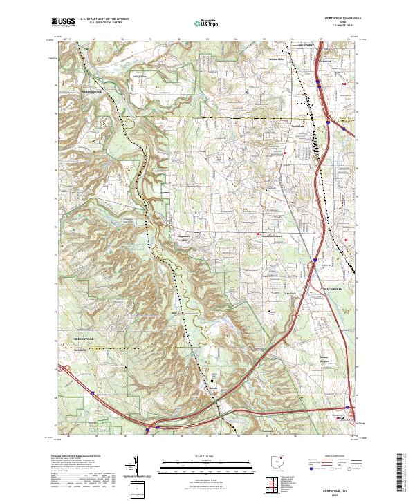 2023 Northfield2023 Print · USGSThe Cuyahoga Valley in the early 2020s shows a landscape of deep ravines and suburban growth preserved alongside a major national park. Researchers can trace historic local burials at All Saints Cem or locate the old company town of Jaite and the falls at Brandywine Falls.
 - 2023 Map of Twinsburg, 2023 Print
 2023 Twinsburg2023 Print · USGSThe suburbs southeast of Cleveland come into sharp focus in this recent survey of the Cuyahoga and Summit County line. Local researchers can trace residential growth and land use around Geauga Lake and find landmarks like Crown Hill Cem and Mausoleum.
 - 2023 Map of West Richfield, 2023 Print
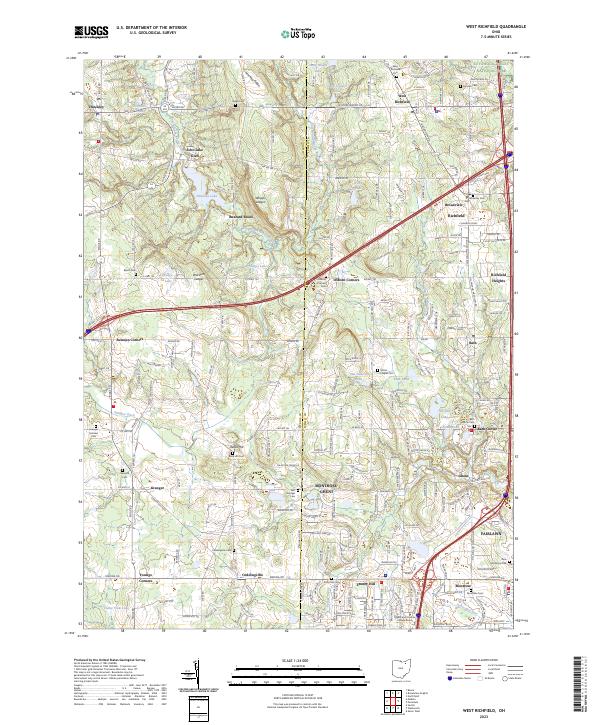 2023 West Richfield2023 Print · USGSMedina and Summit counties are captured in this modern survey as residential development meets the protected reaches of Cuyahoga Valley National Park. Genealogists can locate many local burial sites like Ridge Cem and Reed Hill Cem alongside landmarks like Whipps Ledges.
 - 2023 Map of Peninsula, 2023 Print
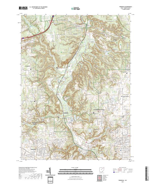 2023 Peninsula2023 Print · USGSThe Cuyahoga Valley at the start of the 2020s remains a mix of protected parkland and expanding suburbs. Trace local family history through numerous burial sites like Cedar Grove Cem or Chamberlain Cem, and explore the terrain around Boston Ledges.
 - 2023 Map of Akron West, 2023 Print
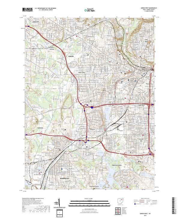 2023 Akron West2023 Print · USGSThe industrial landscape of Akron and its suburbs comes alive in this survey, showing the city's growth from Cuyahoga Valley National Park down to the Portage Lakes. Researchers can locate historic burial grounds like Black Plague Cemetery and family landmarks near Lake Anna.
 - 2023 Map of Broadview Heights, 2023 Print
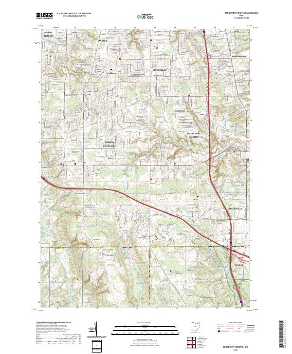 2023 Broadview Heights2023 Print · USGSCuyahoga County’s southern suburbs and the wooded fringes of the national park are shown here in recent years. Researchers can trace local lineage through North Royalton Cem and Center Cem or locate institutional landmarks like Stautzenberger College Brecksville Campus.
 - 2023 Map of Akron East, 2023 Print
 2023 Akron East2023 Print · USGSThe Summit County suburbs east of Akron are captured here in a moment of modern growth and historical preservation. Trace family roots at Old Tallmadge Cem, explore the areas around Springfield Lake, or locate the Akron Fulton International Airport.
End of results
Showing maps 1-12 of 12
Top cities of Summit County
- Akron historical maps
- Cuyahoga Falls historical maps
- Stow historical maps
- Green historical maps
- Barberton historical maps
- Hudson historical maps
See more
Frequently asked questions
- What are the different types of historical maps available for Summit County?
- What is the oldest map of Summit County?
- Where can I purchase historical maps of Summit County for my home or office?
- Where can I download high-res historical maps of Summit County?
- Are there historical topographic maps available for Summit County?
- Is there historical aerial imagery available for Summit County?
- Where are historical maps of Summit County sourced from?