2020s Maps of Orrville, Ohio
Explore 2 historic maps of Orrville from the 2020s. These maps offer a rare glimpse into what life looked like during the 2020s — showing old roads, neighborhoods, homes, and landmarks that have changed or disappeared over time.
Whether you're researching your family's past, planning a metal detecting trip, or studying how Orrville's landscape evolved across the 2020s, these high-resolution maps are a powerful tool for exploring the history of this region.
- Focus on a specific era: All maps on this page are from the 2020s, giving you a focused view of this time period.
- See what’s changed: Compare century-old streets, trails, and buildings to today's modern landscape using overlays and satellite layers.
- Research with precision: Use these maps for genealogy, historical research, land use analysis, or educational projects.
- View, download, or print: Maps are fully viewable online in high resolution, and can be downloaded or printed for your own records.
Start exploring Orrville's history through authentic maps from the 2020s. This is your window into the past.
Orrville, OH maps
(2)- 2023 Map of Orrville, 2023 Print
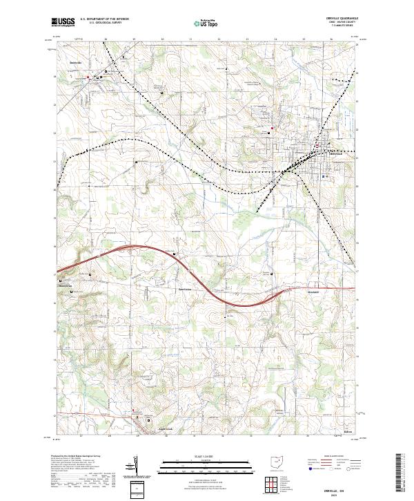 2023 Orrville2023 Print · USGSWayne County at the start of the 2020s shows a dense network of historic settlements and rural cemeteries. Genealogists can trace family names at the Old Presbyterian Cem, Oak Grove Mennonite Cem, or the Stoltzfus Airfield area.
 - 2023 Map of Dalton, 2023 Print
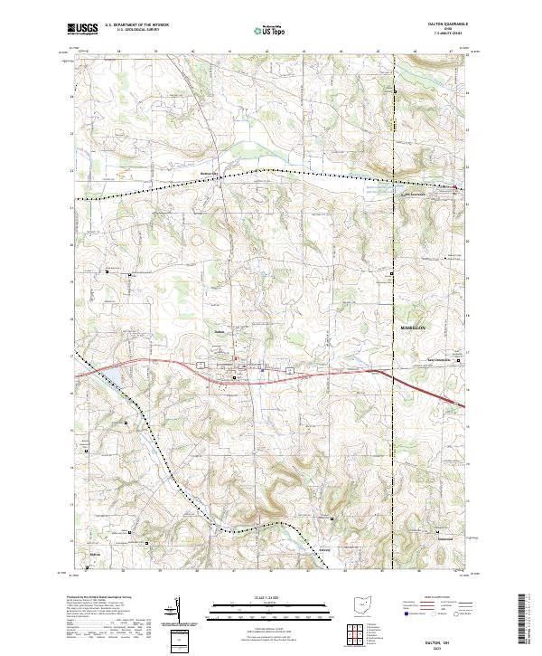 2023 Dalton2023 Print · USGSSettled farmlands and numerous Mennonite churchyards define the Wayne County landscape in the early twenty-first century. Genealogists can trace family lines at Bethel Mennonite Cem, Clover Hill Cem, and Union Cem near Dalton.
End of results
Showing maps 1-2 of 2
Top cities near Orrville
- Akron historical maps
- Massillon historical maps
- Wooster historical maps
- Barberton historical maps
- Wadsworth historical maps
- New Franklin historical maps
See more
Frequently asked questions
- What are the different types of historical maps available for Orrville?
- What is the oldest map of Orrville?
- Where can I purchase historical maps of Orrville for my home or office?
- Where can I download high-res historical maps of Orrville?
- Are there historical topographic maps available for Orrville?
- Is there historical aerial imagery available for Orrville?
- Where are historical maps of Orrville sourced from?