2020s Maps of Williams County, Ohio
Explore 14 historic maps of Williams County from the 2020s. These maps offer a rare glimpse into what life looked like during the 2020s — showing old roads, neighborhoods, homes, and landmarks that have changed or disappeared over time.
Whether you're researching your family's past, planning a metal detecting trip, or studying how Williams County's landscape evolved across the 2020s, these high-resolution maps are a powerful tool for exploring the history of this region.
- Focus on a specific era: All maps on this page are from the 2020s, giving you a focused view of this time period.
- See what’s changed: Compare century-old streets, trails, and buildings to today's modern landscape using overlays and satellite layers.
- Research with precision: Use these maps for genealogy, historical research, land use analysis, or educational projects.
- View, download, or print: Maps are fully viewable online in high resolution, and can be downloaded or printed for your own records.
Start exploring Williams County's history through authentic maps from the 2020s. This is your window into the past.
Williams County, OH maps
(14)- 2022 Map of Clear Lake, 2022 Print
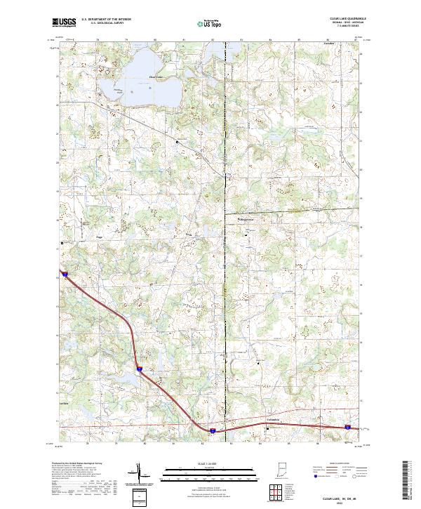 2022 Clear Lake2022 Print · USGSThe intersection of Indiana, Michigan, and Ohio is captured here in the early twenty-first century, highlighting a unique tri-state landscape. Researchers can trace family roots through Billingstown Cem and Teeters Cem or explore the shoreline developments of Clear Lake and Lake Anne.
 - 2022 Map of Butler East, 2022 Print
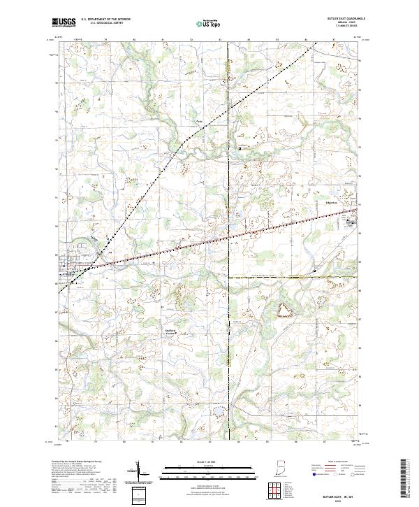 2022 Butler East2022 Print · USGSThe Indiana-Ohio borderlands come into focus in this contemporary survey of DeKalb and Williams Counties. Genealogists and local historians can trace the rural landscape between Edgerton and Butler, locating family sites near Saint Marys Cem and Ladd Lake.
 - 2023 Map of Blakeslee, 2023 Print
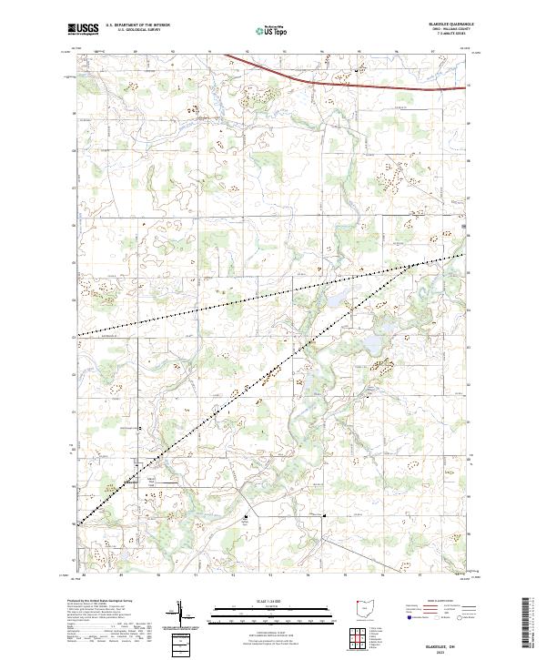 2023 Blakeslee2023 Print · USGSThe village of Blakeslee and the surrounding Williams County farmland are captured here in the early twenty-first century. Genealogists and local historians can trace family ties at West Buffalo Cem, Hepker Cem, and Union Chapel Cem along the Saint Joseph River.
 - 2023 Map of Montpelier, 2023 Print
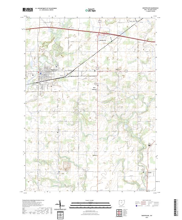 2023 Montpelier2023 Print · USGSNorthwest Ohio at the start of the 2020s remains a landscape of organized townships and quiet river bends. Researchers can trace ancestral sites at Riverside Cem and Shiffler Cem or locate old community centers like West Jefferson and Pulaski.
 - 2023 Map of Archbold, 2023 Print
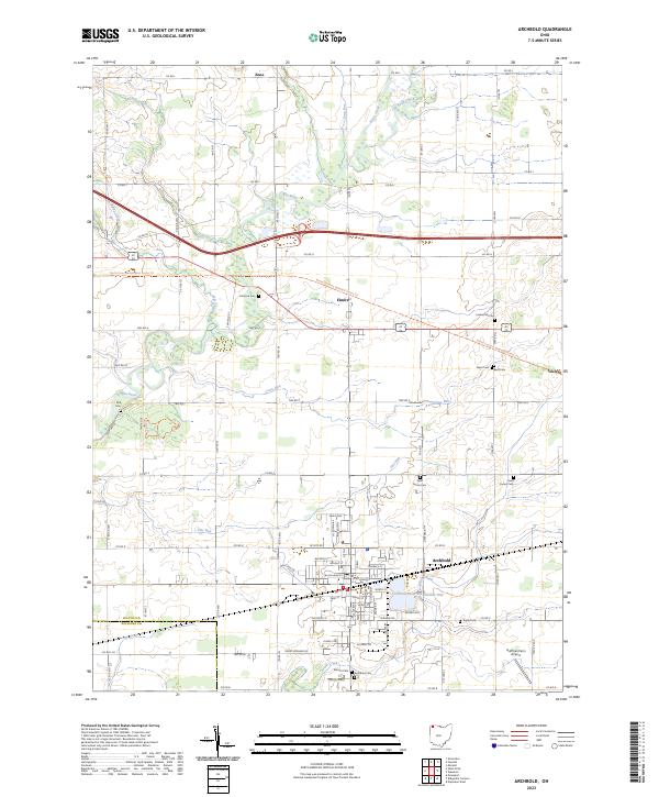 2023 Archbold2023 Print · USGSArchbold and the surrounding Fulton County farmland are captured here in a period of modern agricultural stability. Genealogists can locate numerous small burial sites like Lauber Hill Cem and Saint Peters Cem near the winding Tiffin River.
 - 2023 Map of Edgerton, 2023 Print
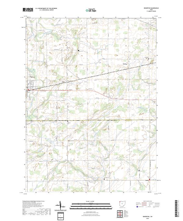 2023 Edgerton2023 Print · USGSThe rural landscapes of Williams and Defiance Counties come alive in this survey of agricultural hamlets and river valleys. Researchers can trace family history through numerous burial sites like Tamarack Cem and Farmer Cem near the banks of the Saint Joseph River.
 - 2023 Map of Alvordton, 2023 Print
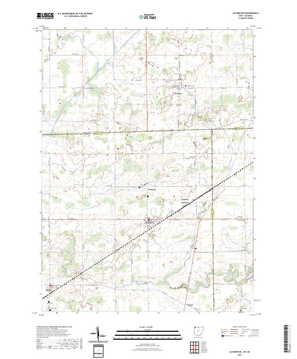 2023 Alvordton2023 Print · USGSSettled along the Michigan-Ohio border in the early 2020s, this region reveals a classic Midwestern landscape of farm grids and small villages. Genealogists can trace family names at Walnut Grove Cem and Kunkle Cem or explore the rural hubs of Alvordton and Primrose.
 - 2023 Map of Bryan, 2023 Print
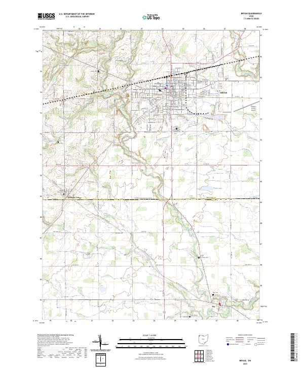 2023 Bryan2023 Print · USGSBryan and the surrounding rural townships of Williams County are captured here in the early 2020s, showing a landscape of established agriculture and industry. Genealogists can locate family burial sites like Brown Cem and Trinity Lutheran Cem or trace the civic heart of the area at the Williams County Courthouse.
 - 2023 Map of West Unity, 2023 Print
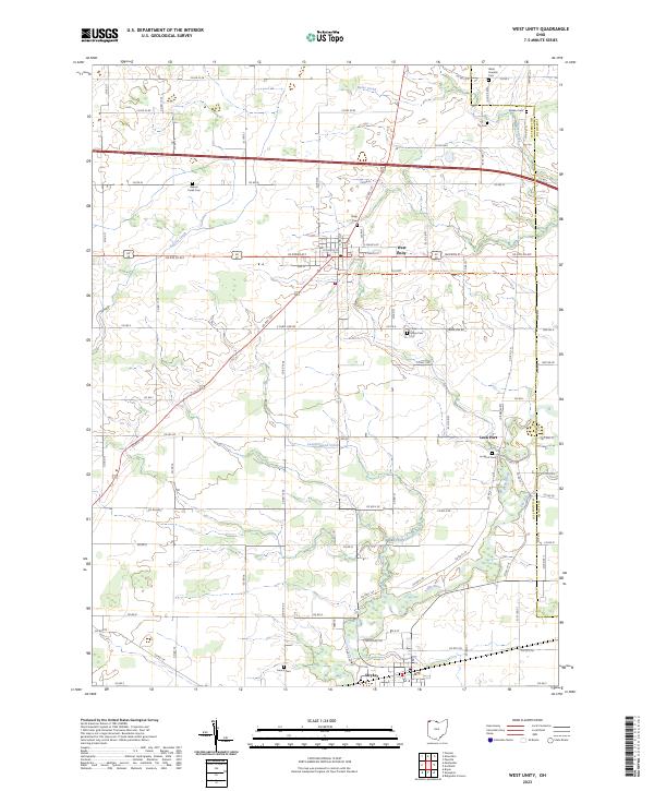 2023 West Unity2023 Print · USGSThe rural landscapes of Williams and Fulton Counties are captured here in the 2020s. Genealogists can trace burial sites like Floral Grove Cem and Lockport Cem or explore the riverfront at Stryker and Lock Port.
 - 2023 Map of Nettle Lake, 2023 Print
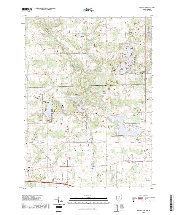 2023 Nettle Lake2023 Print · USGSThe Michigan-Ohio border region comes into focus in this contemporary survey of the tri-state area's glaciated terrain. Genealogists can trace family burial sites like Cellars Cem and Palmer Cem alongside the residential developments of Nettle Lake and Lake Seneca.
 - 2023 Map of Pioneer, 2023 Print
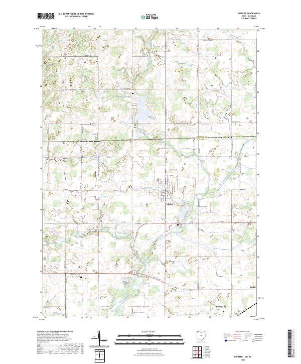 2023 Pioneer2023 Print · USGSThe tri-state border region of northwestern Ohio and southern Michigan comes alive in this contemporary survey. Family historians can trace local roots through numerous rural burial grounds like Floral Grove Cem, Drake Cem, and Cogswell Cem.
 - 2023 Map of Ridgeville Corners, 2023 Print
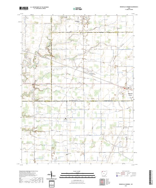 2023 Ridgeville Corners2023 Print · USGSThis part of Northwest Ohio is captured in the early 2020s as a landscape of intersection between four counties and a network of traditional farmsteads. Genealogists can trace several local burying grounds like Bethlehem Lutheran Cem and Domersville Cem near Ridgeville Corners.
 - 2023 Map of Evansport, 2023 Print
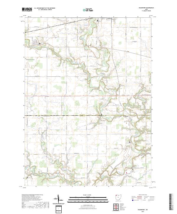 2023 Evansport2023 Print · USGSSoutheastern Williams County appears in the 2020s as a landscape shaped by the winding Tiffin River and deep Methodist roots. Genealogists can trace local heritage through numerous burial sites including Evansport Cem, Boynton Cem, and Doll Cem.
 - 2023 Map of Edon, 2023 Print
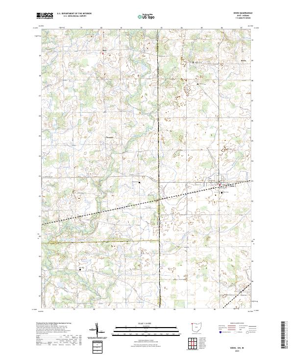 2023 Edon2023 Print · USGSThe crossroads of Indiana and Ohio are captured here in the early 2020s, showing a landscape defined by drainage and small-town roots. Researchers can trace family history through several rural burial grounds including Eddy Cem, Boisher Cem, and the village of Edon.
End of results
Showing maps 1-14 of 14
Top cities of Williams County
Frequently asked questions
- What are the different types of historical maps available for Williams County?
- What is the oldest map of Williams County?
- Where can I purchase historical maps of Williams County for my home or office?
- Where can I download high-res historical maps of Williams County?
- Are there historical topographic maps available for Williams County?
- Is there historical aerial imagery available for Williams County?
- Where are historical maps of Williams County sourced from?