Old Maps of Williams County, Ohio for Academic Research
Study the evolution of Williams County with 101 high-resolution historic maps. Whether you're teaching, researching, or modeling changes in land use, these maps provide essential visual documentation of urban, environmental, and geographic change.
- Analyze long-term change: Track patterns in development, transportation, and natural features.
- Ideal for environmental or urban studies: Support academic projects with primary historical map data.
- Use in the classroom or lab: Educators and researchers rely on these maps to bring historical context to life.
These maps are a powerful tool for teaching, research, and visualizing how Williams County has changed over the decades.
Williams County, OH maps
(101)- 1907 Map of Defiance, 1960 Print
 1907 Defiance1960 Print · USGSNorthwest Ohio’s river-and-rail economy is on full display at the turn of the century, centered on the strategic confluence at Defiance. Genealogists can trace family footprints in outlying settlements like Evansport, Jewell, and Ridgeville Corners.
 - 1909 Map of Defiance, 1940 Print
 1909 Defiance1940 Print · USGSNorthwest Ohio thrives at the junction of the Maumee and Auglaize rivers in the early twentieth century. Genealogists can trace family footprints in Defiance or explore rural outposts like Evansport and the path of the Miami and Erie Canal.
 - 1913 Map of Alvordton
 1913 Alvordton1913 Print · USGSThe rural borderlands of Ohio and Michigan are captured here just after the turn of the century, showing a landscape of burgeoning rail junctions and tight-knit farming townships. Researchers can trace the heritage of vanished school districts and country houses of worship like Gray Church and the Mennonite Church near Archbold.3 unique versions available
 - 1914 Map of Pioneer
 1914 Pioneer1914 Print · USGSNorthwest Ohio and the Michigan borderlands come alive in this pre-war survey of Williams and Hillsdale Counties. Genealogists can trace family farm locations through a dense network of country schools and rail stops like Montpelier, Edon, and the County Infirmary.2 unique versions available
 - 1914 Map of Bryan, 1942 Print
 1914 Bryan1942 Print · USGSNorthwest Ohio at the height of the steam era reveals a landscape of thriving rail towns and dense country school districts. Researchers can trace the original routes of the Wabash RR and Electric R R through Bryan and Hicksville, while locating vanished rural sites like Crazy School and Ziegler.
 - 1939 Map of Clear Lake
 1939 Clear Lake1939 Print · USGSSteuben County was a landscape of intricate glacial lakes and quiet crossroads during the late 1930s. Researchers can trace old family lines through landmarks like Covenant Cem, the settlement at Ray, and the shoreline at Paradise Pt.2 unique versions available
 - 1940 Map of Metz
 1940 Metz1940 Print · USGSThe Indiana-Ohio borderlands come into focus in the years before the war, showing a landscape of drainage ditches and family-named bridge crossings. Genealogists can trace rural life through landmarks like Metz Cem, Bethel Ch, and the small settlement of Alvarado.2 unique versions available
 - 1940 Map of Clear Lake
 1940 Clear Lake1940 Print · USGSThe tri-state border region of Indiana, Michigan, and Ohio is captured here just before the 1940s, centered on the activity surrounding Clear Lake. Researchers can trace early school sites and family landmarks like Powers Sch, Stallman Bridge, and the Teeters Cem.2 unique versions available
 - 1943 Map of Bryan
 1943 Bryan1943 Print · USGSNorthwest Ohio during the mid-century is captured here as a landscape of grid-roads, small hamlets, and heavy rail traffic. Genealogists and local historians can trace family roots through numerous rural landmarks like Bethel Ch, Bratton Sch, and the hamlet of Farmer.
 - 1944 Map of Pioneer
 1944 Pioneer1944 Print · USGSWilliams County and the Michigan border are captured here during the mid-forties, showing a landscape of small farming hamlets and district schools. Researchers can trace the path of the Wabash railroad through Montpelier or locate family sites near Nettle Lake and the County Infirmary.
 - 1944 Map of Alvordton
 1944 Alvordton1944 Print · USGSSpanning the Michigan and Ohio border in the 1940s, this area shows a landscape of busy rail junctions and rural school districts. Genealogists can trace family roots through sites like Gray Church, Virginia School, or the settlements of Fayette and West Unity.
 - 1953 Map of Fort Wayne, 1963 Print
 1953 Fort Wayne1963 Print · USGSNortheast Indiana and its neighboring borderlands in Michigan and Ohio appear here during a peak era of rail and road expansion. Researchers can trace the massive rail networks of the Nickel Plate Road and Wabash or locate lakeside landmarks like Lake Wawasee and Clear Lake.4 unique versions available
 - 1956 Map of Fort Wayne
 1956 Fort Wayne1956 Print · USGSThe tri-state borderlands of Indiana, Michigan, and Ohio are captured here in the mid-fifties, centered on the growing industrial hub of Fort Wayne. Researchers can trace the heavy rail lines of the New York Central and Pennsylvania alongside prominent water features like Lake Wawasee and the Maumee River.2 unique versions available
 - 1958 Map of Butler East, 1960 Print
 1958 Butler East1960 Print · USGSDeKalb County and the Ohio borderlands are shown here in the late fifties, where the Principal Meridian separates two states. Researchers can locate community anchors like Stafford Center, Big Run Ch, and the old Jerusalem Sch.4 unique versions available
 - 1959 Map of Archbold, 1961 Print
 1959 Archbold1961 Print · USGSIn the late 1950s, Archbold stood as a thriving rail hub at the intersection of the New York Central and Wabash lines. Genealogists can trace family roots through numerous local landmarks, including Rupp Cem, West Franklin Ch, and Ruihley Park.2 unique versions available
 - 1959 Map of Ridgeville Corners, 1961 Print
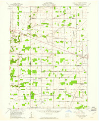 1959 Ridgeville Corners1961 Print · USGSNorthwest Ohio at the end of the fifties reveals a landscape shaped by township grids and converging county lines. Researchers can trace family history through local landmarks like Ridgeville Corners, Bethlehem Ch, and the Domersville Cemetery.3 unique versions available
 - 1960 Map of Evansport, 1961 Print
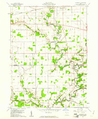 1960 Evansport1961 Print · USGSNorthwest Ohio at the dawn of the sixties shows a landscape shaped by the winding Tiffin River and the New York Central rail line. Genealogists can trace family landmarks like Evansport Cem, Oak Grove Ch, and the Township High Sch near Evansport.2 unique versions available
 - 1960 Map of Bryan, 1961 Print
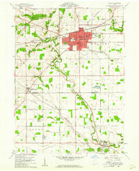 1960 Bryan1961 Print · USGSThe Northwest Ohio landscape of the early sixties comes alive around Bryan and the winding Lick Creek. Genealogists and local historians can trace rural roots through Brown Cem, Washington Sch, and the small settlement of Ney.4 unique versions available
 - 1961 Map of Edgerton, 1962 Print
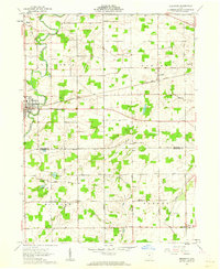 1961 Edgerton1962 Print · USGSIn the early sixties, the Williams and Defiance County line was a landscape of quiet crossroads and bustling rail stops. Trace family history and rural industry through Edgerton, the trackside hamlet of Mina, and local landmarks like Tamarack Cem.3 unique versions available
 - 1961 Map of Pioneer, 1962 Print
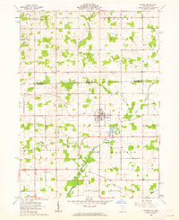 1961 Pioneer1962 Print · USGSNorthwestern Ohio meets the Michigan border in the early 1960s, centered on the village of Pioneer. Genealogists can trace family roots through numerous local landmarks like Floral Grove Cem, Cogswell Cem, and Amboy Ch.3 unique versions available
 - 1961 Map of West Unity, 1962 Print
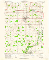 1961 West Unity1962 Print · USGSWilliams County at the start of the sixties shows a landscape defined by the Tiffin River and the new Ohio Turnpike. Researchers can trace family history at the Quaker Ch Cem or explore the rail era through West Unity and Stryker.2 unique versions available
 - 1961 Map of Clear Lake, 1963 Print
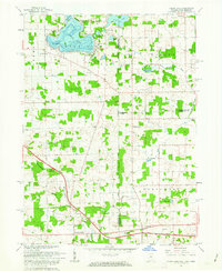 1961 Clear Lake1963 Print · USGSThe tri-state junction of Indiana, Ohio, and Michigan comes alive in the early sixties as a crossroads of high-speed travel and quiet lakeside life. Researchers can trace the connection between the Indiana Toll Road and the Ohio Turnpike or locate family roots at Teeters Cemetery and Powers Church.3 unique versions available
 - 1961 Map of Edon, 1963 Print
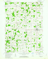 1961 Edon1963 Print · USGSIn the early 1960s, this tri-state border region centered on Edon highlights a landscape of river-fed farms and remote rural settlements. Researchers can locate historic landmarks like the Covered Bridge and family heritage sites such as Eddy Cem and Zion Ch.4 unique versions available
 - 1961 Map of Montpelier, 1963 Print
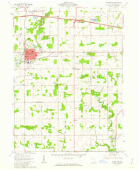 1961 Montpelier1963 Print · USGSMontpelier and the surrounding Williams County townships are shown here in the early sixties as modern turnpikes and airports began to change the rural landscape. Researchers can trace family roots at Riverside Cem, visit the County Home, or locate the West Bethesda Ch.2 unique versions available
 - 1961 Map of Nettle Lake, 1963 Print
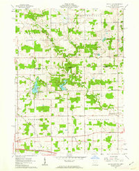 1961 Nettle Lake1963 Print · USGSThe Ohio-Michigan borderlands appear in the early sixties as a patchwork of farms and glacial lakes. Genealogists can trace property lines and family landmarks like Malcom Cem, Nettle Lake Ch, and the small settlement of Cooney.3 unique versions available
Showing maps 1-25 of 101
Top cities of Williams County
Frequently asked questions
- What are the different types of historical maps available for Williams County?
- What is the oldest map of Williams County?
- Where can I purchase historical maps of Williams County for my home or office?
- Where can I download high-res historical maps of Williams County?
- Are there historical topographic maps available for Williams County?
- Is there historical aerial imagery available for Williams County?
- Where are historical maps of Williams County sourced from?