1990s Maps of Canadian County, Oklahoma
Explore 2 historic maps of Canadian County from the 1990s. These maps offer a rare glimpse into what life looked like during the 1990s — showing old roads, neighborhoods, homes, and landmarks that have changed or disappeared over time.
Whether you're researching your family's past, planning a metal detecting trip, or studying how Canadian County's landscape evolved across the 1990s, these high-resolution maps are a powerful tool for exploring the history of this region.
- Focus on a specific era: All maps on this page are from the 1990s, giving you a focused view of this time period.
- See what’s changed: Compare century-old streets, trails, and buildings to today's modern landscape using overlays and satellite layers.
- Research with precision: Use these maps for genealogy, historical research, land use analysis, or educational projects.
- View, download, or print: Maps are fully viewable online in high resolution, and can be downloaded or printed for your own records.
Start exploring Canadian County's history through authentic maps from the 1990s. This is your window into the past.
Canadian County, OK maps
(2)- 1990 Map of Oklahoma City North
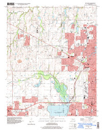
 1990 Oklahoma City North1990 Print · USGSOklahoma City and its northern reaches are captured in the 1990s as suburban growth stretched toward the Cimarron River. Genealogists and historians can trace rail-town legacies along the Atchison Topeka and Santa Fe Railroad and find landmarks like the El Reno Federal Reformatory.
 - 1995 Map of Bethany, 1999 Print
 1995 Bethany1999 Print · USGSOklahoma City and its neighbors were rapidly expanding toward the turn of the millennium, centered on critical aviation and water resources. Genealogists and local historians can locate established landmarks like Bethany College, Wiley Post Airport, and the Chapel Hill Memorial Gardens Cemetery.
End of results
Showing maps 1-2 of 2
Top cities of Canadian County
- Yukon historical maps
- Mustang historical maps
- El Reno historical maps
- Piedmont historical maps
- Union City historical maps
- Calumet historical maps
Frequently asked questions
- What are the different types of historical maps available for Canadian County?
- What is the oldest map of Canadian County?
- Where can I purchase historical maps of Canadian County for my home or office?
- Where can I download high-res historical maps of Canadian County?
- Are there historical topographic maps available for Canadian County?
- Is there historical aerial imagery available for Canadian County?
- Where are historical maps of Canadian County sourced from?