Old Maps of Canadian County, Oklahoma for Genealogy
Trace your family roots with 157 historic maps of Canadian County. These high-res maps reveal old neighborhoods, homesites, landmarks, and streets — helping you uncover where your ancestors lived and how the area evolved over time.
- Explore historic neighborhoods: Identify where your relatives may have lived in the 1800s or 1900s.
- Compare maps over time: Trace the changes in streets, buildings, and landmarks for multi-generational research.
- Perfect for genealogy & ancestry research: Used by family historians and researchers to map out lineage and migration.
These maps are an incredible resource for exploring your personal connection to Canadian County's past.
Canadian County, OK maps
(157)- 1892 Map of Kingfisher, 1957 Print
 1892 Kingfisher1957 Print · USGSOklahoma Territory was in a state of rapid transition during the 1890s as railroads and cattle trails shared the same landscape. Researchers can trace the original Chisholm Trail alongside early settlements like Mathewson and river crossings such as Kirby Ford.
 - 1893 Map of Fort Reno
 1893 Fort Reno1893 Print · USGSCentral Oklahoma's frontier landscape is documented here in the final decade of the nineteenth century. Genealogists and historians can locate the Darlington Agency, the early enclave of African City, and the military post at Fort Reno.2 unique versions available
 - 1893 Map of Oklahoma City
 1893 Oklahoma City1893 Print · USGSOklahoma City and the surrounding territory are captured here in the 1890s, just as the rail lines began transforming the landscape. You can trace early township developments and find the historic border between the Oklahoma territory and the Chickasaw Nation near Walden and Clancy.
 - 1893 Map of Buggy Creek
 1893 Buggy Creek1893 Print · USGSOklahoma Territory near the turn of the century reveals a landscape defined by the Wichita Reservation and frontier outposts. Genealogists and historians can trace early activity at the Indian Village and Stage Stand along the Canadian River.2 unique versions available
 - 1893 Map of Minco
 1893 Minco1893 Print · USGSIndian Territory and the Chickasaw Nation lands meet at the turn of the century along the Canadian River. Genealogists can trace early homesteading patterns near Minco and along the Chicago Rock Island and Pacific Rail Road.
 - 1895 Map of Kingfisher
 1895 Kingfisher1895 Print · USGSOklahoma Territory during the mid-1890s reveals a rapidly developing frontier defined by river crossings and expanding rail lines. Genealogists and historians can trace the early foundations of Kingfisher, Elreno, and Yukon alongside historic river crossings like Gould Ford.4 unique versions available
 - 1904 Map of Chickasha
 1904 Chickasha1904 Print · USGSIndian Territory and Oklahoma Territory meet in this detailed 1904 survey, showing the region just years before statehood. Genealogists can trace the early rail stops at Minco and Tuttle or locate family homesteads near Womack and Dibble.4 unique versions available
 - 1941 Map of Fort Reno
 1941 Fort Reno1941 Print · USGSThe North Canadian River valley was a center of agricultural and military life in the late thirties. Genealogists can trace family footprints across dozens of country schools and churches like Sunny Hill Sch, Swappingback Indian Chapel, and the historic Fort Reno grounds.3 unique versions available
 - 1942 Map of Fort Reno
 1942 Fort Reno1942 Print · USGSOklahoma's Canadian County plains come alive in this early-forties survey, showcasing a landscape defined by military depots and tribal schools. Researchers can trace rural lineages through dozens of local sites like Banner Sch, Canadian Valley Cem, and the Fort Reno garrison.
 - 1942 Map of Geary
 1942 Geary1942 Print · USGSCentral Oklahoma's agrarian heartland comes alive in this pre-war survey of the winding Canadian River valley. Genealogists and local historians can map out dozens of rural school sites like Victor Sch and Richland Sch alongside the busy Chicago Rock Island and Pacific rail line.3 unique versions available
 - 1949 Map of Fort Reno
 1949 Fort Reno1949 Print · USGSOklahoma's Canadian County comes to life in this mid-century survey, capturing the unique intersection of military history, tribal education, and Route 66 commerce. Genealogists can locate family landmarks like Swappingback Indian Chapel, Calumet, and the expansive Fort Reno Military Reservation.
 - 1951 Map of Binger, 1952 Print
 1951 Binger1952 Print · USGSCaddo County's agricultural and social landscape is captured here in the early fifties, showing a dense web of rural school districts and crossroads. Researchers can trace family roots through numerous sites like Sickles Sch, Hinton Cem, and the Indian Community House.3 unique versions available
 - 1954 Map of Oklahoma City
 1954 Oklahoma City1954 Print · USGSOklahoma City and its surrounding counties are captured here in the early fifties during a period of significant postwar growth. Researchers can trace the development of the Turner Turnpike and locate aviation hubs like Tinker Field or Will Rogers Field.
 - 1955 Map of Clinton, 1964 Print
 1955 Clinton1964 Print · USGSWestern Oklahoma during the mid-century transition shows a landscape of growing reservoirs and active military flight lines. Genealogists and historians can locate rural landmarks such as Mountain View Church, Berlin School, and the Riverside Indian School Reserve.3 unique versions available
 - 1956 Map of Oklahoma City, 1957 Print
 1956 Oklahoma City1957 Print · USGSCentral Oklahoma in the mid-fifties shows the transition from a rail-centered capital to a modern aviation and oil hub. Researchers can trace family roots through neighborhood landmarks like St Patricks Sch, Fairlawn Cem, and the old Union Station.2 unique versions available
 - 1957 Map of Clinton
 1957 Clinton1957 Print · USGSWestern Oklahoma in the mid-fifties is captured here as a landscape of river-valley settlements and emerging energy fields. Genealogists can trace family roots through numerous rural landmarks like the Swapping Back Indian School, Hebron Church, and the Riverside Indian School Reserve.
 - 1957 Map of Oklahoma City, 1969 Print
 1957 Oklahoma City1969 Print · USGSCentral Oklahoma is captured here in a period of significant mid-century growth and industrialization. Researchers can trace family roots through numerous rural markers like Memory Lane Cem, New Hope School, and the sprawling grounds of Tinker Air Force Base.3 unique versions available
 - 1963 Map of Oklahoma City
 1963 Oklahoma City1963 Print · USGSCentral Oklahoma in the early sixties showcases a landscape of rapid suburban growth and established oil production. Researchers can trace historic rail lines like the Chicago Rock Island and Pacific RR or locate rural landmarks such as Mayflower School and Bethel Church.
 - 1965 Map of Oklahoma City SW, 1967 Print
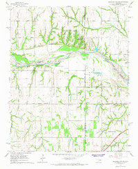 1965 Oklahoma City SW1967 Print · USGSSouthwest of the capital in the mid-sixties, this landscape shows the meeting point of three counties along the Canadian River. Genealogists and historians can trace the early footprints of Tuttle and Newcastle near sites like Snow Hill Ch and Camp Kickapoo.3 unique versions available
 - 1966 Map of Minco NE, 1967 Print
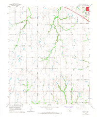 1966 Minco NE1967 Print · USGSCanadian County in the mid-1960s shows the suburban expansion of Oklahoma City meeting established rural communities. Local historians can trace the foundations of Yukon and El Reno or locate sites like Forehand Cem and the Banner Sch.3 unique versions available
 - 1966 Map of Union City, 1967 Print
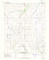 1966 Union City1967 Print · USGSUnion City and the surrounding Canadian County prairie were defined by the rail and river economy of the mid-sixties. Local researchers can trace the historic footprints of St Josephs church, the Chicago Rock Island and Pacific rail line, and the Mustang Field airstrip.2 unique versions available
 - 1966 Map of Bethany, 1967 Print
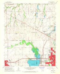 1966 Bethany1967 Print · USGSOklahoma City's western expansion is in full swing during the mid-sixties, showing the transition from oil fields and gravel pits to bustling suburban corridors. Researchers can trace the development of local institutions like Bethany College and St. Francis DeSales Seminary or locate family plots at Chapel Hill Memorial Gardens Cemetery.3 unique versions available
 - 1966 Map of Mustang, 1967 Print
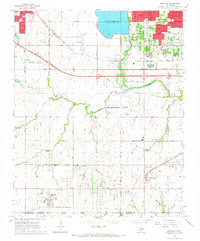 1966 Mustang1967 Print · USGSThe Oklahoma prairie west of the capital city was rapidly evolving in the mid-sixties as suburban growth pushed into Mustang and Yukon. Genealogists and historians can locate old landmarks like Pleasant Valley Cem, Wheatland, and Mustang Valley Sch along the river basin.3 unique versions available
 - 1966 Map of Minco, 1967 Print
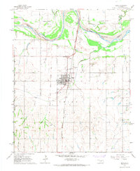 1966 Minco1967 Print · USGSMinco and the surrounding Grady County prairie are captured here in the mid-1960s, framed by the wide Canadian River. Researchers can trace the Old Oklahoma Indian Territory Boundary Line and locate local landmarks like Evergreen Cem and the rail corridor.2 unique versions available
 - 1966 Map of Piedmont, 1967 Print
 1966 Piedmont1967 Print · USGSMid-century Piedmont and its surrounding rural townships appear here during a period of urban expansion and petroleum development. Researchers can find old family cemeteries like Kansas Cem, trace the Old Railroad Grade, and locate the early infrastructure of the West Edmond Oil and Gas Field.3 unique versions available
Showing maps 1-25 of 157
Top cities of Canadian County
- Yukon historical maps
- Mustang historical maps
- El Reno historical maps
- Piedmont historical maps
- Union City historical maps
- Calumet historical maps
Frequently asked questions
- What are the different types of historical maps available for Canadian County?
- What is the oldest map of Canadian County?
- Where can I purchase historical maps of Canadian County for my home or office?
- Where can I download high-res historical maps of Canadian County?
- Are there historical topographic maps available for Canadian County?
- Is there historical aerial imagery available for Canadian County?
- Where are historical maps of Canadian County sourced from?