1970s Maps of Carter County, Oklahoma
Explore 5 historic maps of Carter County from the 1970s. These maps offer a rare glimpse into what life looked like during the 1970s — showing old roads, neighborhoods, homes, and landmarks that have changed or disappeared over time.
Whether you're researching your family's past, planning a metal detecting trip, or studying how Carter County's landscape evolved across the 1970s, these high-resolution maps are a powerful tool for exploring the history of this region.
- Focus on a specific era: All maps on this page are from the 1970s, giving you a focused view of this time period.
- See what’s changed: Compare century-old streets, trails, and buildings to today's modern landscape using overlays and satellite layers.
- Research with precision: Use these maps for genealogy, historical research, land use analysis, or educational projects.
- View, download, or print: Maps are fully viewable online in high resolution, and can be downloaded or printed for your own records.
Start exploring Carter County's history through authentic maps from the 1970s. This is your window into the past.
Carter County, OK maps
(5)- 1974 Map of Pernell, 1977 Print
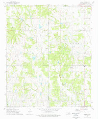 1974 Pernell1977 Print · USGSSouth-central Oklahoma's oil-rich landscapes come into focus during the mid-1970s as industrial development meets rural heritage. Researchers can trace local lineage through Pernell Sch and family landmarks like Robberson Cem and Dripping Springs Cem.
 - 1974 Map of Orr, 1977 Print
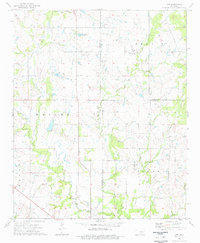 1974 Orr1977 Print · USGSThe Oklahoma borderlands near Orr are shown here in the mid-1970s, at the intersection of three counties. Genealogists and researchers can trace local landmarks like Center Point Ch, Orr Cem, and the active Oil Field that defined the regional economy.
 - 1974 Map of Ratliff City, 1977 Print
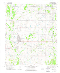
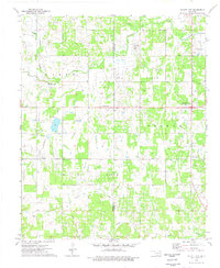 1974 Ratliff City1977 Print · USGSThe Oklahoma oil country of Stephens and Carter Counties comes alive in this mid-seventies survey of the southern plains. Researchers can trace the petroleum infrastructure and small-town roots of Ratliff City, Alma, and the Graham Oil Field.
 - 1974 Map of Cottonwood Creek, 1977 Print
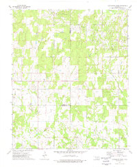 1974 Cottonwood Creek1977 Print · USGSIn the mid-1970s, this pocket of southern Oklahoma was a hub of energy production where the Loco Field met cattle-country creeks. Researchers can trace historical oil infrastructure alongside local landmarks like the Asphaltum Ch and Dixie Cemetery.
 - 1974 Map of Ringling, 1977 Print
 1974 Ringling1977 Print · USGSSouthern Oklahoma oil country comes into focus in the 1970s, showcasing the industrial footprint of the Hewitt Oil Field and the surrounding rail towns. Genealogists can trace family sites at the Cornish Cem and IOOF Cem or locate former rail stops like Cobalt Junction.
End of results
Showing maps 1-5 of 5
Top cities of Carter County
- Ardmore historical maps
- Lone Grove historical maps
- Healdton historical maps
- Wilson historical maps
- Dickson historical maps
- Springer historical maps
See more
Frequently asked questions
- What are the different types of historical maps available for Carter County?
- What is the oldest map of Carter County?
- Where can I purchase historical maps of Carter County for my home or office?
- Where can I download high-res historical maps of Carter County?
- Are there historical topographic maps available for Carter County?
- Is there historical aerial imagery available for Carter County?
- Where are historical maps of Carter County sourced from?