2020s Maps of Proposed - Bridgeview at Carrington, Norman
Explore 2 historic maps of Proposed - Bridgeview at Carrington from the 2020s. These maps offer a rare glimpse into what life looked like during the 2020s — showing old roads, neighborhoods, homes, and landmarks that have changed or disappeared over time.
Whether you're researching your family's past, planning a metal detecting trip, or studying how Proposed - Bridgeview at Carrington's landscape evolved across the 2020s, these high-resolution maps are a powerful tool for exploring the history of this region.
- Focus on a specific era: All maps on this page are from the 2020s, giving you a focused view of this time period.
- See what’s changed: Compare century-old streets, trails, and buildings to today's modern landscape using overlays and satellite layers.
- Research with precision: Use these maps for genealogy, historical research, land use analysis, or educational projects.
- View, download, or print: Maps are fully viewable online in high resolution, and can be downloaded or printed for your own records.
Start exploring Proposed - Bridgeview at Carrington's history through authentic maps from the 2020s. This is your window into the past.
Proposed - Bridgeview at Carrington, Norman maps
(2)- 2022 Map of Moore, 2022 Print
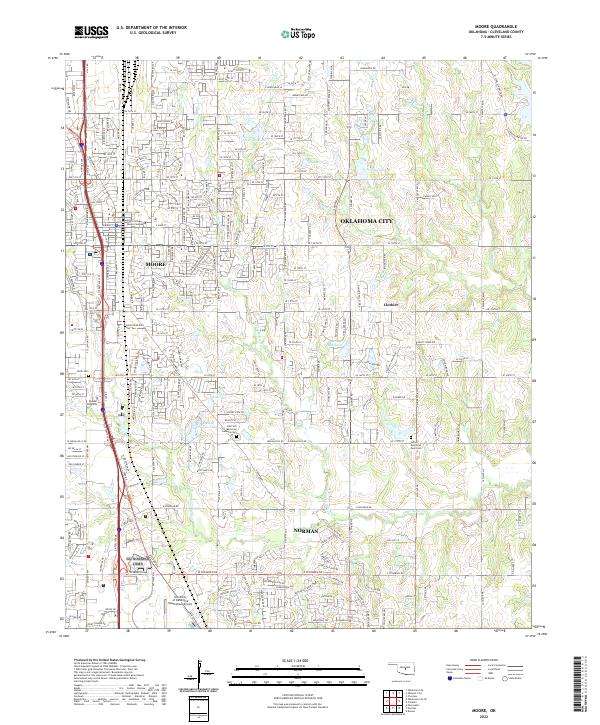 2022 Moore2022 Print · USGSThe suburban corridor between Oklahoma City and Norman is captured in this recent survey, showcasing modern expansion alongside long-standing landmarks. Researchers can locate Smith Cem, Mussel Shoals Lake, and the grounds of Randall University.
 - 2022 Map of Oklahoma City SE, 2022 Print
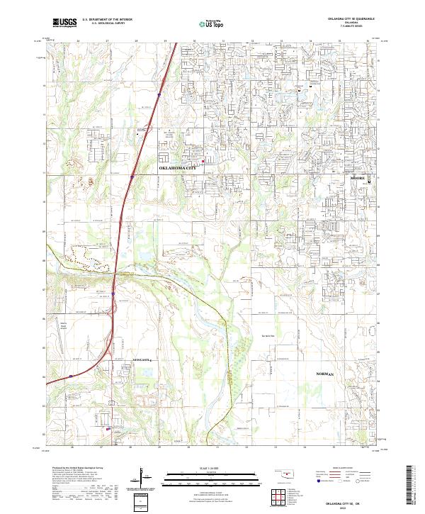 2022 Oklahoma City SE2022 Print · USGSOklahoma City and its southern suburbs appear here during a period of steady growth across the Cleveland and McClain county line. Researchers can locate family sites at Resthaven Gardens Cem or trace the geography of Ten Mile Flat and Marcy Creek.
End of results
Showing maps 1-2 of 2
Frequently asked questions
- What are the different types of historical maps available for Proposed - Bridgeview at Carrington?
- What is the oldest map of Proposed - Bridgeview at Carrington?
- Where can I purchase historical maps of Proposed - Bridgeview at Carrington for my home or office?
- Where can I download high-res historical maps of Proposed - Bridgeview at Carrington?
- Are there historical topographic maps available for Proposed - Bridgeview at Carrington?
- Is there historical aerial imagery available for Proposed - Bridgeview at Carrington?
- Where are historical maps of Proposed - Bridgeview at Carrington sourced from?