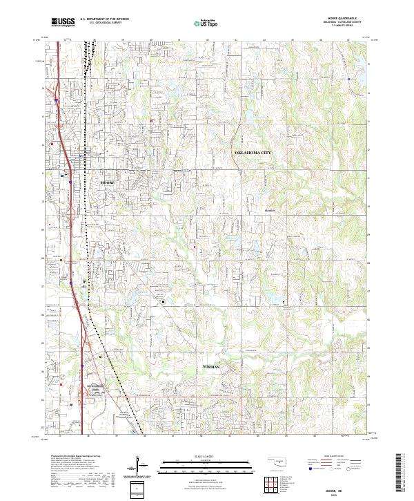
2022 Map of Moore
USGS Topo · Published 2022About this map
Moore and the northern outskirts of Norman dominate this 2022 survey, showing the intensive suburban expansion and infrastructure of central Oklahoma. The landscape is defined by the Little River and its various tributaries, such as the N Fork Little River, which feed into numerous reservoirs like 02726 Reservoir and Sooner Lake. This modern record illustrates the transition from rural land to educational and residential hubs, marked by institutions like Randall University, the Platt College Moore Campus, and the University of Oklahoma Westheimer Airport. Local history is preserved in several burial grounds, including the Smith Cem and Lilac Hill Memorial Gardens Cem, which remain as traditional landmarks amidst the surrounding development. The connectivity of the region is centered on the S Interstate 35 St corridor, which anchors the commercial and industrial growth through both cities.
Find a feature on this map
33 named features on this map. Tap any name to fly to it.
Don’t see what you’re looking for? This feature index may not catch every label — zoom into the map to look around manually.
Map Details
Editions of this 2022 Moore Map
This is the sole edition of this map. No revisions or reprints were ever made.
Other maps of this area

1892 · Moore
USGS Topo · 1:62,500

1893 · Norman
USGS Topo · 1:62,500

1893 · Oklahoma City
USGS Topo · 1:62,500

1898 · Purcell
USGS Topo · 1:125,000

1904 · Chickasha
USGS Topo · 1:125,000

1925 · Norman NO 2
USGS Topo · 1:24,000

1934 · Crutcho Creek
USGS Topo · 1:24,000

1934 · Moore
USGS Topo · 1:62,500

1936 · Norman
USGS Topo · 1:62,500

1938 · Moore
USGS Topo · 1:62,500